Day Night Band imagery of Idalia and Franklin
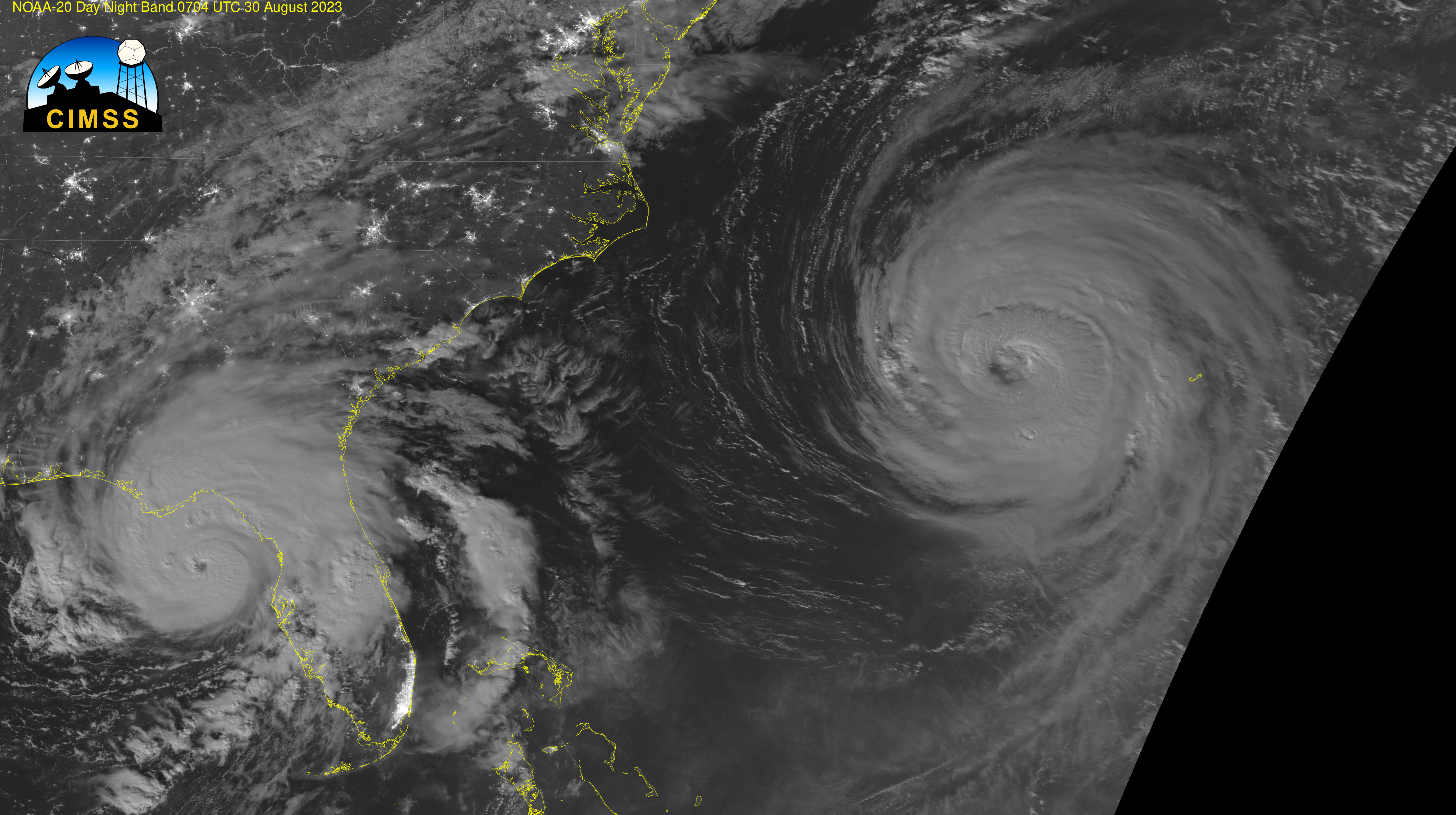
NOAA-20 overflew Hurricanes Franklin and Idalia shortly after 0700 UTC on 30 August 2023. Ample lunar illumination (the Full Moon occurs on 30 August) meant the Day Night Band yielded very sharp imagery, as shown above. This data was downloaded at the CIMSS Direct Broadcast antenna and processed with CSPP software, yielding the georeferenced... Read More