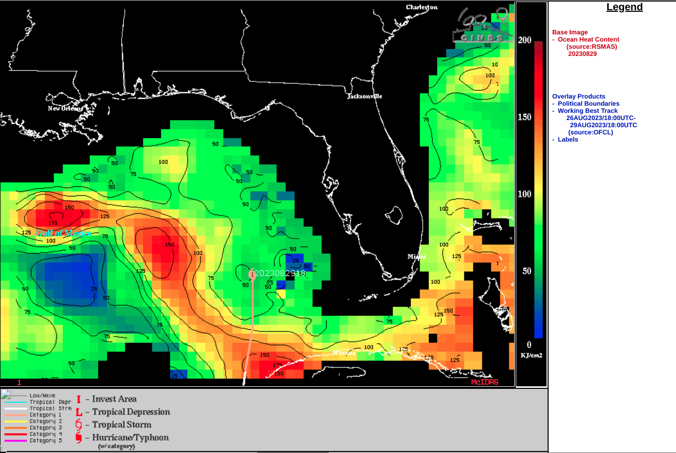
Idalia becomes a Hurricane
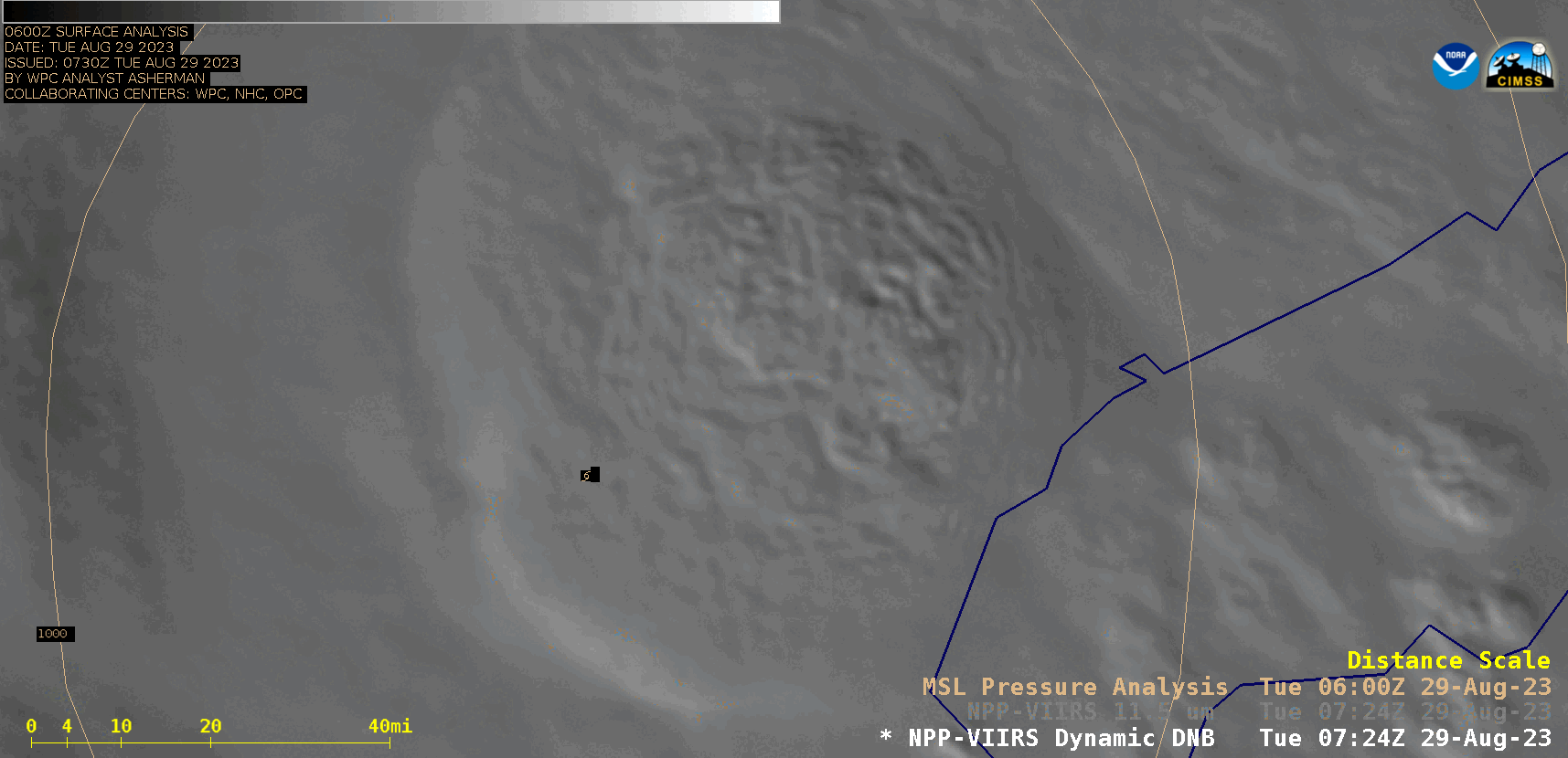
NOAA-20 VIIRS Day/Night Band (0.7 µm) and Infrared Window (11.45 µm) images valid at 0735 UTC [click to enlarge]
Overlapping 1-minute Mesoscale Domain Sectors provided 30-second GOES-16 “Clean” Infrared Window (10.3 µm) images (with/without an overlay of GLM Flash Extent Density) and “Red” Visible (0.64 µm) images during the 10-hour period from 1000-2000 UTC (below). Cloud-top infrared brightness temperatures were as cold as -90C (yellow pixels embedded within darker purple areas) — and occasional bursts of lightning activity were seen.
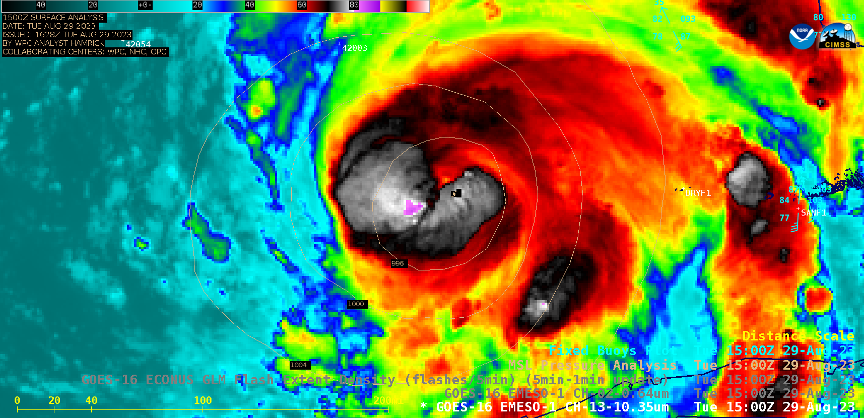
30-second GOES-16 “Clean” Infrared Window (10.3 µm) images (with/without an overlay of GLM Flash Extent Density) and “Red” Visible (0.64 µm) images, 1000-2000 UTC [click to play MP4 animation]
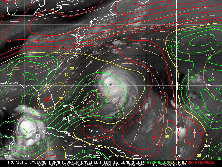
GOES-16 Water Vapor images, with analyses of deep-layer wind shear [click to enlarge]