Cyclone Ilsa makes landfall in Australia
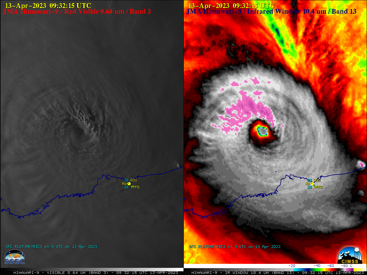
2.5-minute rapid scan (Target Sector) JMA Himawari-9 “Red” Visible and “Clean” Infrared Window images (above) showed Category 4 Cyclone Ilsa as it approached the northwest coast of Australia, eventually making landfall near Port Hedland (station identifier YPPD) just after 1500 UTC on 13 April 2023. Overshooting tops within the eyewall... Read More