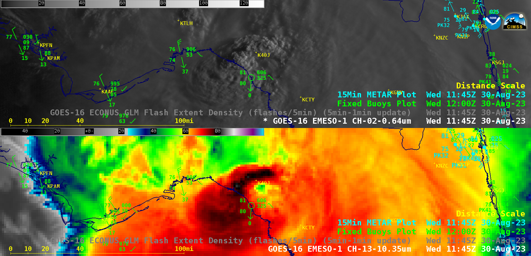
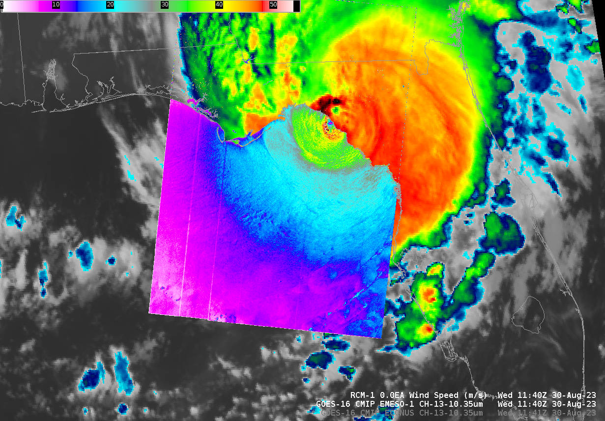
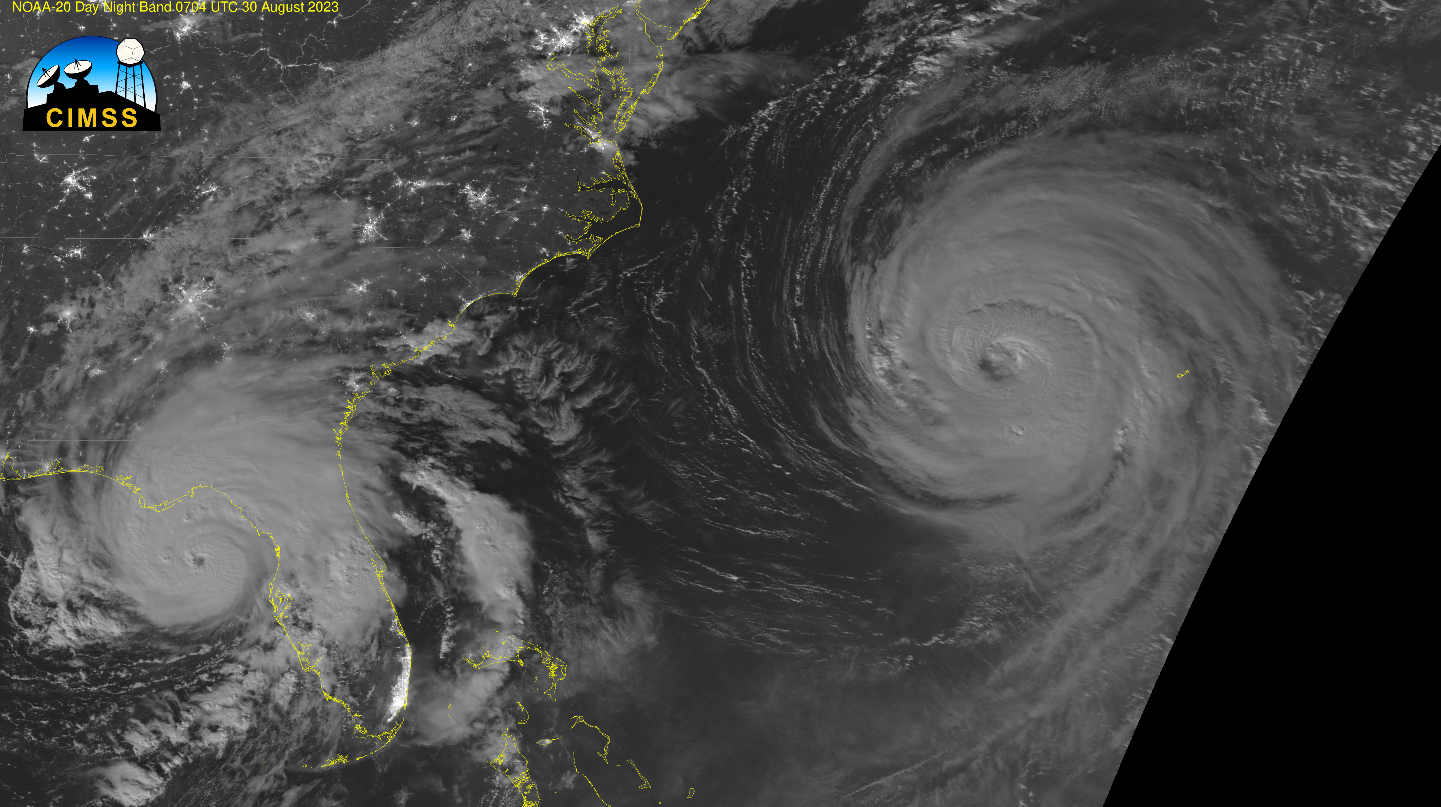
Typhoon Saola’s meandering path towards China
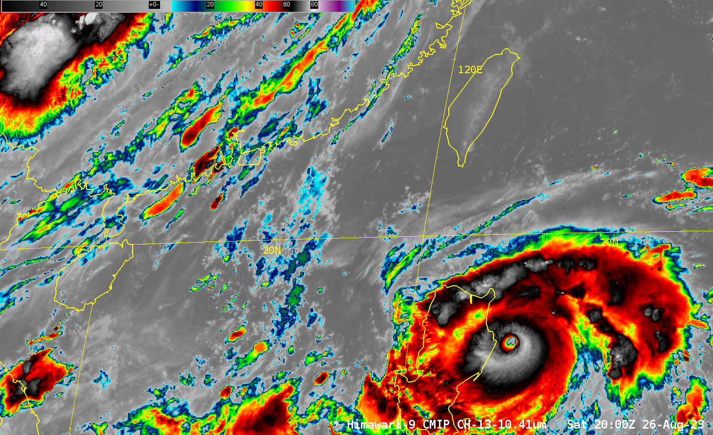
Himawari-9 Clean Window infrared (10.4 µm, Band 13) imagery (every 30 minutes) in late August and early September 2023, above, show the initially looping and later linear path of Typhoon Saola from its development east of the Philippines to its landfall in southern China. Saola was very strong just east... Read More