Tropical Storm Calvin moves through the Hawai’ian Islands
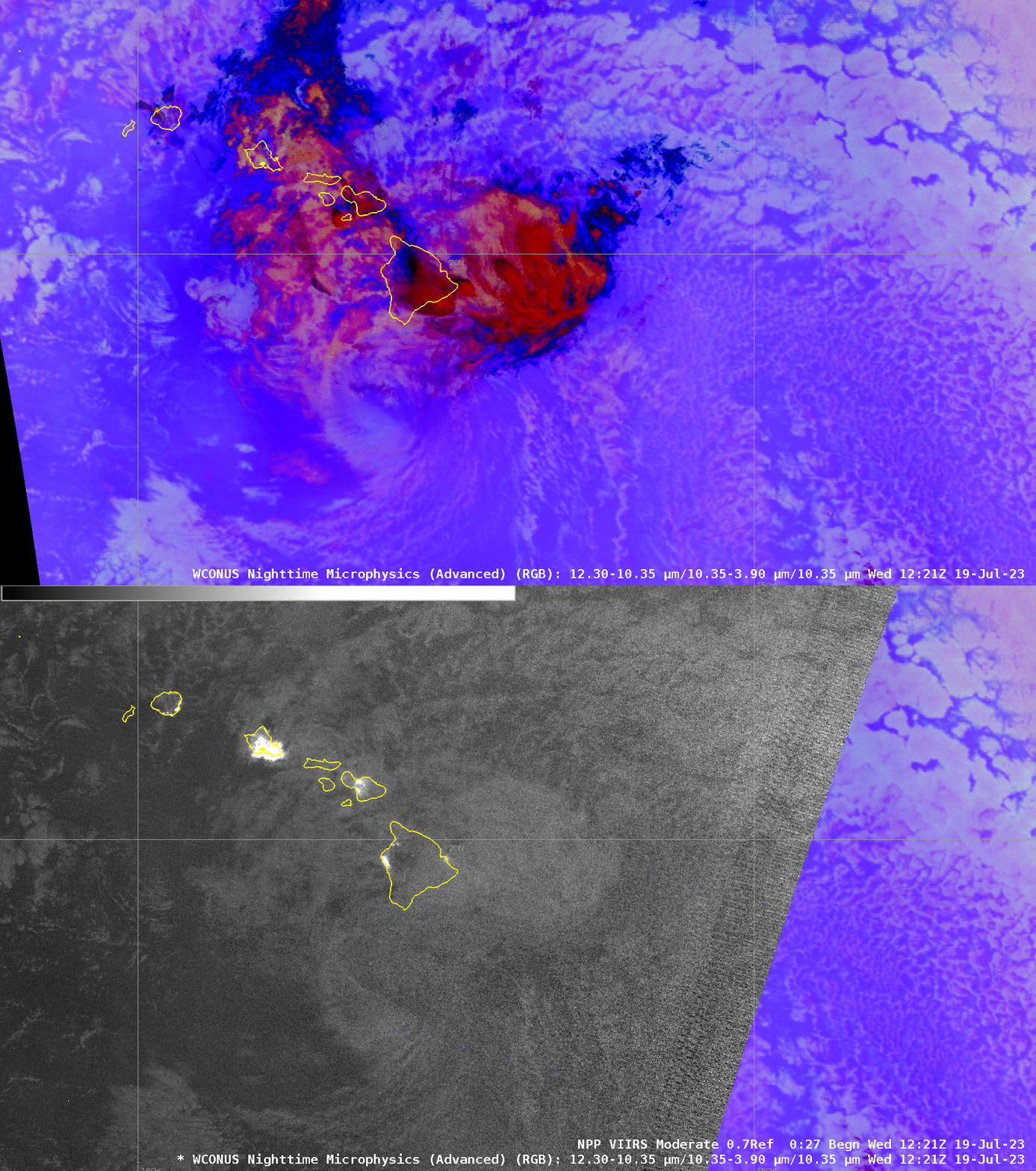
GOES-18 Night Microphysics imagery from 19 July 2023, above, shows a disorganized Tropical Storm Calvin moving south of Hawai’i before sunrise on 19 July. The low-level swirl of the system is apparent to the south of the Big Island; convection associated with the system develops during the animation over Hawai’i, and high clouds with the system are present to the east of Hawai’i. Convection produced heavy rains that closed some roads. The CPHC discussion on the storm at 1500 UTC (link) noted the separation between the surface and mid- and upper-level features. Visible imagery, below, a bit later than the animation above, shows the obvious low-level swirl (still associated with occasional isolated convection), but by 2100 UTC, the system was declared post-tropical.
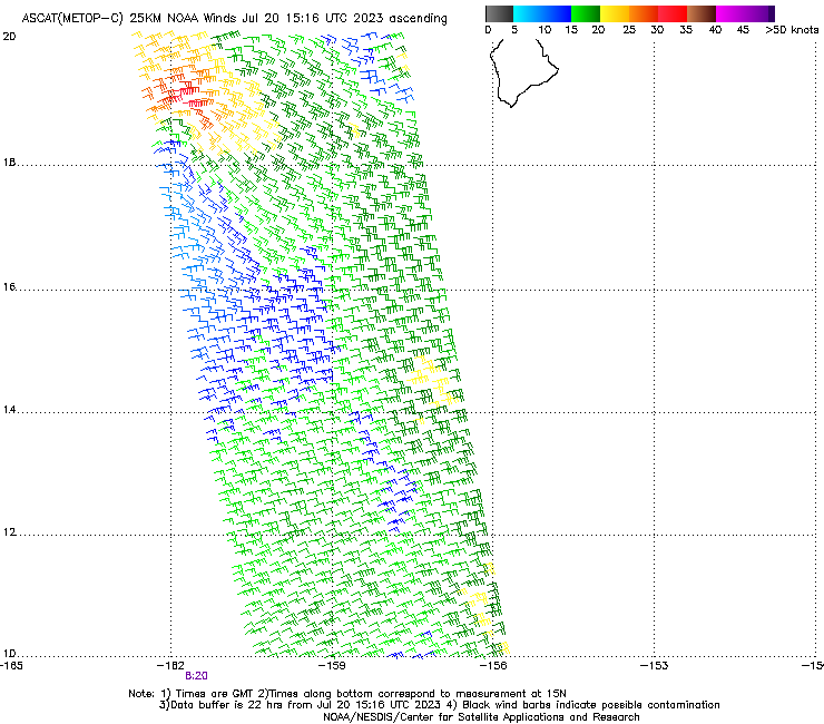
By 0800 UTC on 20 July 2023, the system had weakened to an open-wave as shown in the Advanced Scatterometer (ASCAT) image shown below from Metop-C. Winds of 30-35 knots are still indicated, but no westerly winds Equatorward of the strong easterly winds are present.
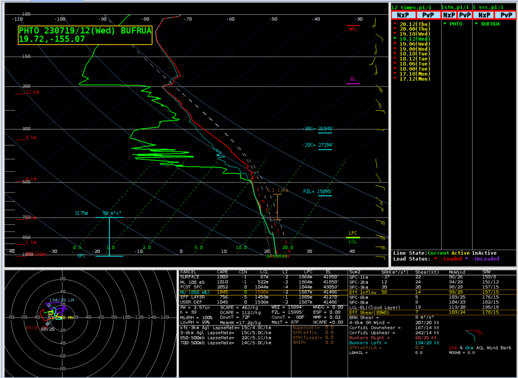
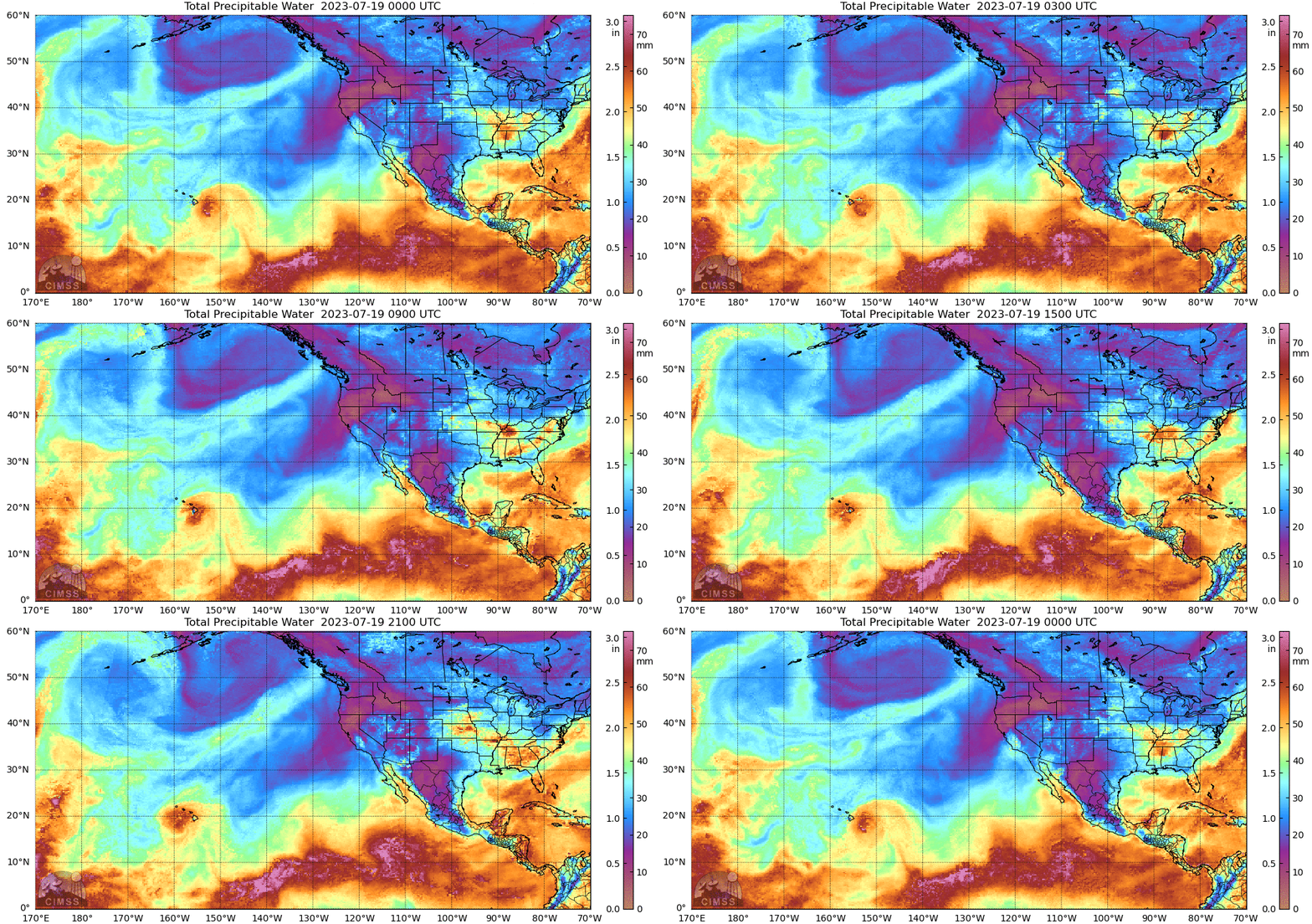
Calvin brought extraordinary moisture to the Hawai’ian islands. The 1200 UTC sounding at Hilo, below, (also available here) showed Total Precipitable Water exceeding 2.5″! That value, if verified, means this is one of the top 5 wettest soundings at that location according to the SPC Sounding Climatology site. MIMIC Total Precipitable Water values, shown at bottom in the animation from 0000 UTC 19 July to 0000 UTC 20 July, show the moisture associated with the storm.
The identification of the low-level circulation at night in this case was not difficult, perhaps because high clouds were not present over the low-level circulation. The toggle below shows Night Microphysics and the Day Night Band visible image (the New Moon occurred on 17 July, so very little lunar illumination was present). The low-level swirl is apparent in both images.
