Don meanders around the North Atlantic
The animation below, showing GOES-16 Clean Window infrared imagery (Band 13, 10.3 µm; processed using geo2grid, v1.1), tracks the named storm Don, first named as Subtropical Storm Don at 0900 UTC on 14 July, reclassified as Tropical Depression Don at 1500 UTC on the 17th, and upgraded to a Tropical Storm at 0300 UTC on the 18th, and to a hurricane at 2100 UTC on the 22nd. The animation shows the storm periodically affected by shear (when the low-level circulation is separated from the deep convection), especially on the 14th of July.
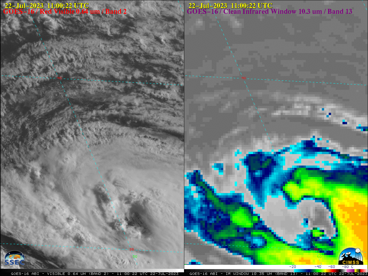
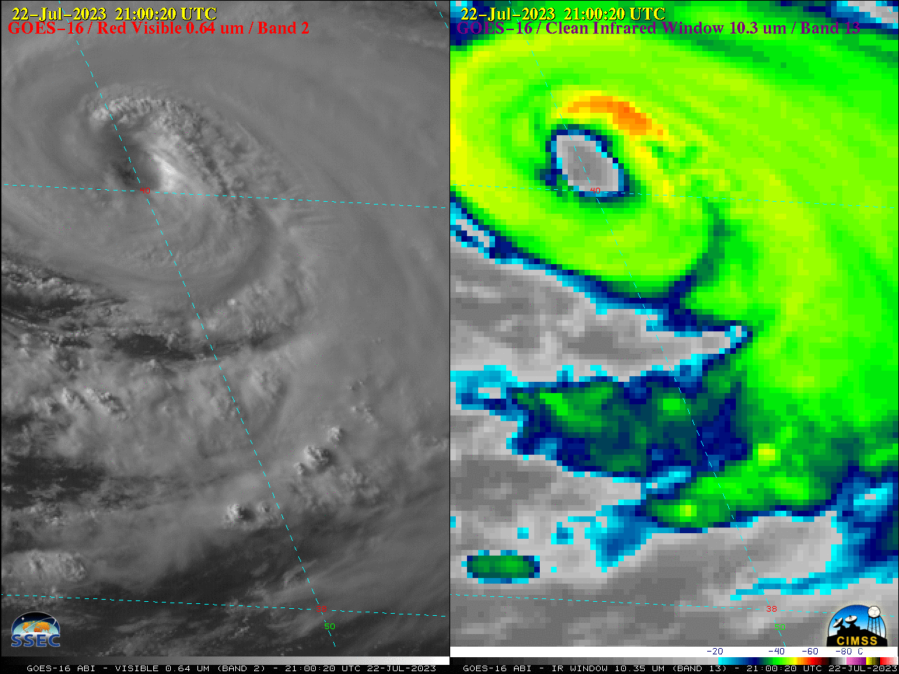
GOES-16 “Red” Visible (0.64 µm, left) and “Clean” Infrared Window (10.3 µm, right) images, 1100 UTC to 2210 UTC on 22 July (courtesy Scott Bachmeier, CIMSS) [click to play animated GIF | MP4]
A closer view using 10-minute GOES-16 Visible and Infrared images on 22 July (above) showed Tropical Storm Don developing a distinct eye, before being upgraded to a Hurricane at 2100 UTC. The coldest cloud-top infrared brightness temperatures were around -60ºC (darker shades of red).
On 24 July, Long-lived Don, devoid of convection, was deemed extra-tropical. This occurred while Don was moving north of the domains shown above. The last tropical advisory was issued at 1500 UTC.
For more information on Don, refer to the National Hurricane Center’s website. Don presents no current threat to land.