This website works best with a newer web browser such as Chrome, Firefox, Safari or Microsoft Edge. Internet Explorer is not supported by this website.

Category: Severe convection

A Nebraska thunderstorm and a Wyoming wildfire, as viewed by GOES-15, GOES-17 and GOES-16

* GOES-17 images shown here are preliminary and non-operational *A comparison of Visible images from GOES-15 (GOES-West), GOES-17 and GOES-16 (GOES-East) (above) showed an isolated thunderstorm that developed in the Nebraska Panhandle late in the day on 29 August 2018. The storm produced hail (SPC storm reports), and also exhibited an Above Anvil Cirrus Plume.... Read More

Severe thunderstorms in Wisconsin

Thunderstorms produced a variety of severe weather (SPC storm reports) as they moved eastward across the Upper Midwest on 28 August 2018. 1-minute Mesoscale Domain Sector 
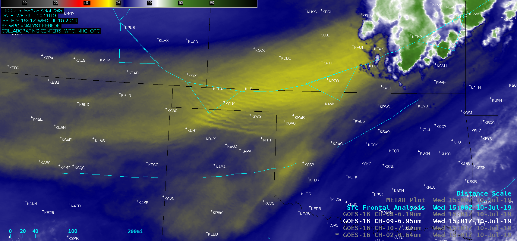
GOES-16 (GOES-East) “Red” Visible (0.64 µm) images (above) and “Clean” Infrared Window (10.3 µm) images (below) showed the development and progression of the severe convection across central Wisconsin.Toggles beween Visible and Infrared... Read More