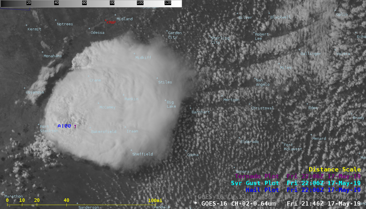
Outbreak of severe thunderstorms from Texas to Nebraska
GOES-16 “Red” Visible (0.64 µm) images, with SPC Storm Reports plotted in red [click to play animation | MP4]
The corresponding GOES-16 “Clean” Infrared Window (10.35 µm) images (below) revealed numerous overshooting tops that exhibited infrared brightness temperatures as cold as -70ºC (black enhancement).
GOES-16 “Clean” Infrared Window (10.35 µm) images, with SPC Storm Reports plotted in cyan [click to play animation | MP4]
GOES-16 “Clean” Infrared Window (10.35 µm) images, with SPC Storm Reports plotted in cyan [click to play animation | MP4]

GOES-16 “Red” Visible (0.64 µm) and “Clean” Infrared Window (10.35 µm) images, with plots of SPC Storm Reports [click to play MP4 animation]
Once the thunderstorm had developed, an Above-Anvil Cirrus Plume was also apparent in the Visible and Infrared imagery (for example, at 2236 UTC and 0101 UTC) — and this AACP feature was *colder* (shades of orange to red) than the adjacent storm top, due to the temperature profile above the equilibrium level/tropopause.
A GOES-17 (GOES-West) Mesoscale Domain Sector had been positioned over the region, providing 1-minute imagery of the storm development (below). The viewing angle from GOES-17 allowed the storm’s flanking line cloud bands to be seen.
![GOES-17 "Red" Visible (0.64 µm) and "Clean" Infrared Window (10.35 µm) images, with plots of SPC Storm Reports [click to play MP4 animation]](https://cimss.ssec.wisc.edu/satellite-blog/wp-content/uploads/sites/5/2019/05/tx_vis_oa_g17-20190517_214627.png)
GOES-17 “Red” Visible (0.64 µm) and “Clean” Infrared Window (10.35 µm) images, with plots of SPC Storm Reports [click to play MP4 animation]
“Red” Visible (0.64 µm) images from GOES-17 (left) and GOES-16 (right), with SPC Storm Reports plotted in red [click to play animation | MP4]

