Thunderstorms force the evacuation and cancellation of an outdoor concert in Nashville
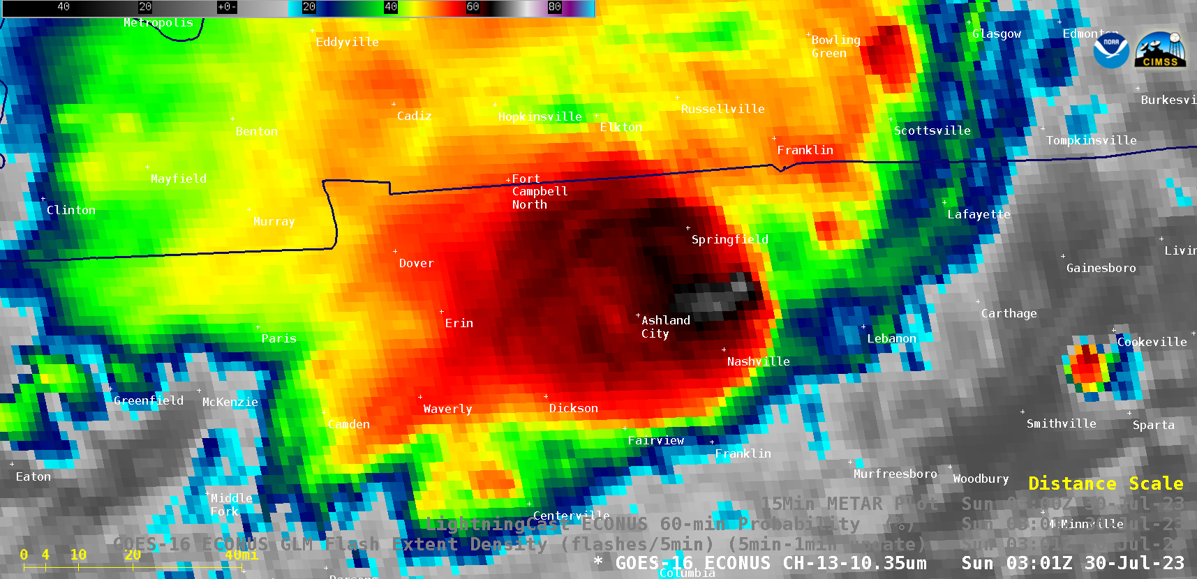
A George Strait concert at an outdoor stadium (Nissan Stadium) in Nashville, Tennessee was cancelled by a forced evacuation — due to approaching thunderstorms — just before 10 PM local time on 29 July 2023 (0300 UTC on 30 July). GOES-16 (GOES-East) “Clean” Infrared Window (10.3 µm) images (above) showed (1) the dissipation... Read More