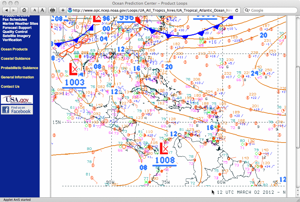
This website works best with a newer web browser such as Chrome, Firefox, Safari or Microsoft Edge. Internet Explorer is not supported by this website.

Category: Satellite winds

QuikSCAT satellite ceases operations

QuikSCAT wind vectors + GOES IR and water vapor images From an email received on the morning of 23 November 2009: “Several hours ago, shortly past 7:00Z today, telemetry received from QuikSCAT indicates that the antenna rotation rate has dropped to zero and remains at zero. The motor remains... Read More

Satellite Observations of a strong Nor’easter

A strong storm is bringing high winds and rain to the east coast of the United States from North Carolina northward to New Jersey. This dangerous weather will persist through tomorrow. The weather results from the combination of the extratropically transitioned remnants of Ida — over southern North Carolina —... Read More

Typhoon Melor: Is it generating a PRE?

Tropical Systems can occasionally be accompanied by Predecessor Rainfall Events (PREs). This band of heavy rainfall is not associated with the spiral bands of the tropical system, but rather with an interaction with a mid-latitude jet that exists Poleward of the tropical feature. Some notable PRE-producing tropical systems in... Read More