This website works best with a newer web browser such as Chrome, Firefox, Safari or Microsoft Edge. Internet Explorer is not supported by this website.

Category: Satellite winds

Tehuano wind event

After a strong arctic cold front plunged southward across the US, the Gulf of Mexico, and then southern Mexico during the previous two days (surface analyses), GOES-17 (GOES-West) and 
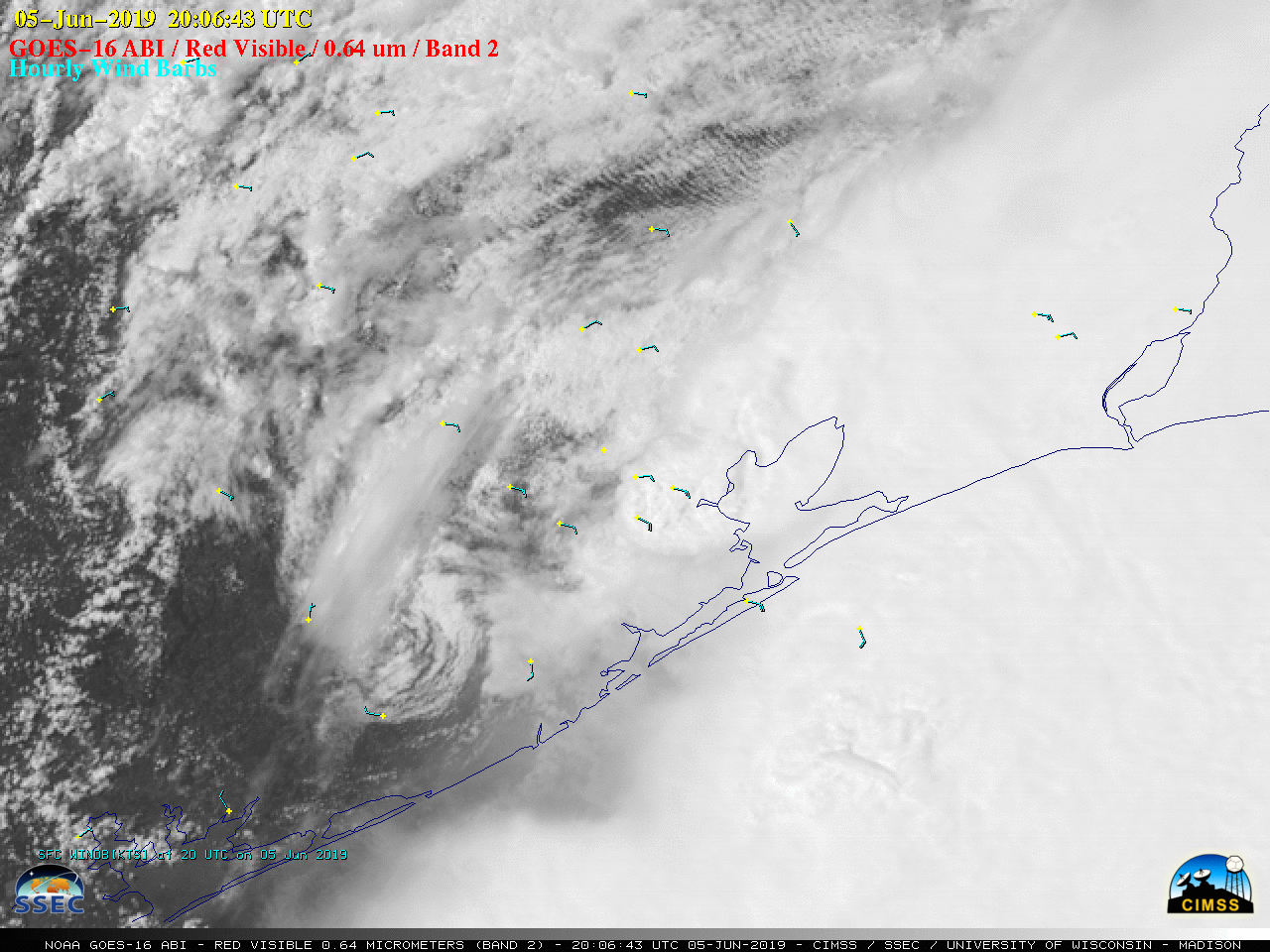
GOES-16 (GOES-East) “Red” Visible (0.64 µm) images (above) revealed the hazy plume of dust-laden Tehuano gap wind flow as it emerged from the... Read More

Super Typhoon Wutip

After previously reaching Category 4 intensity on 23 February, Super Typhoon Wutip underwent an eyewall replacement cycle (MIMIC-TC) and emerged to reach Category 5 intensity at 06 UTC on 25 February 2019 (ADT | SATCON) — becoming the strongest (and only Category 5) February tropical cyclone on record for the Northwest... Read More

Typhoon Wutip in the West Pacific Ocean

VIIRS Day/Night Band (0.7 µm) and Infrared Window (11.45 µm) images from NOAA-20 at 1502 UTC (above) and from Suomi NPP at 1552 UTC (below) showed Category 2 Typhoon Wutip in the West Pacific Ocean (southeast of Guam) on 21 February 2019. With Moon in the Waning Gibbous phase (at... Read More