When Atmospheric Bores cause Severe Weather
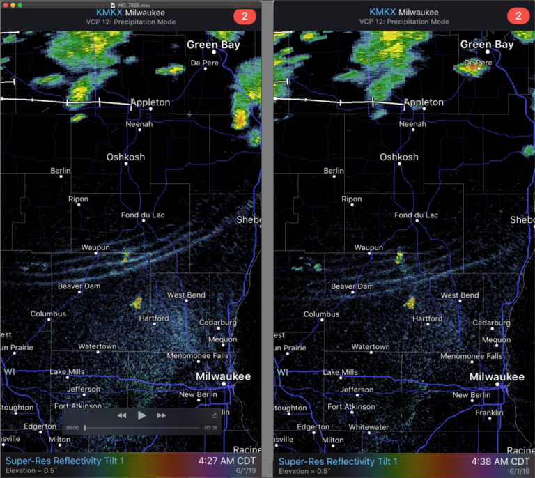
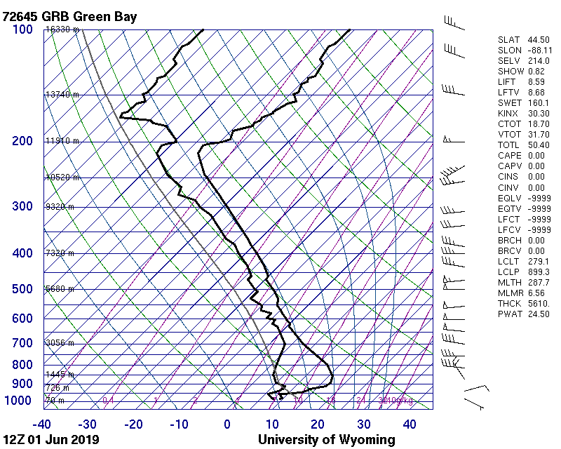
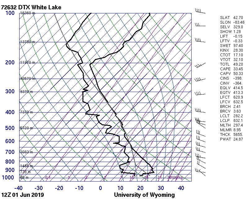
Strong near-surface inversions over the upper-midwest early on 1 June 2019 (as shown by 1200 UTC Skew-Ts at Green Bay, WI, Detroit/WhiteLake, MI and Gaylord, MI) helped support the presence of southward-propagating bore features, as shown in the still image (an animation) of radar imagery above (Courtesy Fred Best, SSEC), and (more subtly) in... Read More
