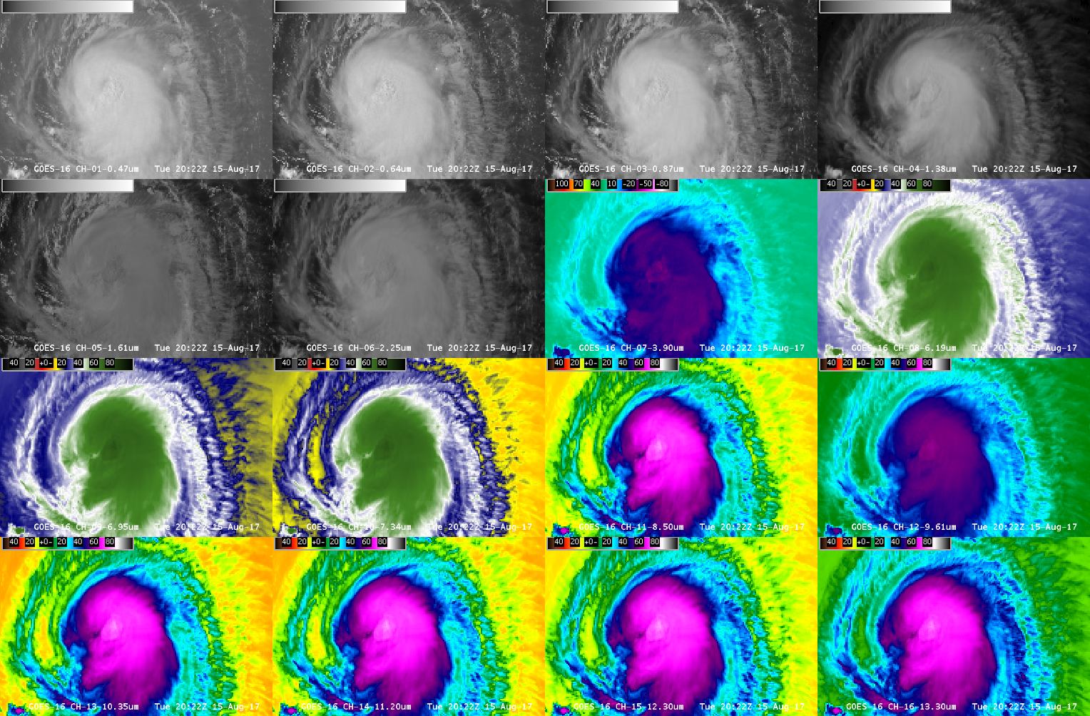
This website works best with a newer web browser such as Chrome, Firefox, Safari or Microsoft Edge. Internet Explorer is not supported by this website.

Category: Other Satellites

Hurricane Matthew moves into the Bahamas

The animation of Matthew, above, from morphed microwave imagery (from this site), shows the toll that interaction with the high terrain of Hispaniola and eastern Cuba has had on the storm (causing it to be downgraded from Category 4 to Category 3 intensity). The formerly distinct eye had eroded, although eye re-formation... Read More

Hurricane Matthew

Early morning visible imagery over Matthew, above, from GOES-13, shows a circular storm with many overshooting tops and no apparent eye. However, Microwave imagery, below, from GCOM at about 0620 UTC, shows an eye structure beneath the clouds. (Information on AMSR-2 is here; Imagery was produced using Polar2Grid, part of... Read More

Heavy rainfall and flash flooding in Maryland

A 2-panel comparison of GOES-13 (GOES-East) Visible (0.63 µm) and Infrared Window (10.7 µm) images (above) showed a band of thunderstorms oriented southwest-to-northeast across northern Virginia and northern Maryland late in the day on 30 July 2016. Cells within this band produced very heavy rainfall and extreme flash flooding at Ellicott City,... Read More