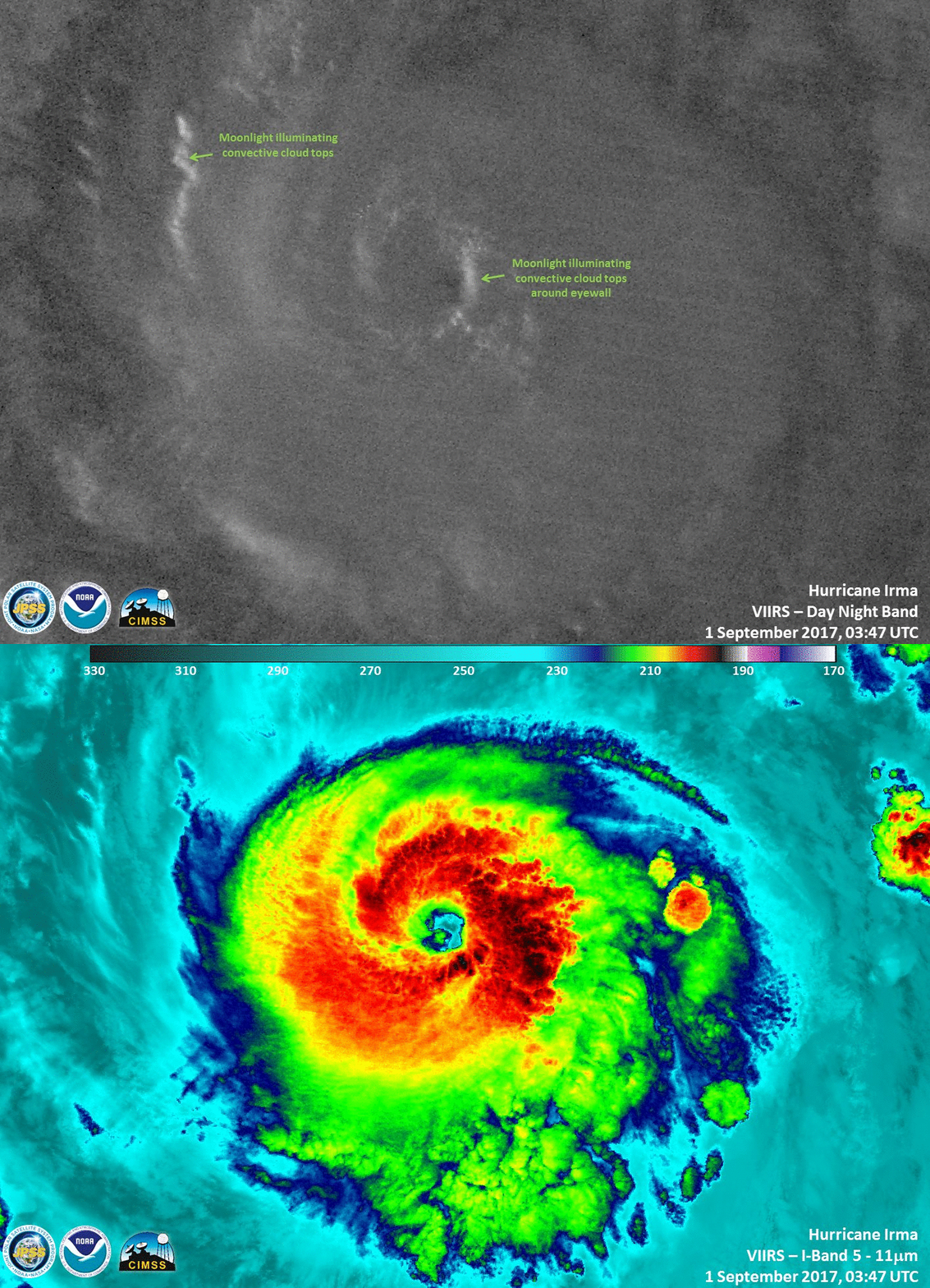
Hurricane Irma in the eastern Atlantic Ocean
A toggle between nighttime images of Suomi NPP VIIRS Infrared Window (11.45 µm) and Day/Night Band (0.7 µm) data at 0347 UTC (courtesy of William Straka, SSEC/CIMSS) showed a high-resolution view of the eye of Category 3 Hurricane Irma.
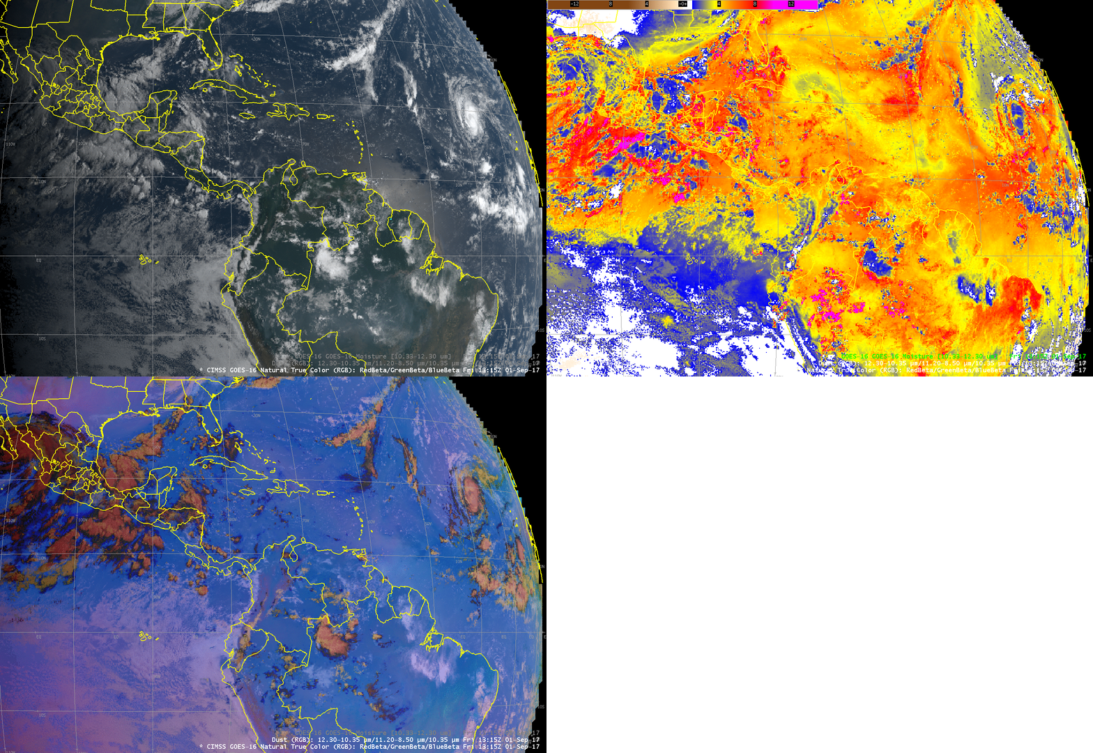
Toggle of CIMSS True Color, GOES-16 Split Window Difference (10.3 µm – 12.3 µm) field, and GOES-16 Dust RGB Product, 1315 UTC on 1 September 2017 (Click to enlarge)
GOES-16 data (ABI and GLM) posted on this page are preliminary, non-operational and are undergoing testing
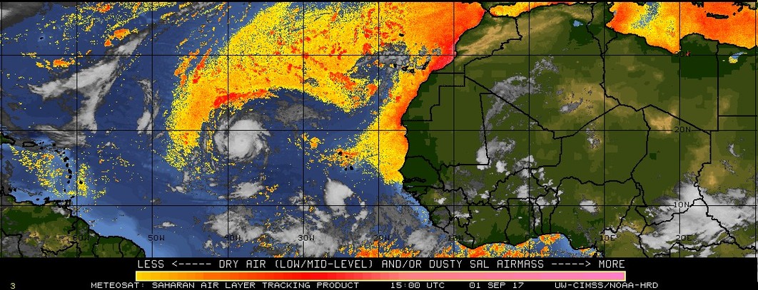
The animation above cycles through imagery from 1315 UTC on 1 September, showing CIMSS GOES-16 True Color Imagery, The GOES-16 Split Window Difference (10.3 µm – 12.3 µm), and the GOES-16 Dust RGB (Red-Green-Blue) Product. The Split Window Difference field highlights moist air (bright red in the enhancement) to the south of Irma, and also dryer air (blue in the color enhancement), to the north. The Saharan Air Analysis, below, from the CIMSS Tropical Weather Website, corroborates the placement of the dry air to the north of Irma, and Total Precipitable Water estimates (from here) also show dry air. This dry air could influence further strengthening of the storm in the short term.
Irma is near the eastern edge of the GLM Domain for GOES-16 in the central Test position at 89.5 W Longitude; the animation below, with GLM Group information (every 10 minutes) over ABI Band 13 (10.3 µm, every 30 minutes from the Full Disk Domain), shows little lightning near the center of Irma on 30/31 August. Lightning was more active on 1 September.
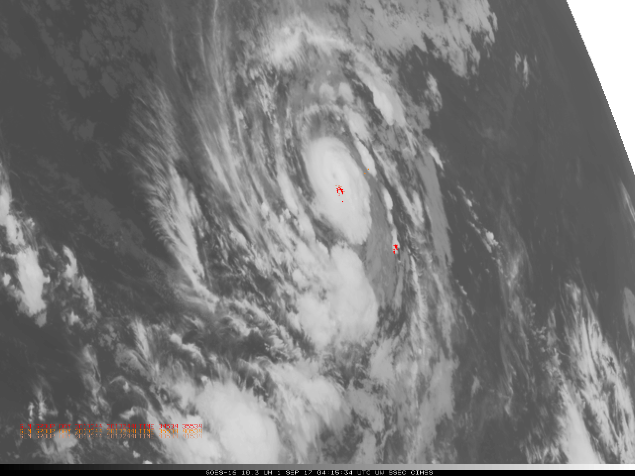
GOES-16 ABI “Clean Window” 10.3 µm Infrared Imagery, every half hour, with GLM Group Data plotted in 10-minute increments from 0000 UTC on 30 September through 1200 UTC on 1 September 2017 (Click to animate)
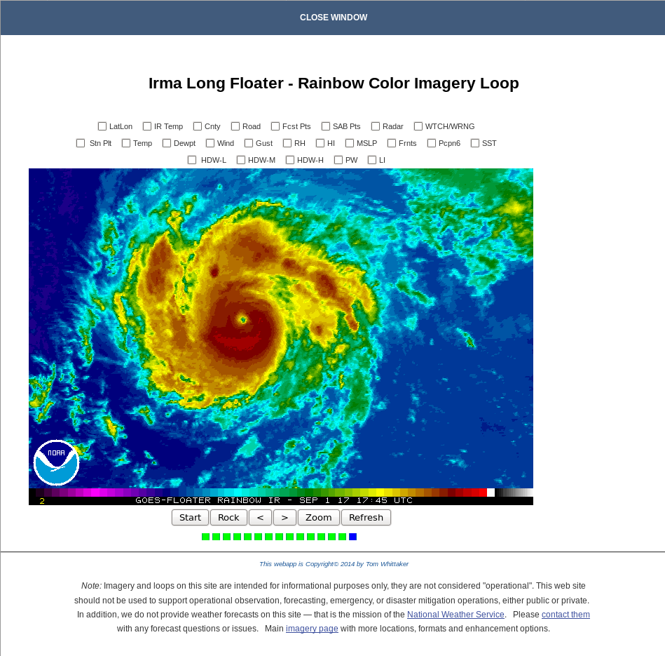
Satellite trends with Irma show the development of an eye structure, as seen below in the screen capture from the GOES-13 Floater (source) at 1745 UTC, and DMSP-16 SSMIS Microwave (85 GHz) at 1829 UTC on 1 September.
The evolution of the eye is also apparent in the GOES-16 Visible Imagery (0.64 µm), below, from 1315-1815 UTC on 1 September 2017.
For more information on Irma, consult the webpages of the National Hurricane Center or the CIMSS Tropical Weather Website.


