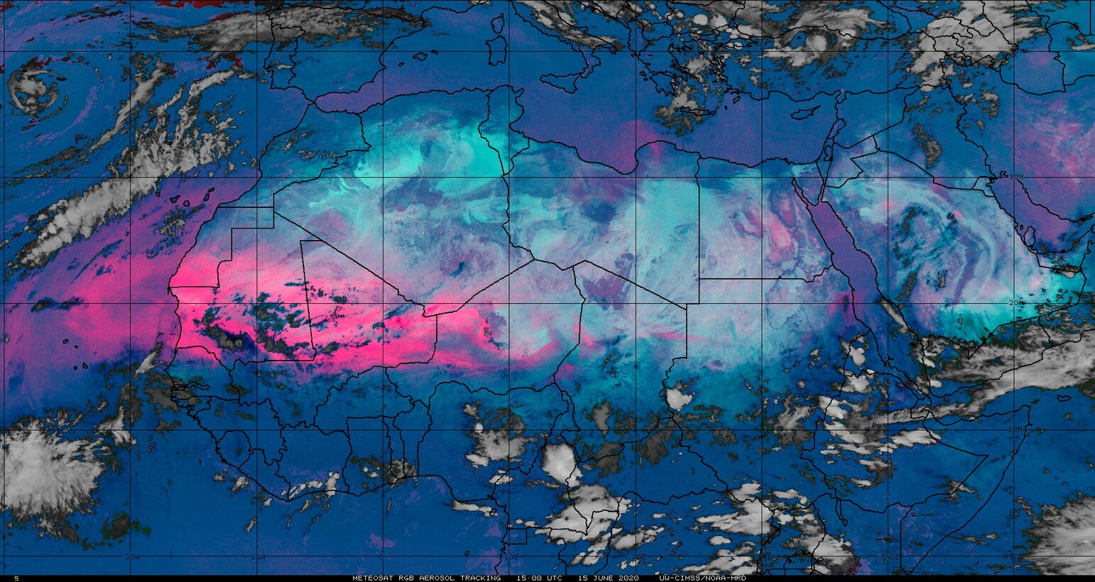
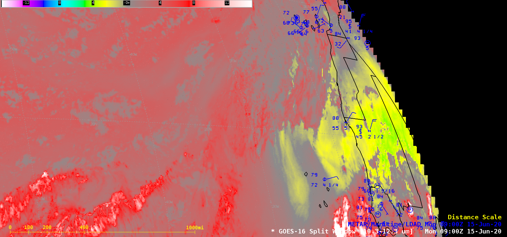
Detection of Saharan Air Layer in the eastern Atlantic
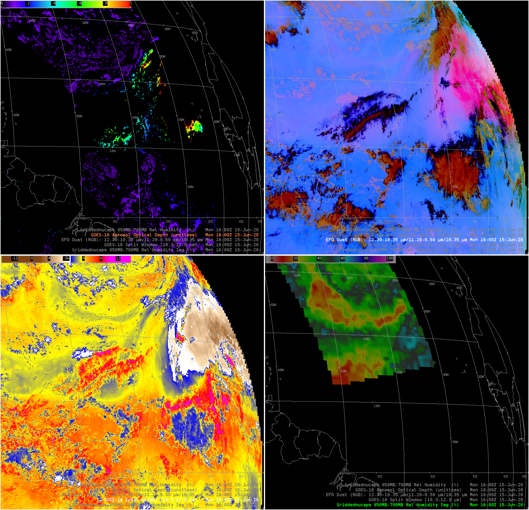
GOES-16 Split Window difference (SWD) fields, above, and Meteosat Dust RGB imagery (both from 1500 UTC on 15 June 2020, and available at this site) suggest that a Saharan Air Layer (SAL) event is developing in the eastern Atlantic Ocean. (Click here to see an animation of the Split Window Difference; AWIPS note: the... Read More

