Heavy Rain over New York City
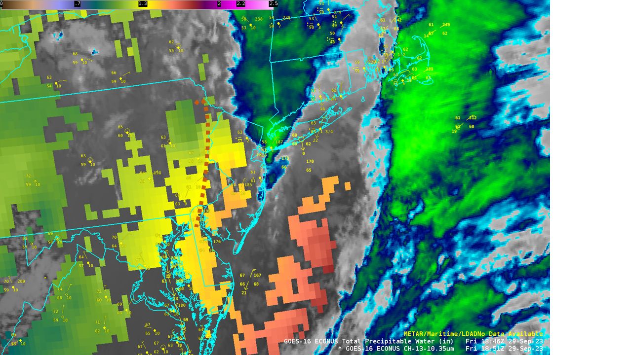
Persistent rains over the New York City metropolitan area have caused urban flooding on 29 September (29 September is the wettest day since 1948 in NYC well!). MIMIC TPW, above (source), shows moisture moving inland from the Atlantic Ocean. It’s often the case that heavy rain is accompanied by advection of moisture at multiple layers in the atmosphere; the Advected Layer Precipitable Water product,... Read More