SAR observations of severe weather over western Lake Superior
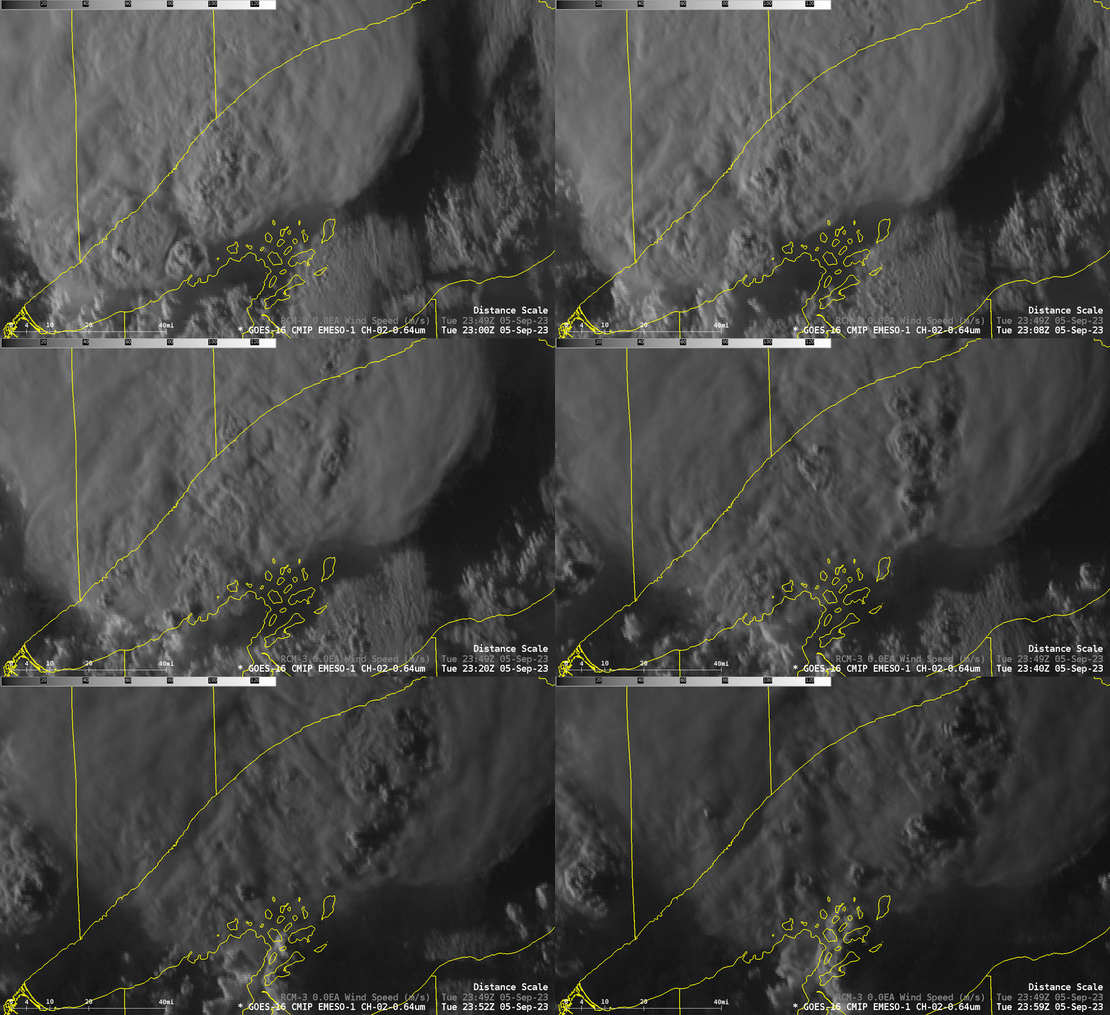
Northeastern Minnesota, northwestern Wisconsin and the adjacent waters of Lake Superior experienced severe weather late on 5 September 2023. The animation below shows the strong convection moving over western Lake Superior. GOES-16 Mesoscale Sector 1 imagery from 2300-2359 UTC shows numerous convective towers bubbling up and collapsing. Storm Reports from SPC include a 2315 UTC report of a 61-knot gust from the ship Dirk S. VanEnkevort 25 miles southeast of Lutsen (satellite image at that time; note the overshooting top!).
The Storm Prediction Center had a Slight Risk over the western Great Lakes on the 5th, consistently from the 1200 outlook through the 2000 UTC outlook. Watch box #669 was issued for the region at 2100 UTC; the primary threat was strong winds and hail. See also SPC”s Mesoscale Discussions 2084 and 2087 on that day.
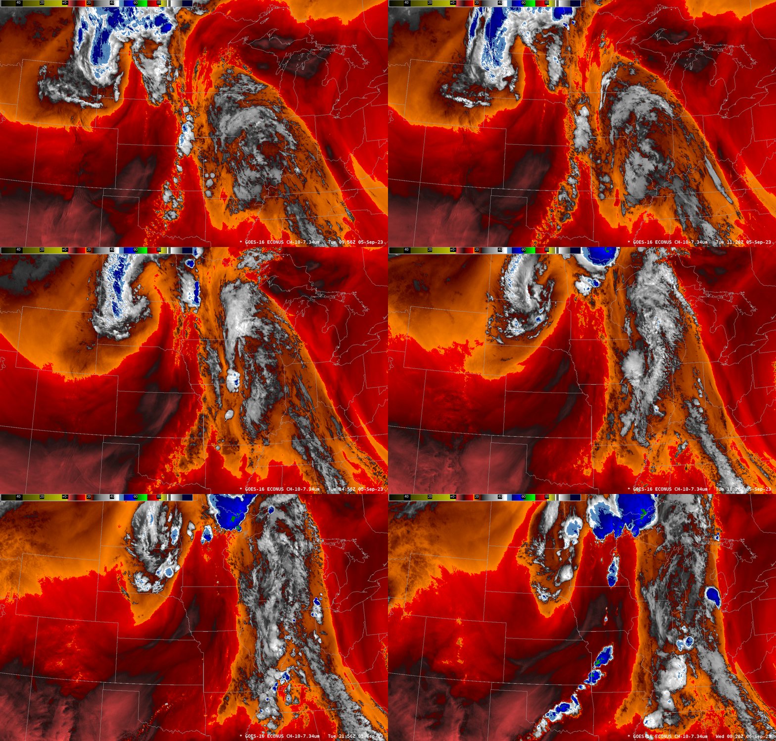
The Plains were under the influence of an Elevated Mixed Layer (EML) on this day, as shown in the GOES-16 Band 10 (Low-level water vapor) infrared animation below; EMLs in this enhancement are dark red. The 1200 UTC sounding from Topeka (here, or here), shows very steep mid-level lapse rates as expected with an EML. That is the type of airmass moving northeastward towards Lake Superior during the day.
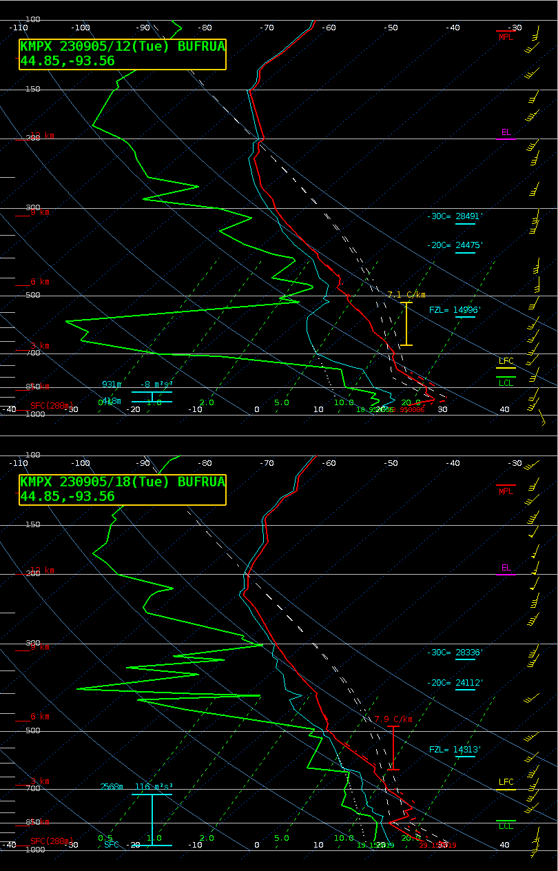
The upper-air station at Chanhassen MN released a balloon at 1800 UTC, and the toggle below shows the airmass change between 1200 and 1800 UTC on the 5th: the atmosphere moistened and destabilized in those 6 hours. Notice that the shear has changed as well.
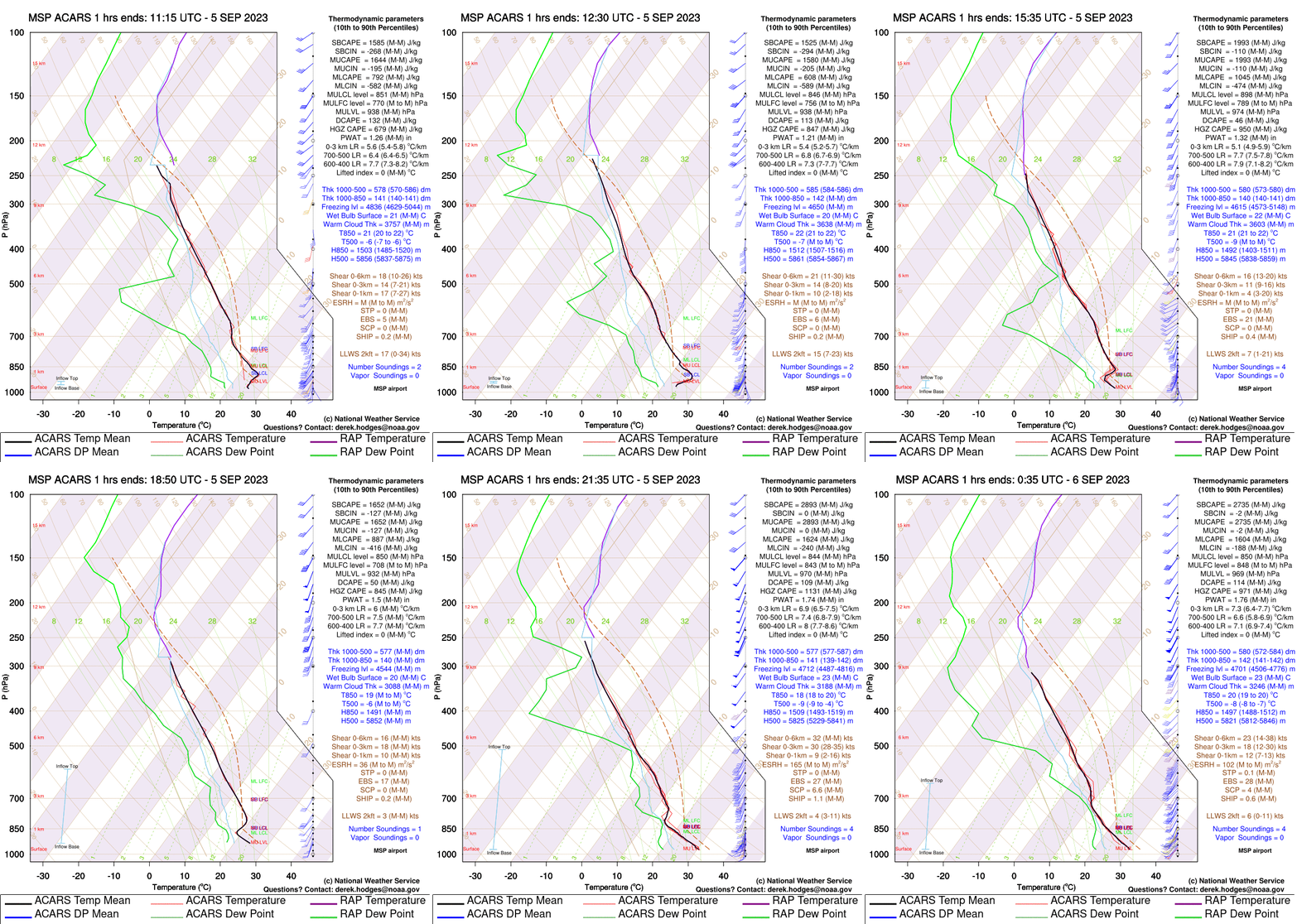
Upper-air information with better time resolution was available 5 September for the Minneapolis airport from ACARS data, as shown below. On this day however, no water vapor information was available, so the erosion of the dry layer that is apparent in the two soundings above is not sampled.
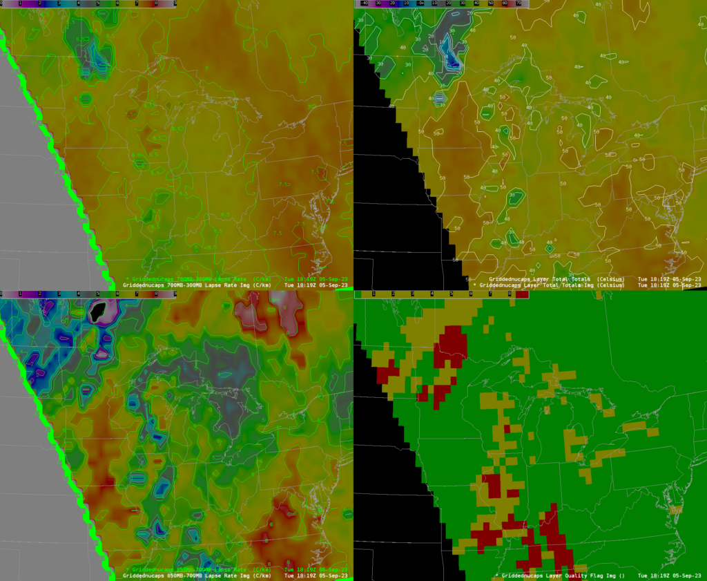
NOAA-20 overflew the region shortly after 1800 UTC on 5 September. NUCAPS profiles derived from CrIS and ATMS data on board NOAA-20 could be used to diagnose the thermodynamics of the atmosphere at the time. The image below shows lapse rates (850-700; 700-300) and the Total Totals index; all parameters show a corridor of reduced stability stretching from south-central Minnesota up to western Lake Superior. Quality Flags show green, many complete infrared retrievals, in this region, as might be expected from the visible satellite image. Data from both GOES and JPSS satellites suggest strong convection is possible.
The slider below compares the 2349 UTC visible imagery with SAR winds derived from RCM3 Normalized Radar Cross Section (NRCS) observations. Note that SAR wind observations over land (including the Apostle Islands) are not valid. Numerous wind maxima in the 25-30 m/s range are apparent in the region of convection extending northeast of the Apostle Islands.
Thanks to Patrick Ayd, Science and Operations Officer at WFO Duluth, for alerting us to this very interesting event!

