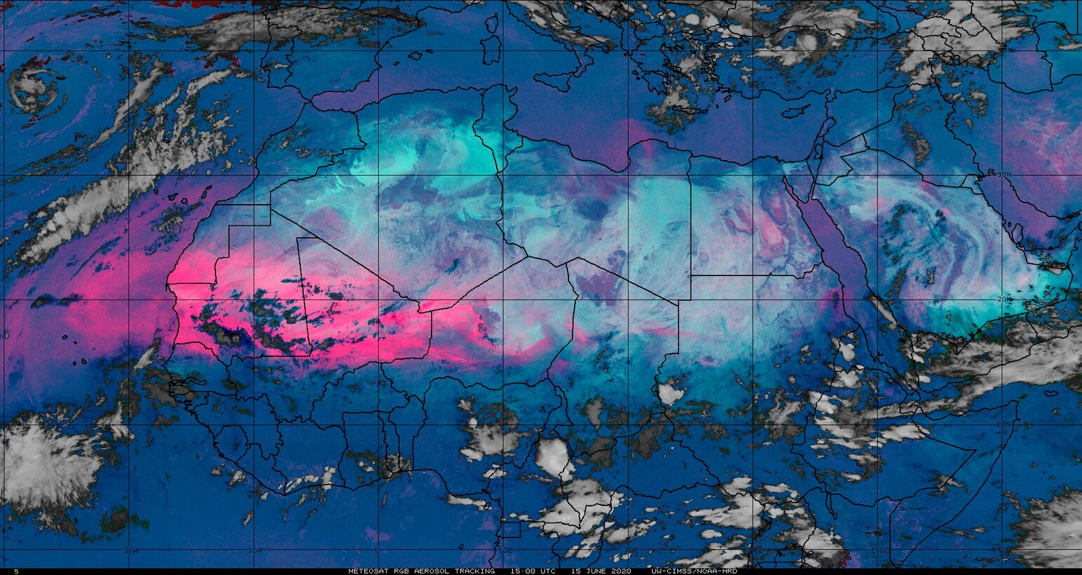
Saharan Air Layer dust continues to stream over the Atlantic Ocean
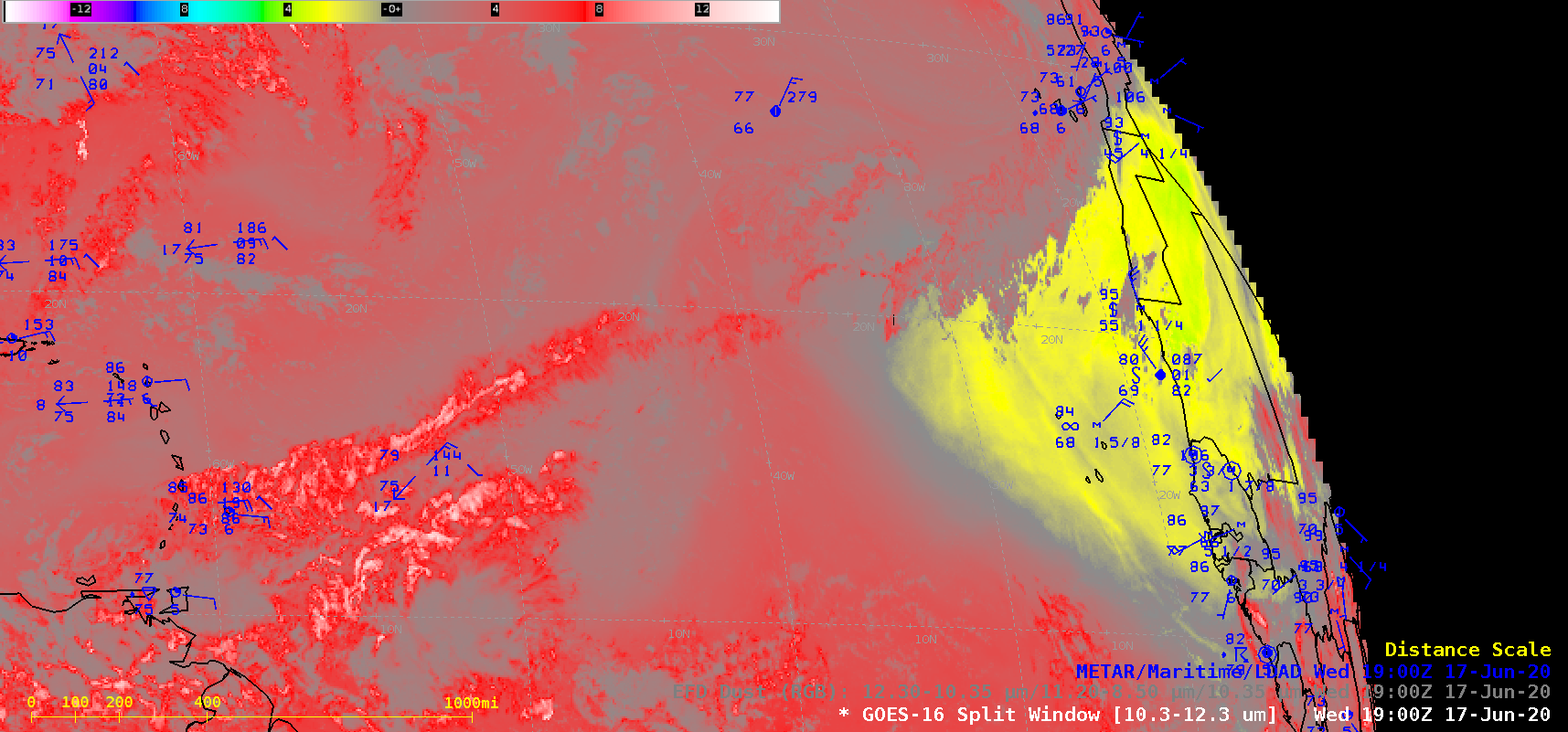
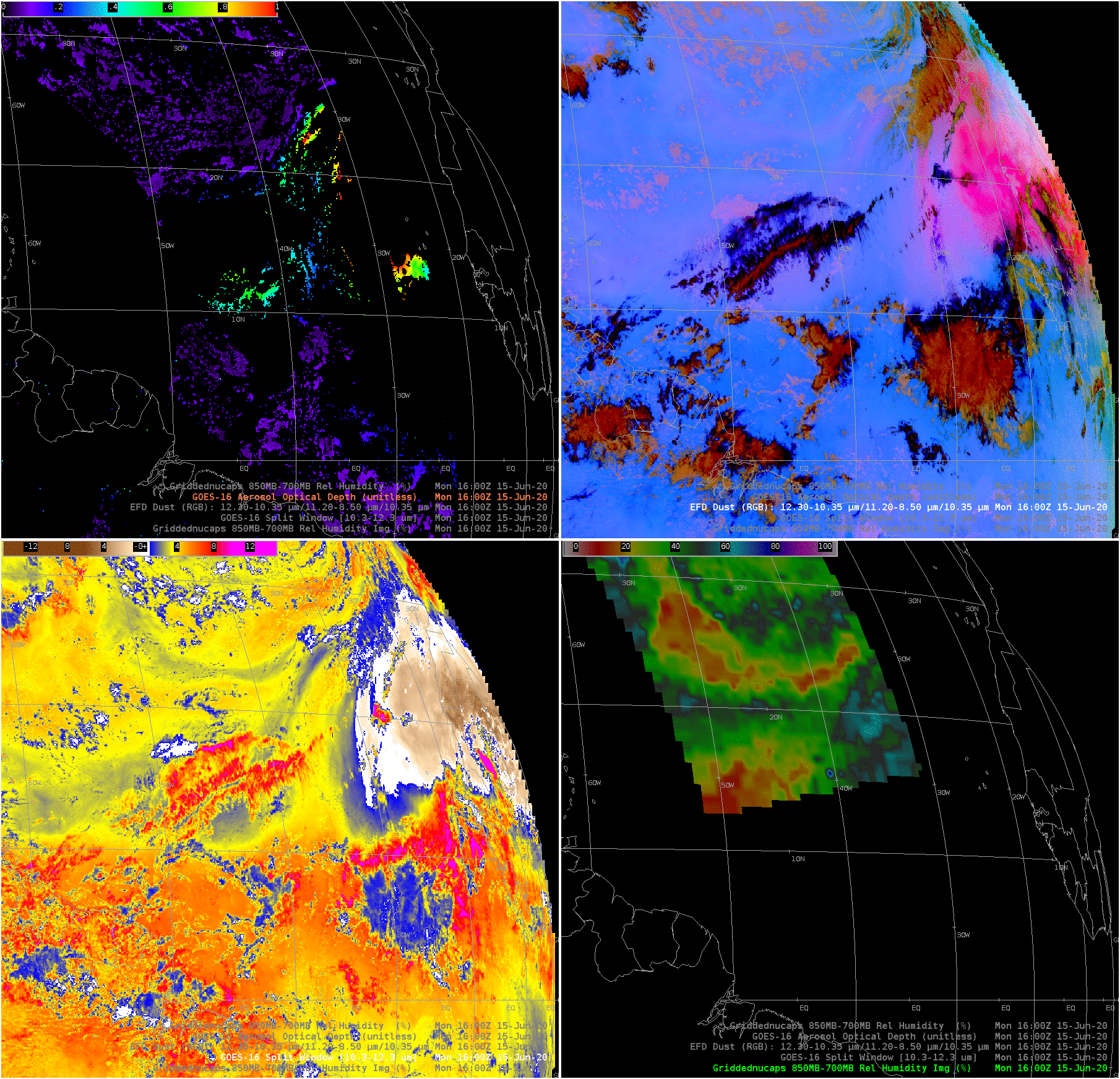
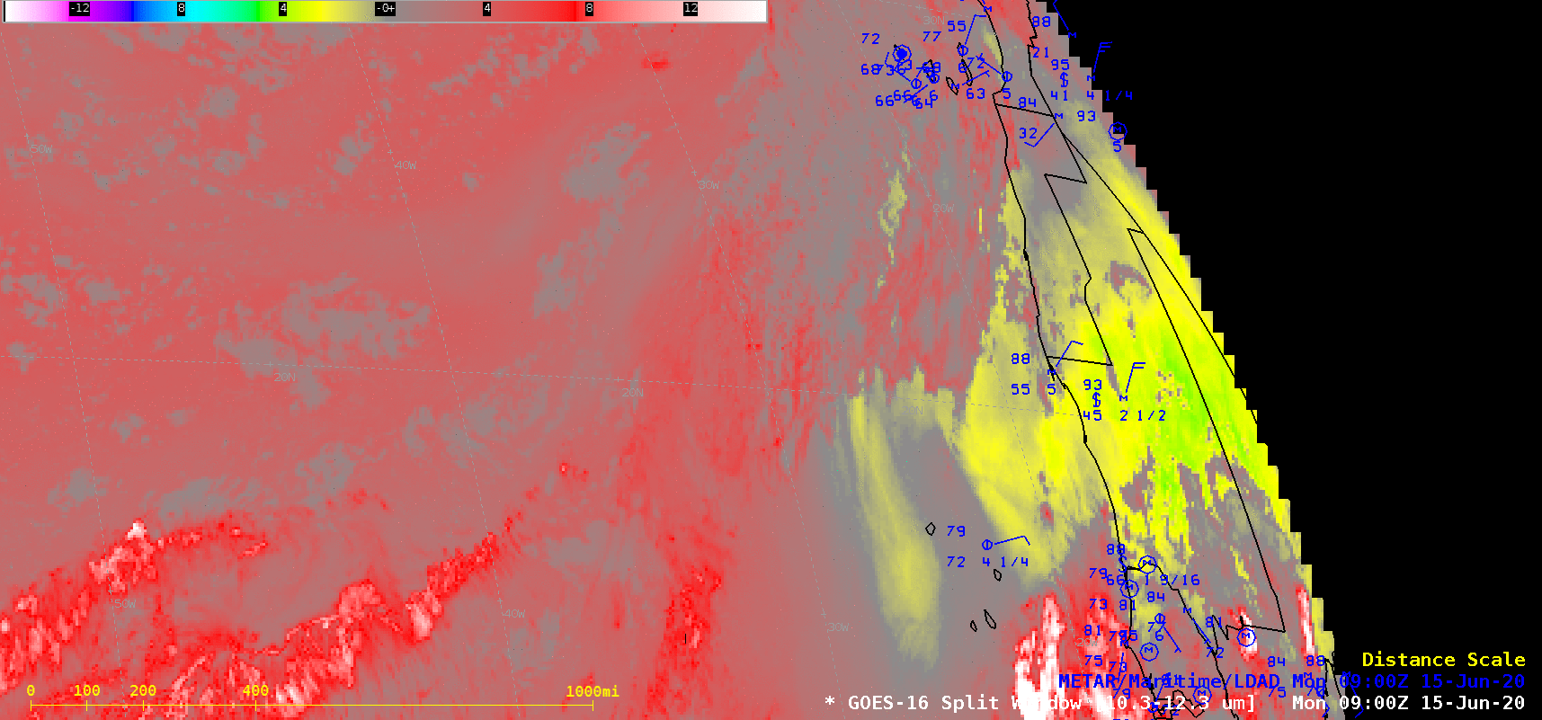
As a follow-up to this 15 June blog post, GOES-16 (GOES-East) Split Window Difference (10.3 µm – 12.3 µm) and Dust RGB (Red-Green-Blue) images (above) displayed signatures of another dense plume of Saharan Air Layer dust — which appeared as shades of yellow in the Split Window Difference images, and shades of magenta in the Dust RGB images — that was... Read More
