Inferring wind speed from ACSPO SSTs

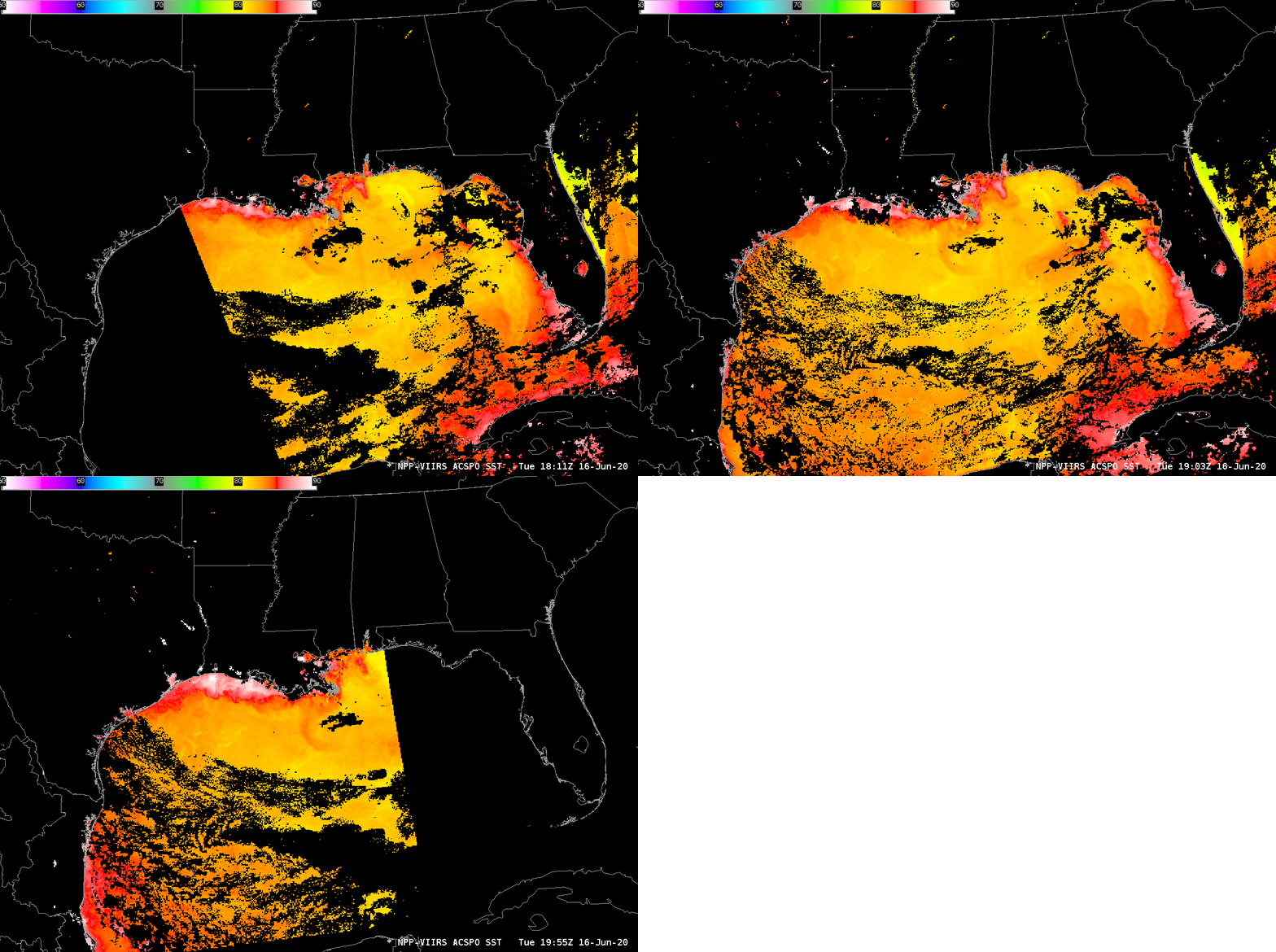
ACSPO Sea Surface Temperatures on 16 June 2020 from 1811 UTC (from Suomi NPP), 1903 UTC (from NOAA-20) and 1955 UTC (from Suomi NPP again) on 16 June 2020 (Click to enlarge)
The animation above shows Advanced Clear-Sky Processor for Ocean (ACSPO) sea-surface temperatures at three different times on 16 June: 1811 UTC (using data from Suomi NPP), 1903 UTC (using data from NOAA-20) and 1955 UTC (using data, again from Suomi NPP). (Orbit paths for the satellites can be viewed here). Note that the default color map bounds for these images has been changed to be from 50º F to 90º F.
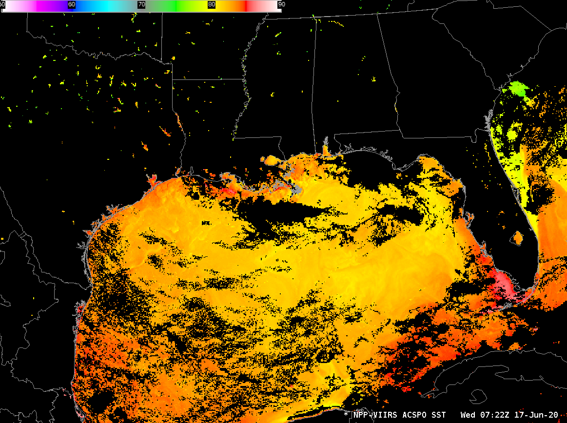
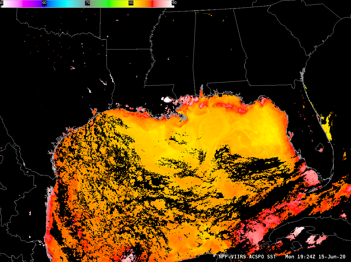
Compare the 3 images above to the 0727 UTC 17 June SST analysis, below, or to the SST analysis from 1924 UTC on 15 June 2020, at bottom. In all the analyses, mid-Gulf SSTs are fairly constant around 82º F. Shoal waters south of Louisiana or off the coast of southwest Florida show very warm temperatures on the 16th. This kind of near-shore warming can occur during the day when winds are weak and wave action is small. (The 3 surface charts from 1800 UTC on 14, 15 and 16 June, shown here, show a weakening in the winds with time over the northern Gulf of Mexico.) As winds and wind-driven waves slacken, the amount of turbulent mixing at the ocean surface decreases, allowing for the surface skin of the ocean to become very warm; that warmth is detected by the satellite. Winds and waves do not slacken in the central Gulf; vertical mixing in the top of the ocean in that region does not change. (The relationship between winds and sea surface temperatures has been discussed on this blog in the past; see here, for example.)
Large diurnal changes in near-shore sea-surface temperatures very often indicate slack winds and small waves.
ACSPO Sea-Surface Temperatures are available via an LDM feed from CIMSS. They are computed from Direct-Broadcast data downloaded via antennas in Madison.


