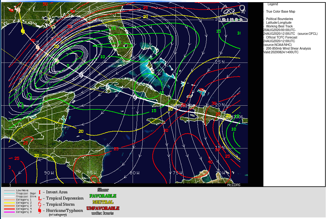
Tropical Storm Laura south of Cuba
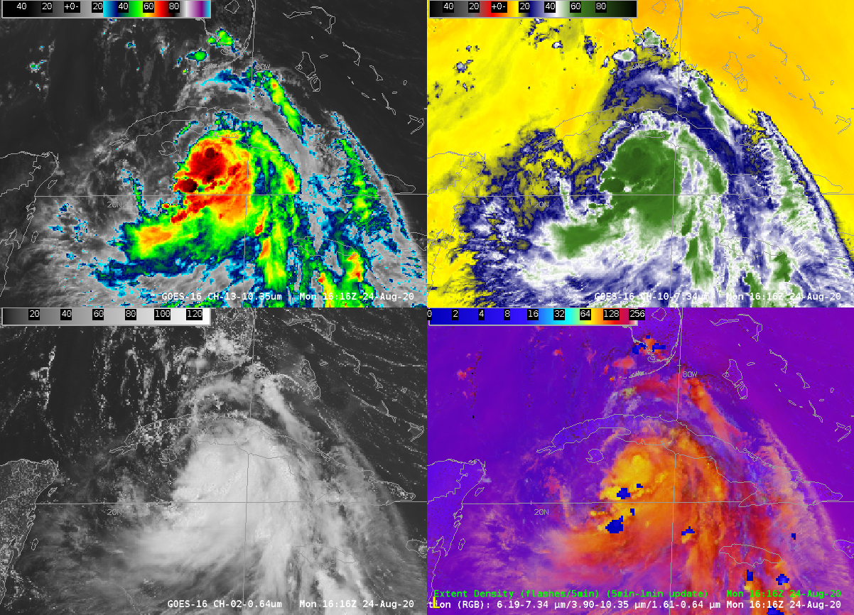
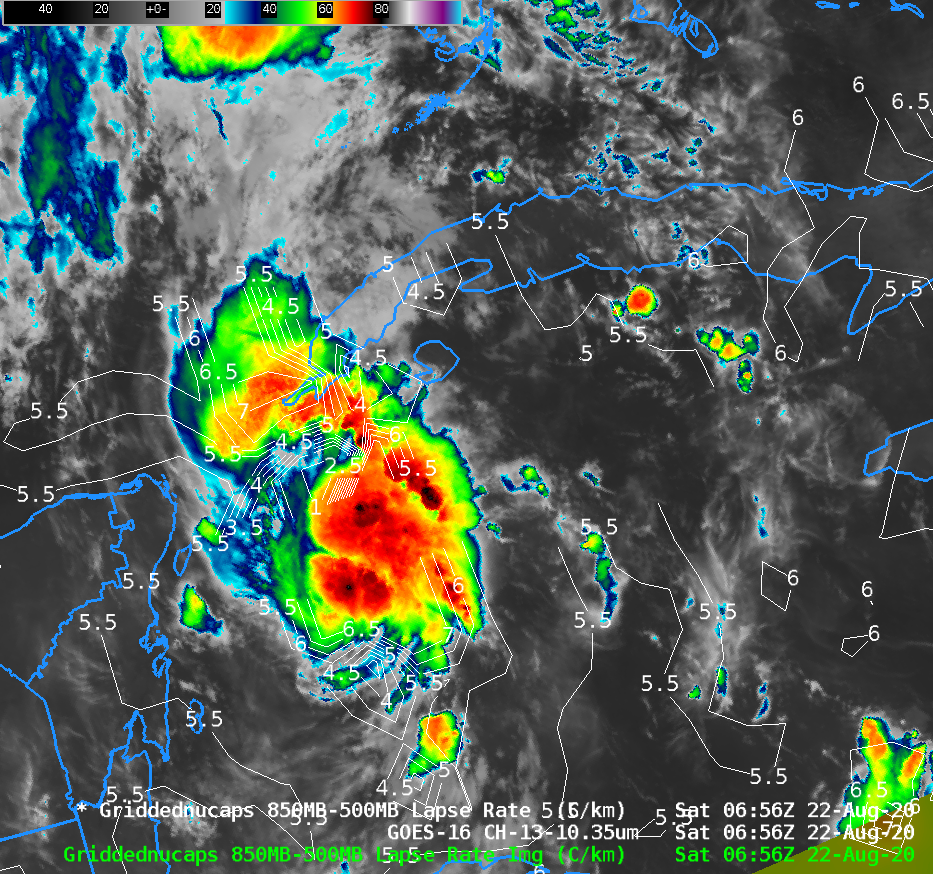
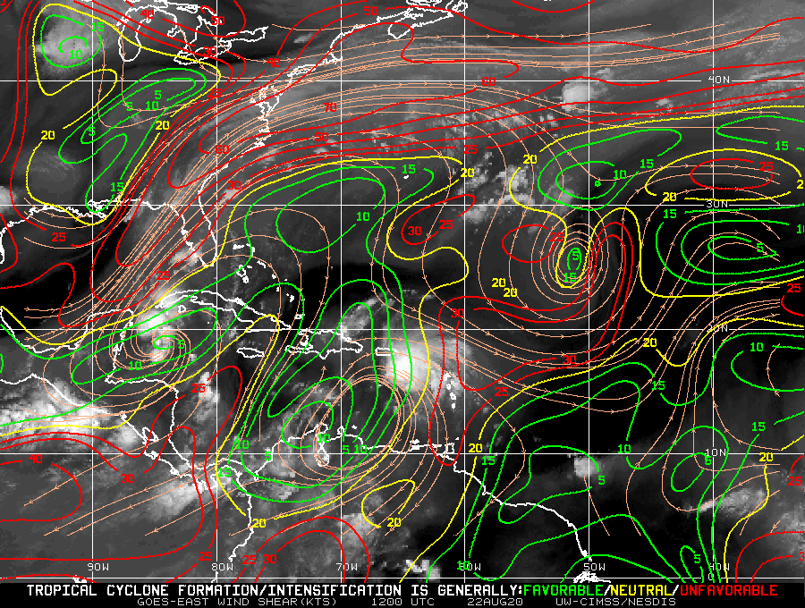
Tropical Storm Laura’s path near/over the Greater Antilles has affected her strength, and the relative lack of organization means that night-time satellite identification of the center is a challenge. Consider the animation above. Northerly shear (analysis from this site) has shifted the coldest cloud tops to the south of the circulation center... Read More
