NUCAPS diagnoses of stable air near Tropical Storm Marco

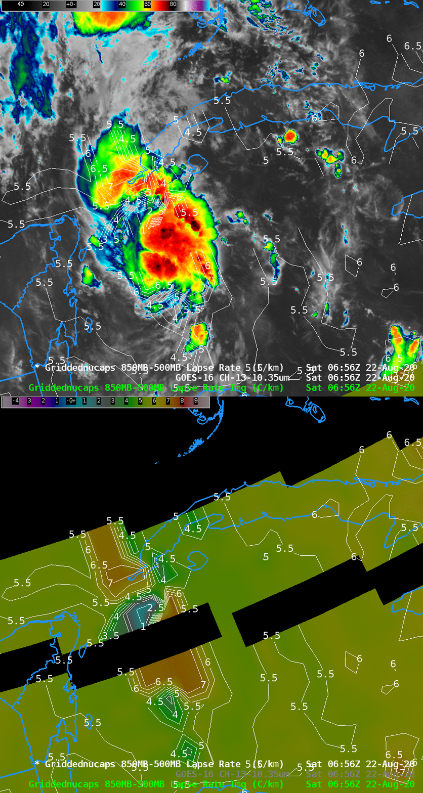
GOES-16 ABI Band 13 Clean Window Infrared Imagery (10.3 µm) and NOAA-20 derived Gridded NUCAPS 850-500 mb lapse rates, 0656 UTC on 22 August 2020 (Click to enlarge)
Tropical Storm Marco over the northwest Caribbean Sea, shown above in a toggle of GOES-16 ABI Clean window imagery (10.3 µm) and a NUCAPS diagnosis of 850-500mb lapse rates, is over very warm waters and in a region of favorably low diagnosed vertical wind shear. (Wind shear is from this website, (direct link to shear); the product is described here) An inhibiting feature in strengthening, as noted in the National Hurricane Center discussion, is stable air.
NOAA-20 overflew Marco shortly before 0700 UTC on 22 August, and NUCAPS soundings derived from CrIS and ATMS data on NOAA-20 showed the stable mid-tropospheric air surrounding the storm. The 850-500 mb lapse rates were around 5.5 C/km. (Gridded NUCAPS data can also be viewed here) Individual soundings over western Cuba and just off the northwest tip of the Yucatan peninsula also show the relatively stable air. (Click here to see the Lapse Rate Analysis overlain with NUCAPS Sounding Availability points from the AWIPS display)
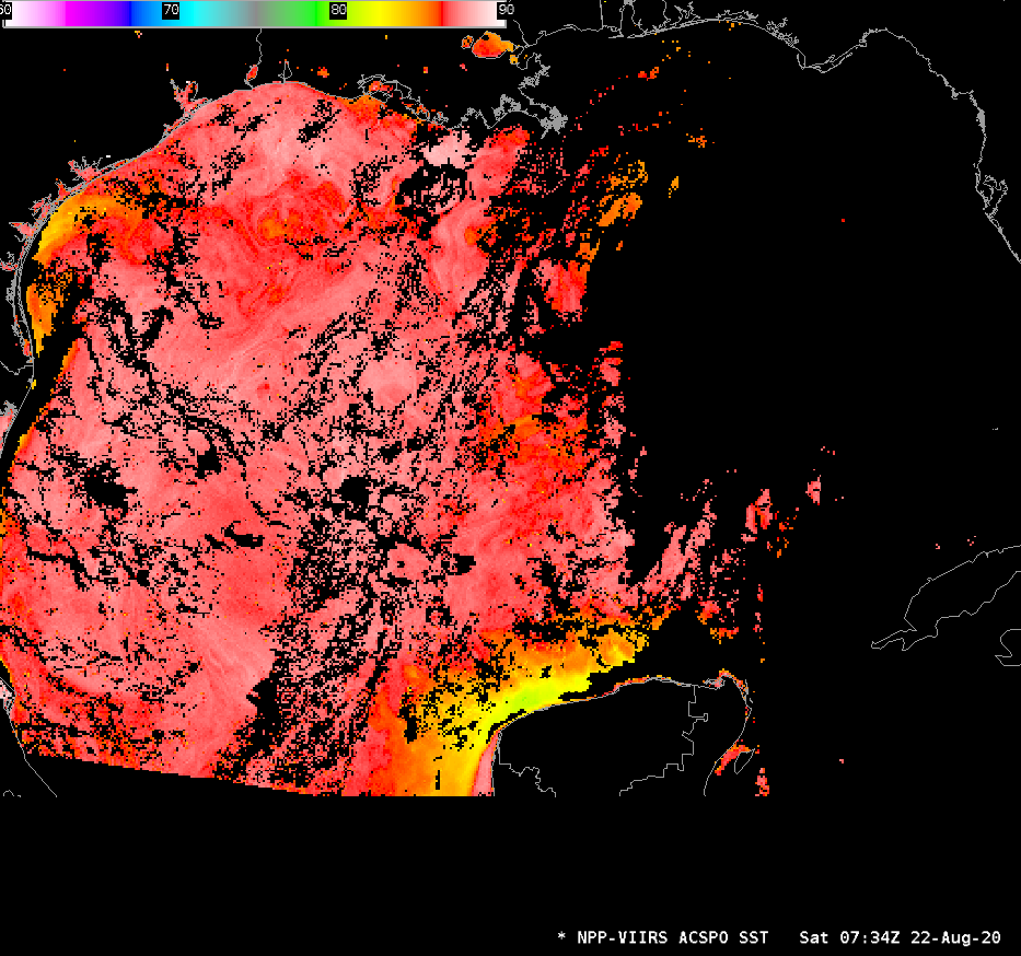
Marco’s future path is forecast to move over very warm waters that are shown in the ACSPO analysis of SSTs, below, from Suomi-NPP VIIRS data. Consult the National Hurricane Center for the latest on this storm that will likely affect the Texas/Louisiana Gulf Coasts.


