This website works best with a newer web browser such as Chrome, Firefox, Safari or Microsoft Edge. Internet Explorer is not supported by this website.

Category: NOAA-20

Using CSPP’s polar2grid to create mappings of sea-surface temperature

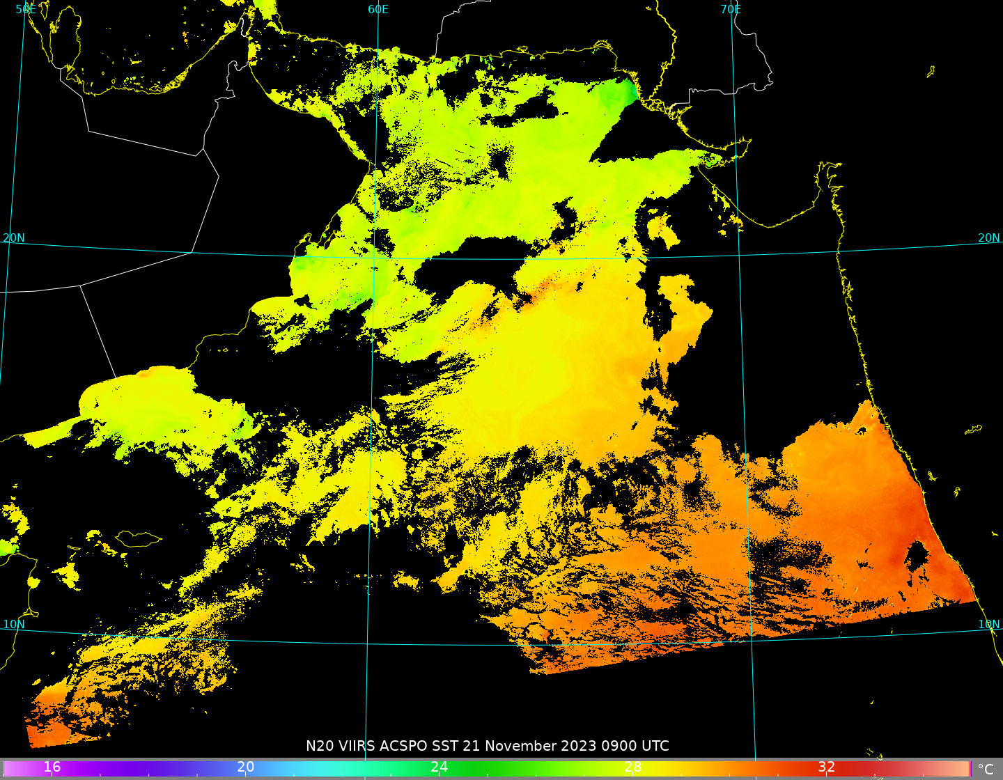
The Community Satellite Processing Package (CSPP) allows a user to manipulate VIIRS data to create high-quality, full-resolution imagery (see, for example, this I05 example, and this Day Night Band example, and this I01 example). In addition to single-band images, imagery for products such as Advanced Clear Sky Processor for Ocean (ACSPO) sea-surface temperatures (SSTs) can also be created, as shown above. Polar2grid software... Read More

Hurricane Otis rapidly intensifies to Category 5, just prior to making landfall near Acapulco, Mexico

1-minute Mesoscale Domain Sector GOES-18 (GOES-West) “Clean” Infrared Window (10.3 µm) images (above) showed Hurricane Otis as it approached the coast of Mexico, making landfall near Acapulco (Acapulco International Airport, METAR identifier MMAA, is located about 16 miles southeast of the city center) around 0625 UTC on 25 October 2023. During the 11-hour time period shown,... Read More