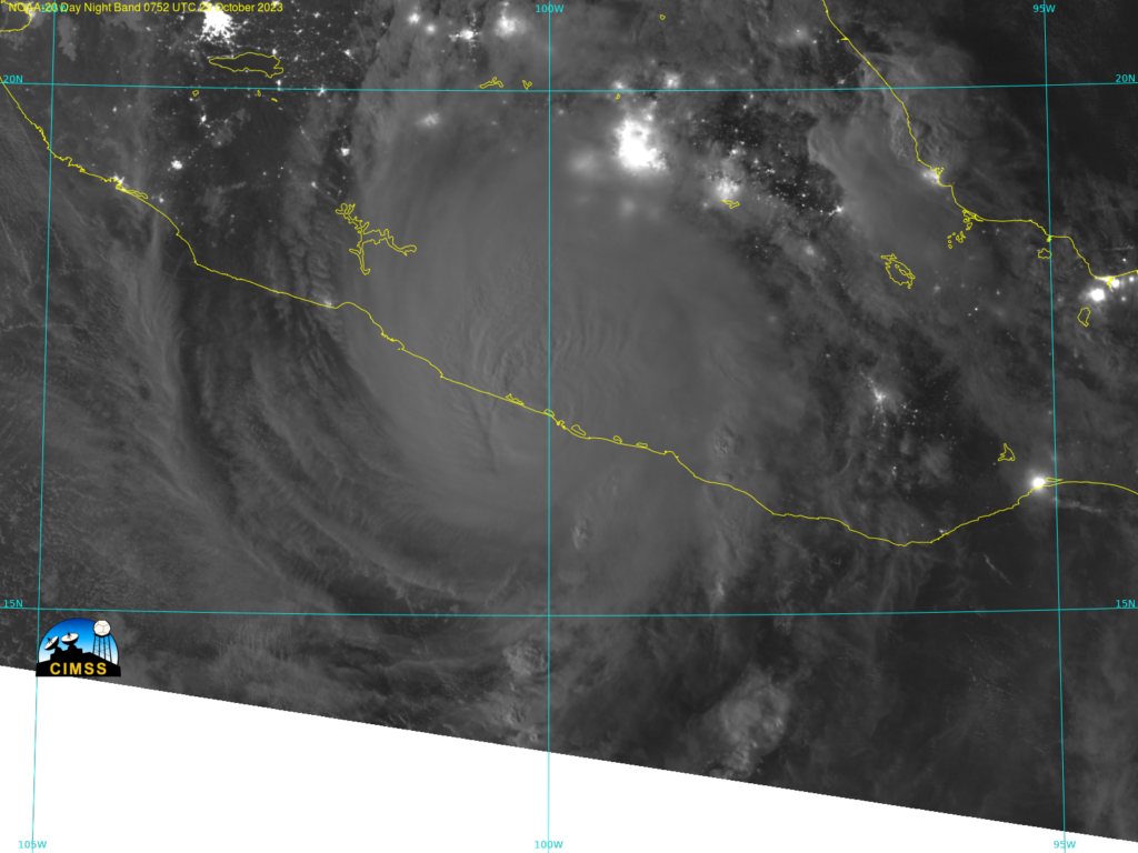
Cat 5 Hurricane Otis from the Wisconsin Direct Broadcast site
Hurricane Otis explosively developed yesterday and made landfall near midnight on 25 October. The image below shows Day Night Band visible imagery from NOAA-20 at 0752 UTC, shortly after the storm made landfall near Acapulco, Mexico as a Category 5 storm. A clear eye is not apparent, and no lightning streaks are detected either. The Sensor Data Records (SDRs) for the image below were downloaded from the CIMSS Direct Broadcast website (at this temporary link; pre-made imagery is also available here), and the imagery was created using Polar2Grid (available at the CSPP download site here). Sensor Data Records for NOAA-20 can also be downloaded here.

Note: The image above is time-stamped 0752 UTC, as that was when the first line of the satellite data used to create the image was received. In reality, NOAA-20 was acquiring data over Acapulco closer to 0808 UTC based on this predicted orbit path (from this site).

