Large-scale blowing dust event
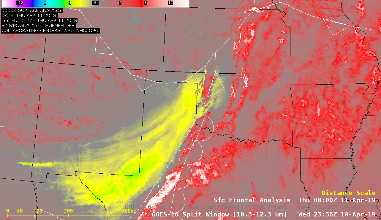
Strong winds — gusting as high as 77 mph in New Mexico and 88 mph in Texas — associated with a rapidly-intensifying midlatitude cyclone generated large plumes of blowing dust (originating from southeastern Arizona,southern New Mexico, northern Mexico and western Texas) on 10 April 2019. GOES-16 (GOES-East) Split Window (10.3-12.3 µm) images (above)... Read More