This website works best with a newer web browser such as Chrome, Firefox, Safari or Microsoft Edge. Internet Explorer is not supported by this website.

Category: MODIS

Thunderstorms in Arizona

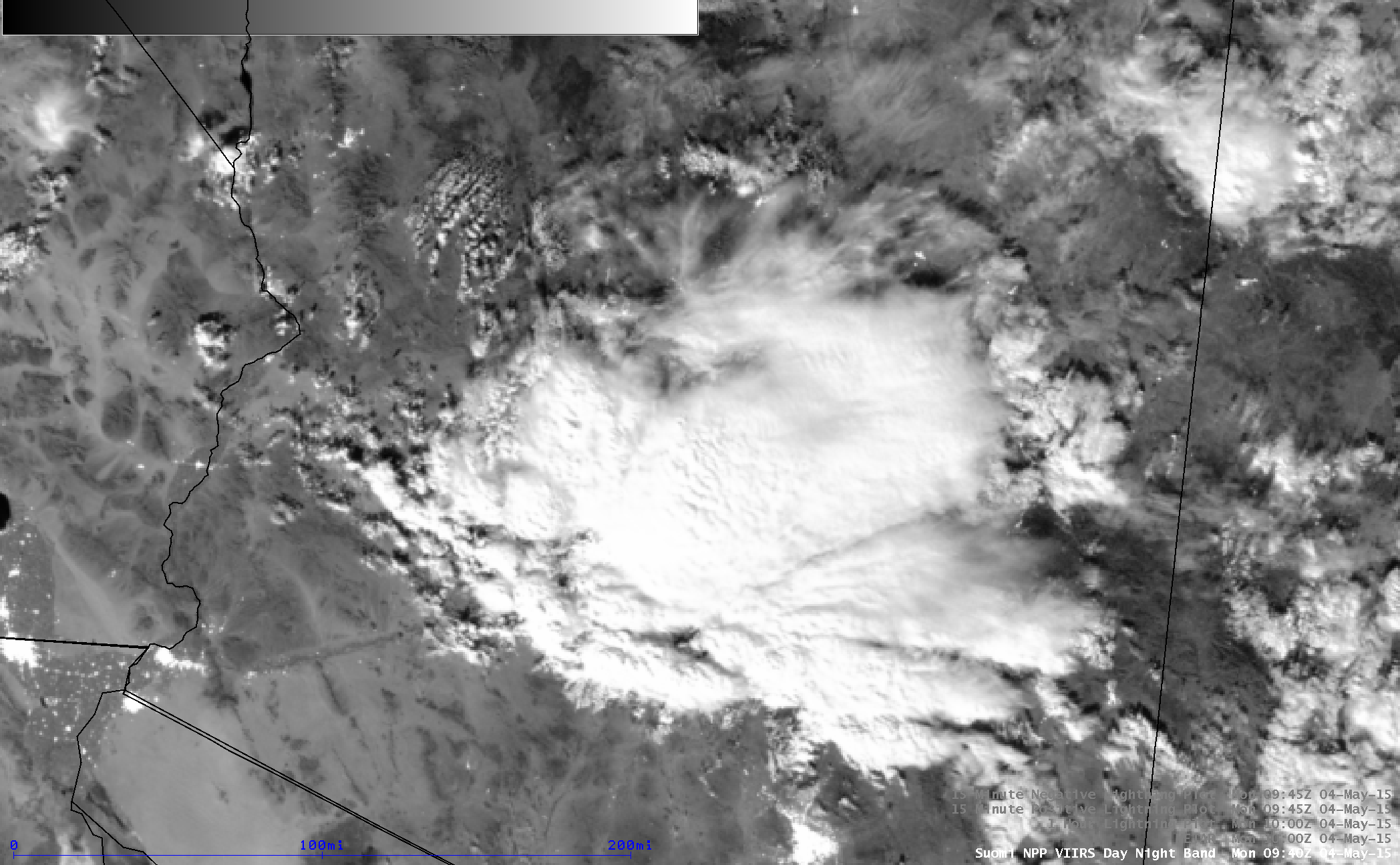
4-km resolution GOES-13 (GOES-East) 10.7 µm IR channel images (above; click image to play animation) showed the development and northward propagation of clusters of thunderstorms across Arizona on 04 May 2015. The coldest cloud-top IR brightness temperature was -49º C (darker red color enhancement). As the storms later organized into... Read More

Calbuco volcanic eruption in Chile

The Calbuco volcano in southern Chile erupted around 2103 UTC or 6:03 pm local time on 22 April 2015. The first good satellite view of the volcanic cloud was provided by the 2138 UTC or 6:38 pm local time GOES-13 (GOES-East) 0.63 µm visible channel and 10.7 µm IR channel... Read More

Ice over the Great Lakes

Visible Imagery over the Great Lakes on Friday April 17th showed mostly open waters over the five lakes, with regions that could be ice confined to coastlines of Lakes Superior, Huron, Erie and Michigan. The animation above is of Suomi NPP VIIRS visible (0.64µm and 0.70µm) and near-infrared (0.86µm) data.... Read More