Heavy rainfall and flash flooding across North Texas
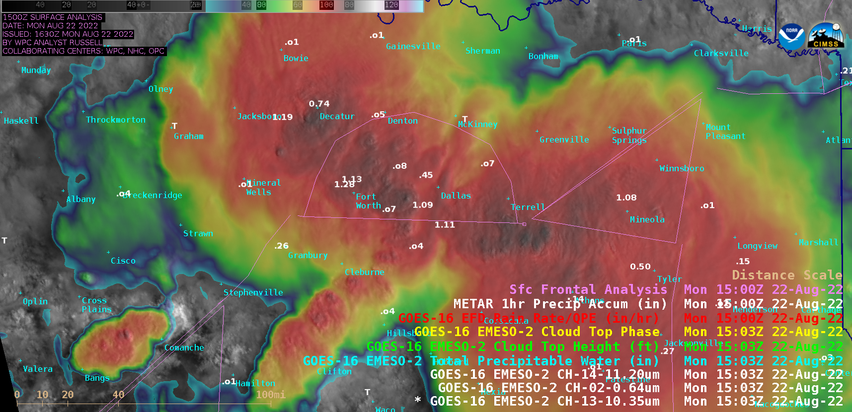
1-minute Mesoscale Domain Sector GOES-16 (GOES-East) Visible/Infrared Sandwich RGB images from 1300-1800 UTC (above) included plots of 1-hour surface precipitation amounts — and showed clusters of thunderstorms moving across North Texas and the greater Dallas/Fort Worth area early in the day on 22 August 2022. These storms were focused along a quasi-stationary surface front... Read More