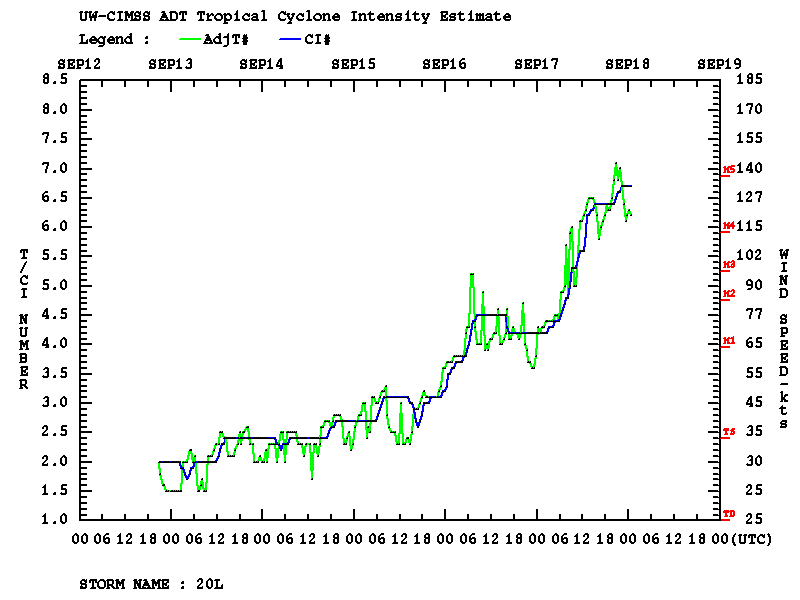
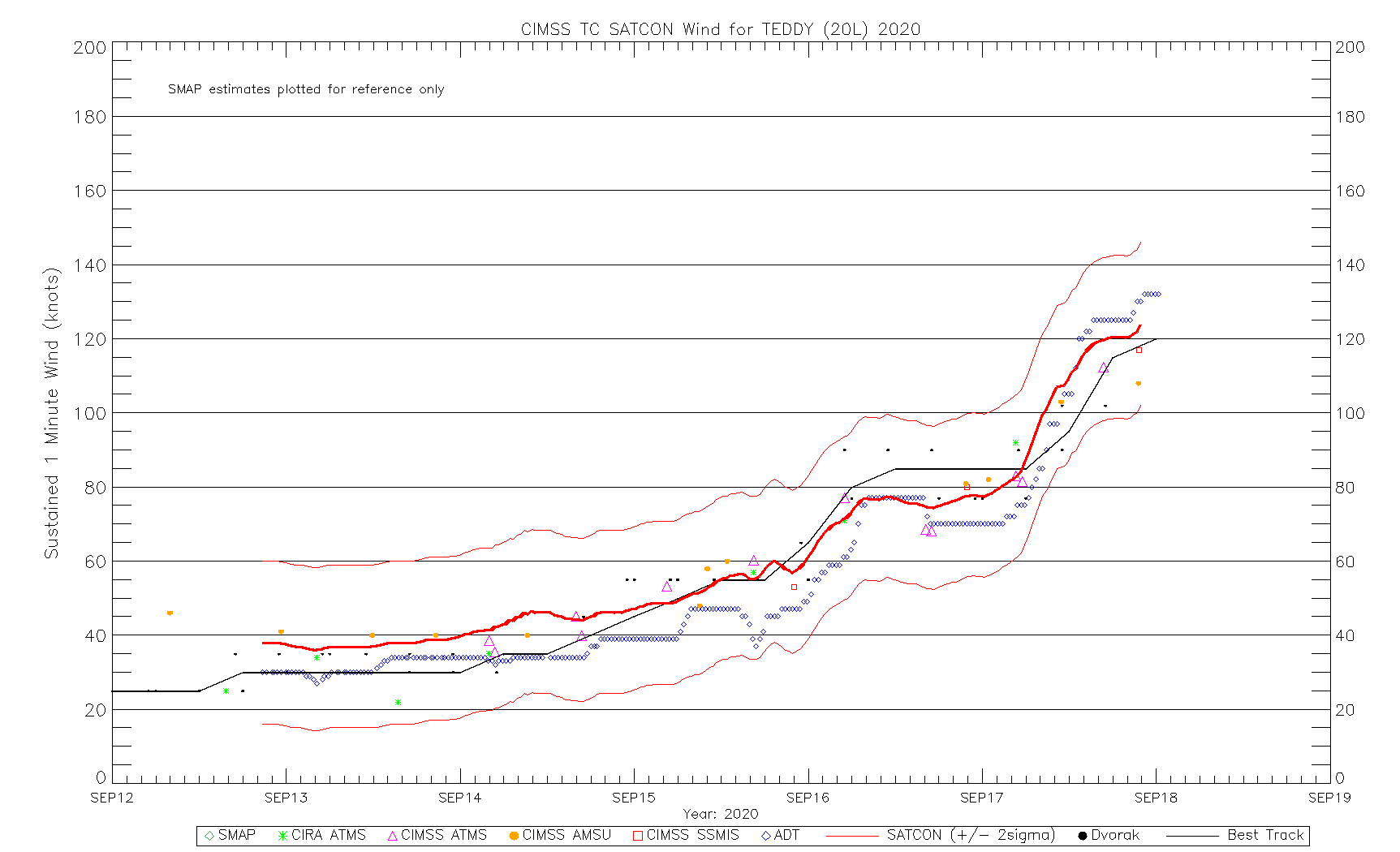
Hurricane Teddy rapidly intensifies to a Category 4 storm
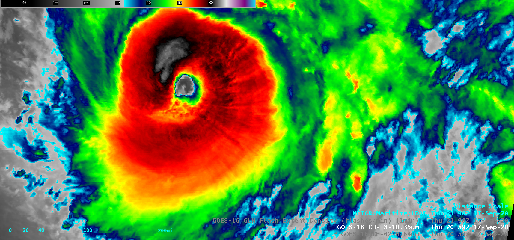
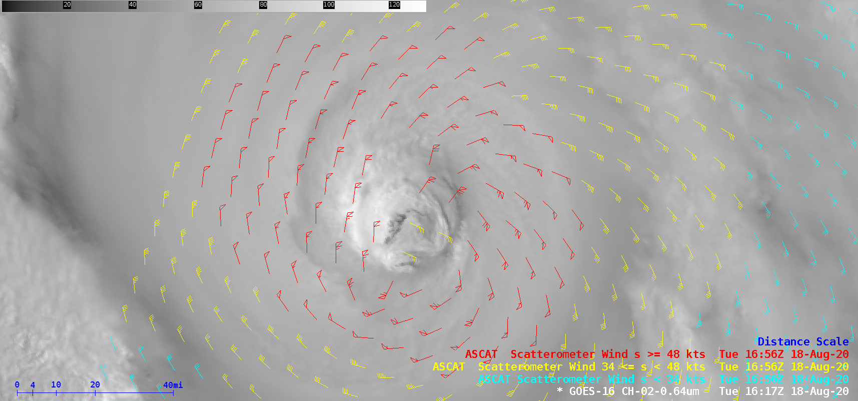
1-minute Mesoscale Domain Sector GOES-16 (GOES-East) “Red” Visible (0.64 µm) and “Clean” Infrared Window (10.35 µm) images — with and without an overlay of GLM Flash Extent Density (above) showed Hurricane Teddy as it rapidly intensified (ADT | SATCON ) to a Category 4 storm on 17 September 2020. The coldest cloud-top infrared brightness temperatures were in the -80 to -85ºC range.Metep-A ASCAT surface scatterometer wind... Read More
