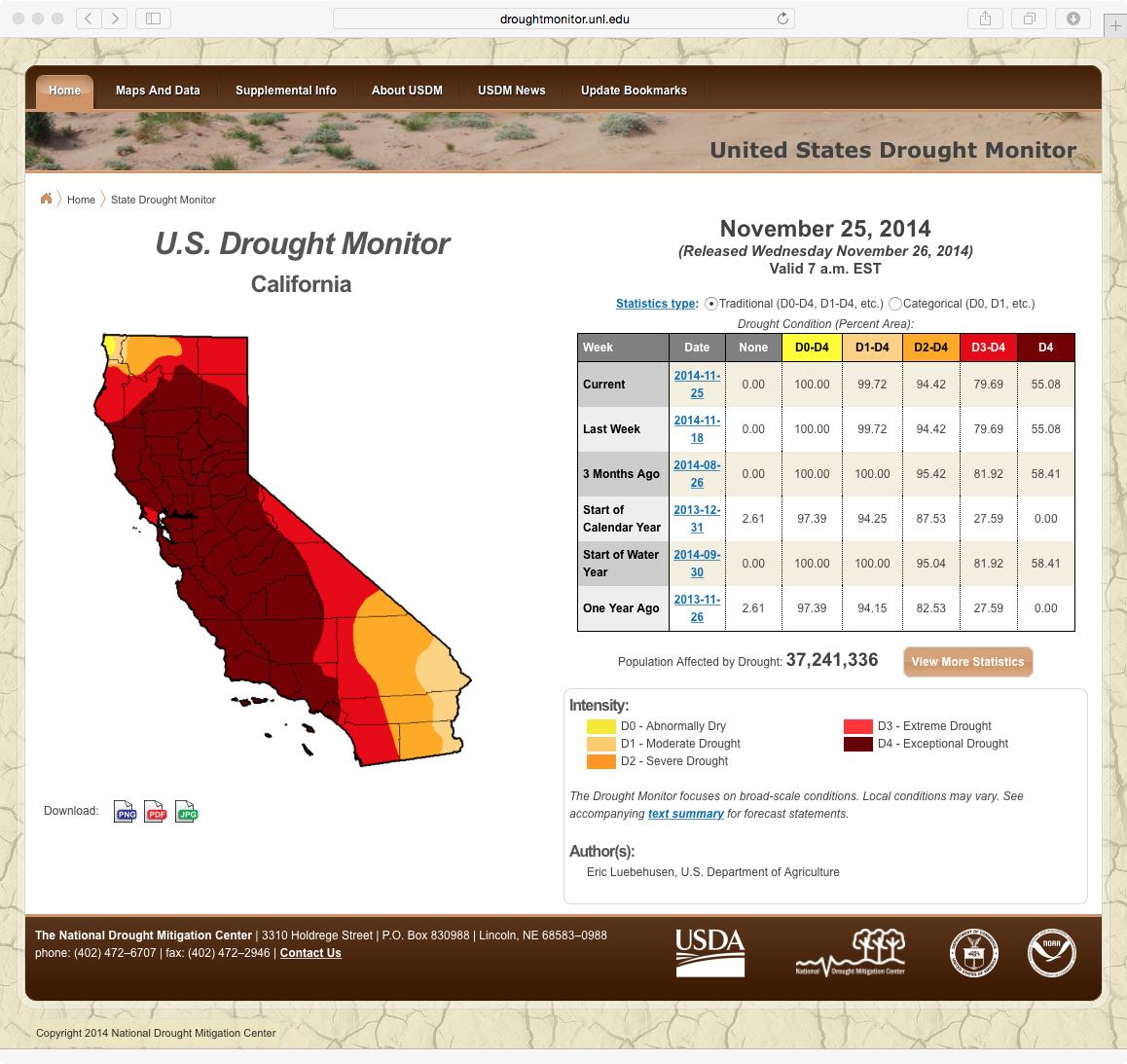
Significant rainfall event in California
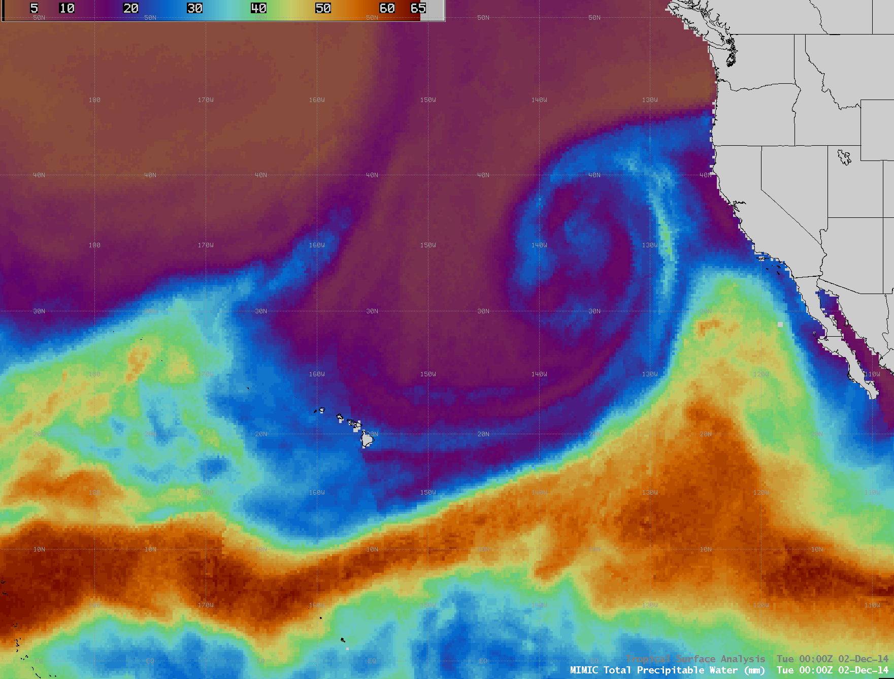
As of 25 November 2014, much of the state of California was experiencing extreme to exceptional drought conditions. However, the development of a large occluded mid-latitude cyclone over the far eastern Pacific Ocean during the 01 December – 02 December time period began to... Read More

