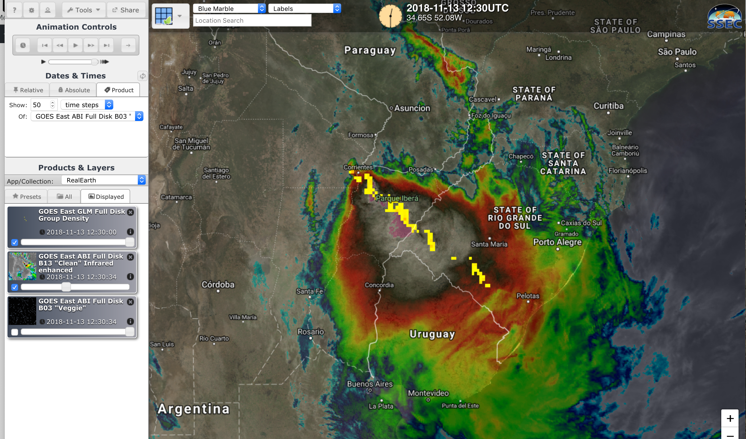
Mesoscale Convective System in Argentina
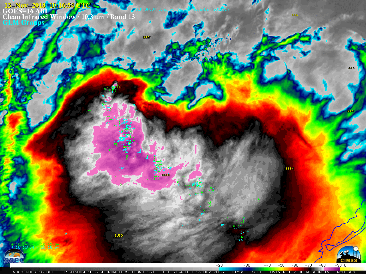
In support of the RELAMPAGO-CACTI field experiment, GOES-16 (GOES-East) had a Mesoscale Domain Sector centered over northeastern Argentina on 13 November 2018 — and 1-minute “Clean” Infrared Window (10.3 µm) images with plots of GLM Groups (above) showed a large and long-lived Mesoscale Convective System moving eastward across far northeastern Argentina and expanding into southern... Read More
