Tropical Storm Cristobal makes landfall along the coast of Louisiana
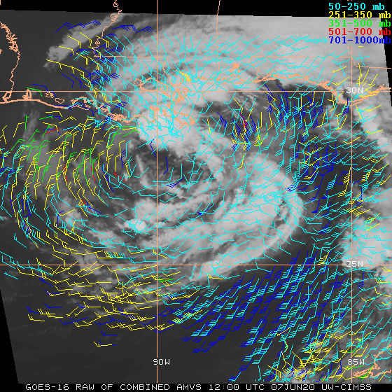
1-minute Mesoscale Domain Sector GOES-16 “Red” Visible (0.64 µm) images (above) revealed low-level vortices that were pivoting around the analyzed center of Tropical Storm Cristobal as it approached the coast of Louisiana on 07 June 2020, making landfall at 2200 UTC. Wind gusts were as high as 57 mph in Louisiana and 64 mph in Mississippi.GOES-16 Visible images with overlays... Read More
