Isaias re-intensifies to a Hurricane
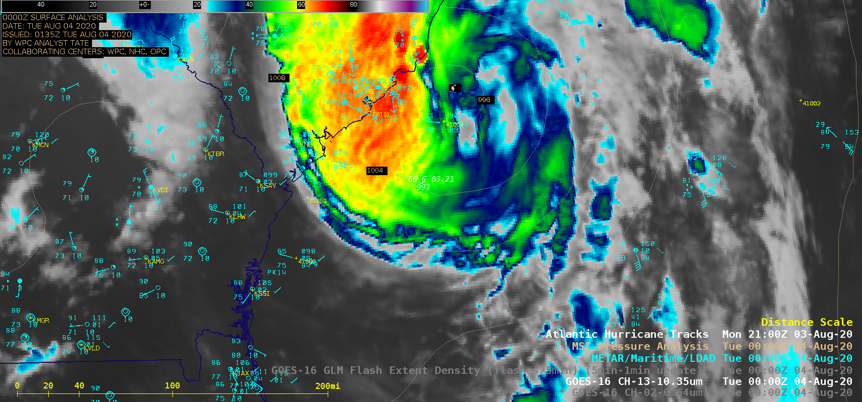
1-minute Mesoscale Domain Sector GOES-16 (GOES-East) “Red” Visible (0.64 µm) and “Clean” Infrared Window (10.35 µm) images (above) showed the 10-hour period leading up to the time when Tropical Storm Isaias re-intensified to Category 1 hurricane intensity on 03 August 2020. The center of Isaias passed near Buoy 41004 (below) — ahead of the storm, there was a wind gust to 62 knots (71 mph)... Read More

