Using the Night Microphysics RGB and LightningCast probabilities to anticipate nighttime convection and Lightning
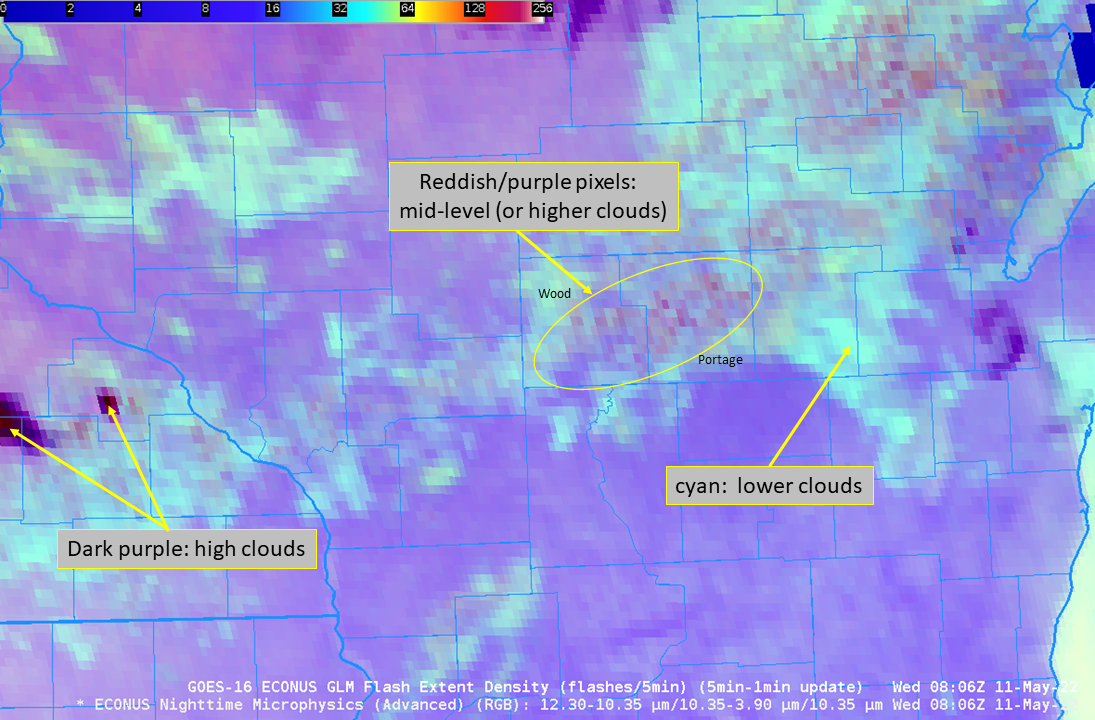
The Nighttime Microphysics RGB, above, over central Wisconsin (that’s Green Bay at the northeastern edge, and southeast Minnesota/northeast Iowa over the southwestern part, of the animation), shows a field of low clouds stretching west-southwest to east-northeast. Note however, the occasional appearance of redder pixels within the field (as shown in... Read More