SAR Observations around Hawai’i on 21 September 2023
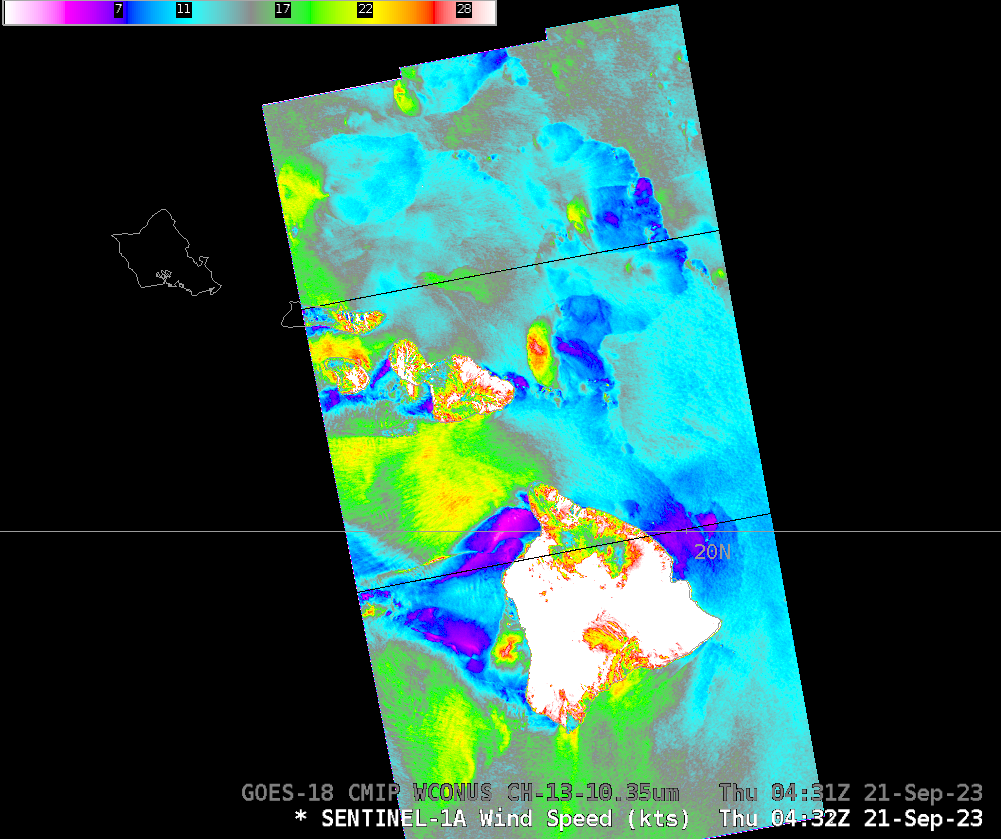
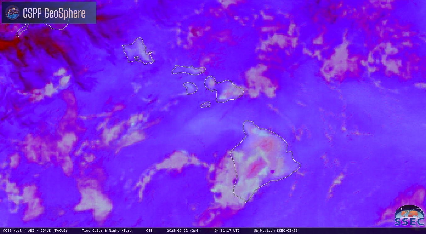
GOES-West imagery, above, from the CSPP Geosphere site, shows Hawaii in a tradewind regime (direct link to animation). The animation, from 0121 to 0556 UTC on 21 September 2023, shows the steady progression of cloud lines moving east-to-west, with embedded regions of apparent showers that generate outflow boundaries. At 0431 UTC, Sentinel-1A overflew the eastern Hawai’ian... Read More
