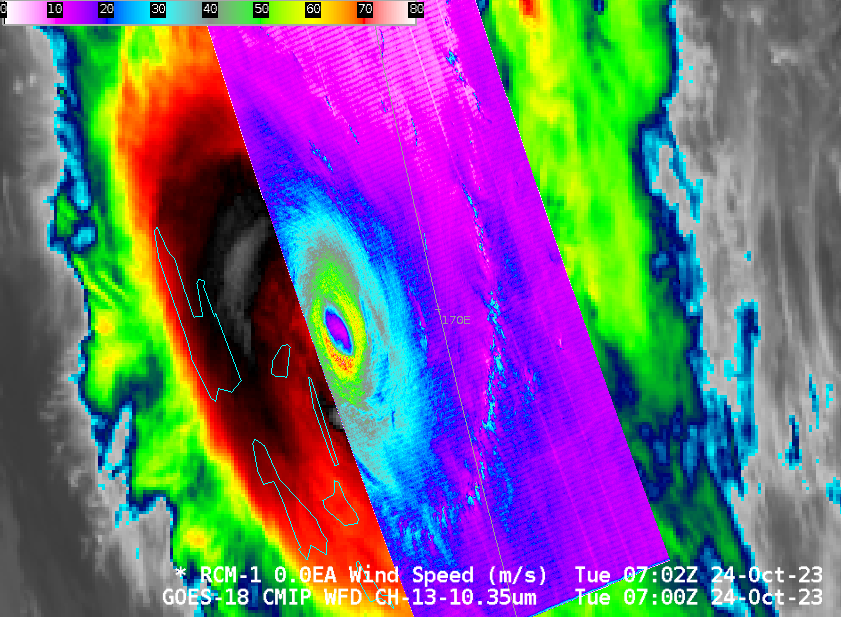
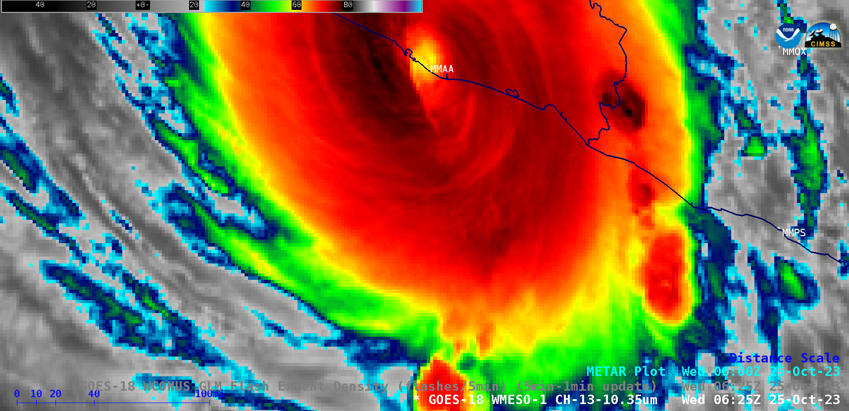
Hurricane Otis rapidly intensifies to Category 5, just prior to making landfall near Acapulco, Mexico
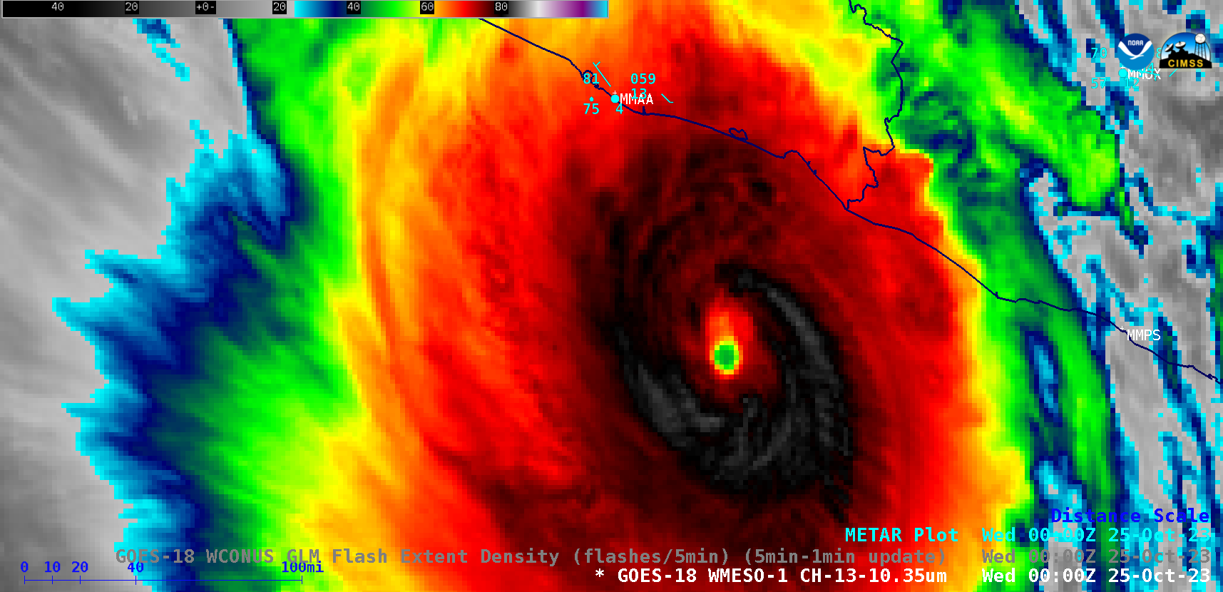
1-minute Mesoscale Domain Sector GOES-18 (GOES-West) “Clean” Infrared Window (10.3 µm) images (above) showed Hurricane Otis as it approached the coast of Mexico, making landfall near Acapulco (Acapulco International Airport, METAR identifier MMAA, is located about 16 miles southeast of the city center) around 0625 UTC on 25 October 2023. During the 11-hour time period shown,... Read More
