Wet weather in the Pacific Northwest
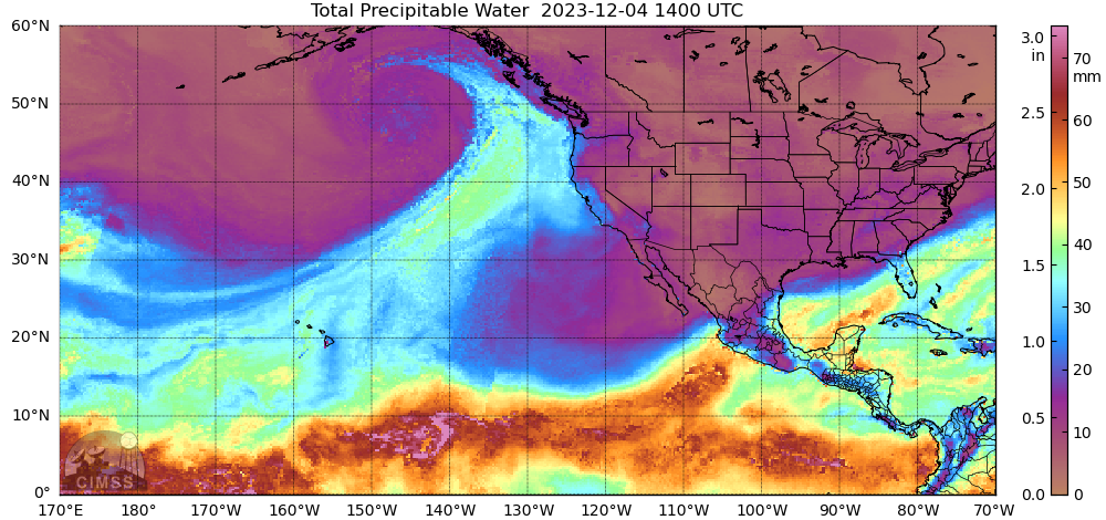
Hourly GOES-18 Hemispheric views, above, from 2140 UTC on 1 December to 2040 UTC on 4 December, (from the CSPP Geosphere site) show the development of a strong system in the Gulf of Alaska. This system is tapping into an airstream rich in moisture that augurs for a wet period along the... Read More
