Strong cold frontal high wind event across the Northern Plains
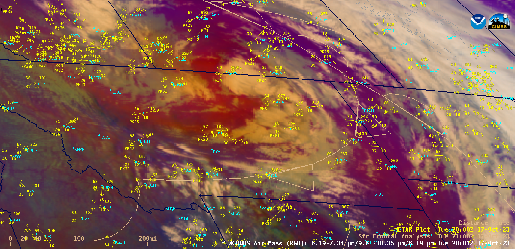
GOES-18 Air Mass RGB images from 1401 UTC on 17 October to 0401 UTC on 18 October, with hourly METAR surface reports plotted in yellow and 3-hourly Frontal Analyses plotted in beige [click to play animated GIF | MP4]
GOES-18 (GOES-West) Air Mass RGB images (above) showed the progression of a strong cold front — associated with a deepening Alberta Clipper type of midlatitude cyclone — which produced strong winds across parts of central/eastern Montana and western North Dakota / South Dakota during the afternoon and evening hours on 17 October 2023. Notable METAR site peak wind gusts included 61 knots (70 mph) at Jordan MT (KJDN) and Buffalo SD (K2WX), and 60 knots (69 mph) at Dickinson, ND (KDIK); in addition, a mesonet station at Beach ND recorded a peak wind gust of 66 knots (76 mph).
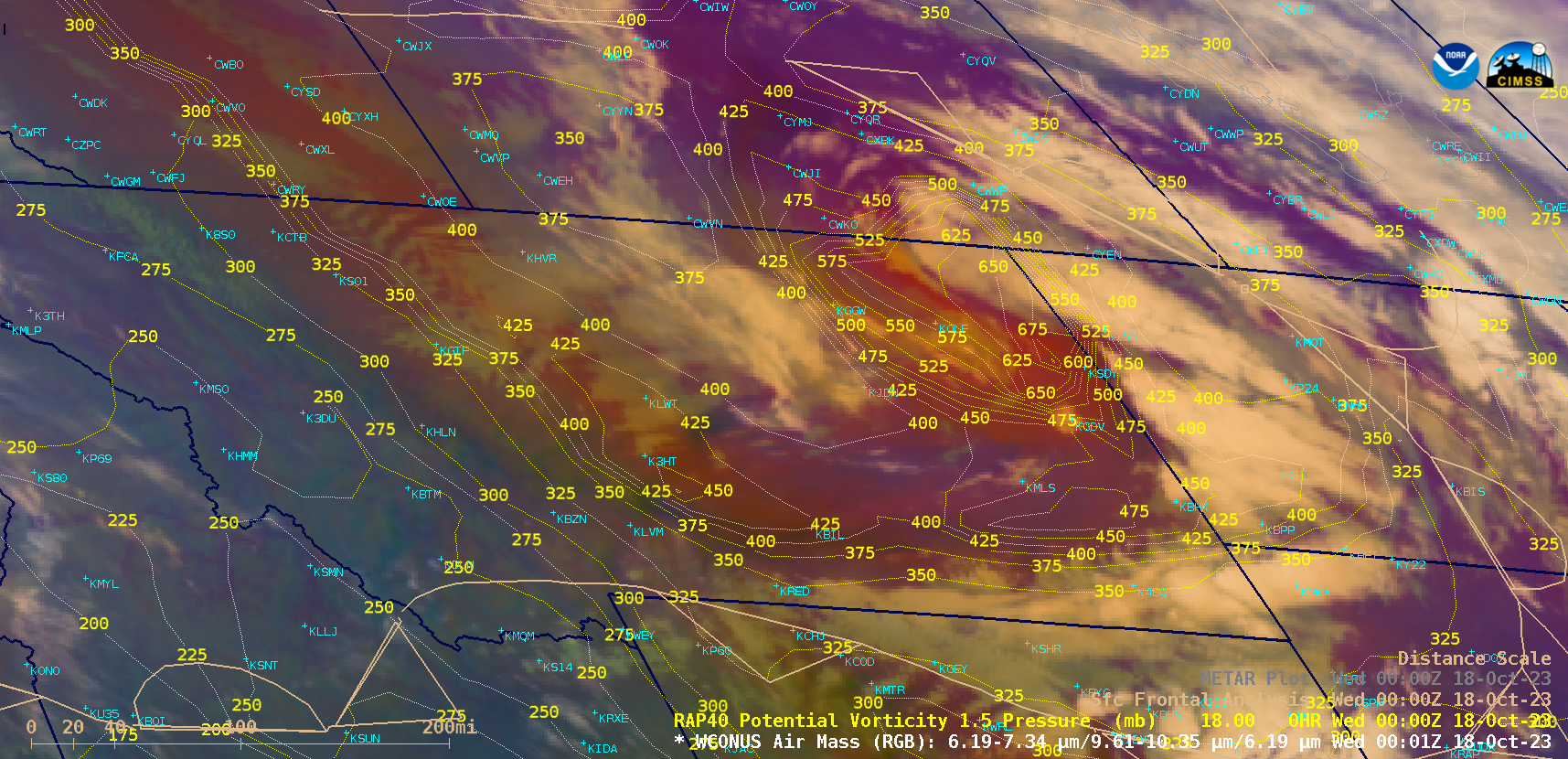
GOES-18 Air Mass RGB image at 0001 UTC on 18 October, with contours of RAP40 model PV1.5 Pressure plotted in yellow [click to enlarge]
The brighter shades of orange-red in the Air Mass RGB imagery highlighted dry, ozone-rich air indicative of the lower tropopause associated with this disturbance. Contours of the “dynamic tropopause” — taken to be the pressure of the RAP40 model PV1.5 surface — portrayed the tropopause extending down to the 650 hPa pressure level over far northeastern Montana (above). A SW-to-NE oriented cross section from western Montana to the US/Canada border (below) also showed the pronounced lowering of stratospheric values of Potential Vorticity (greater than 1.5 PVU) over northeastern Montana.
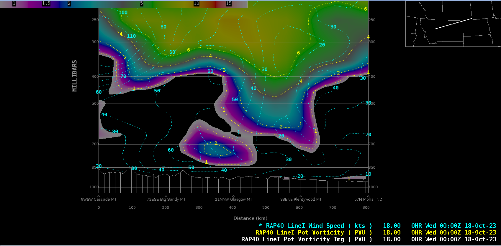
Cross section of RAP40 model Potential Vorticity and Wind Speed along Line I-I’, at 0000 UTC on 18 October [click to enlarge]
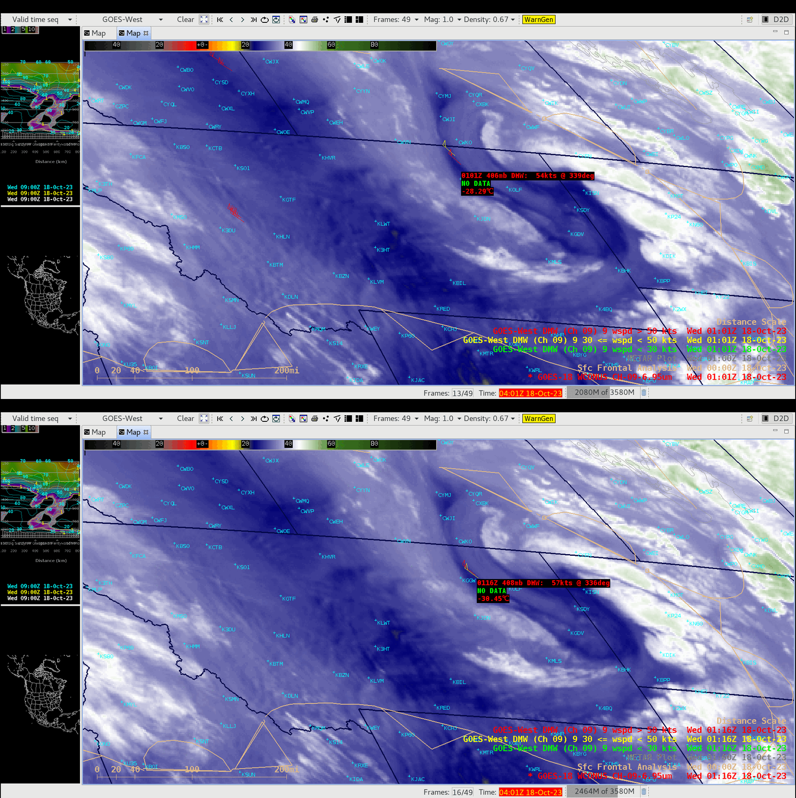
GOES-18 Mid-level Water Vapor (Band 09, 6.9 µm) images, with plots of Band 09 Derived Motion Winds at 0101 UTC and 0116 UTC on 18 October [click to enlarge]
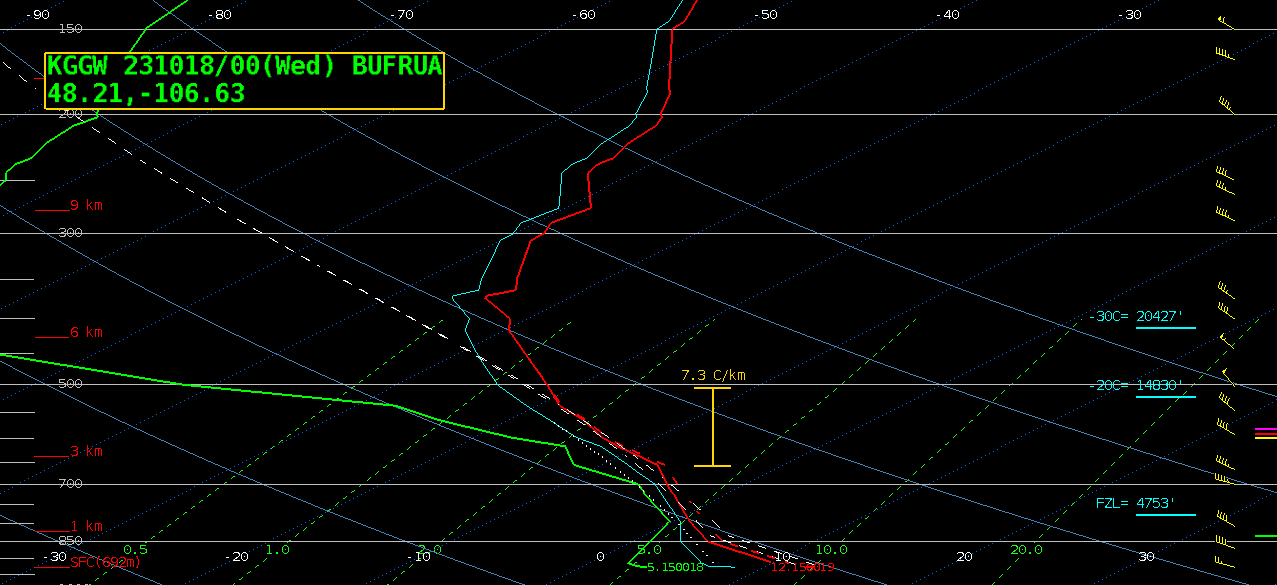
2 examples of GOES-18 Mid-level Water Vapor (6.9 µm) imagery with plots of associated Derived Motion Winds (above) showed speeds greater than 50 knots. A plot of rawinsonde data from Glasgow, Montana at 0000 UTC on 18 October (below) depicted steep mid-level (7.3 C/km) and boundary layer (near dry adiabatic) temperature lapse rates, which were aiding the downward transport of momentum (strong winds) from the middle troposphere to the surface. The aforementioned low tropopause was also evident in the temperature profile, near 370 hPa (which had descended dramatically since 1200 UTC) — with very dry air above 500 hPa.


