This website works best with a newer web browser such as Chrome, Firefox, Safari or Microsoft Edge. Internet Explorer is not supported by this website.

Category: GOES-18

1-minute imagery to monitor deep convection for flooding potential across American Samoa

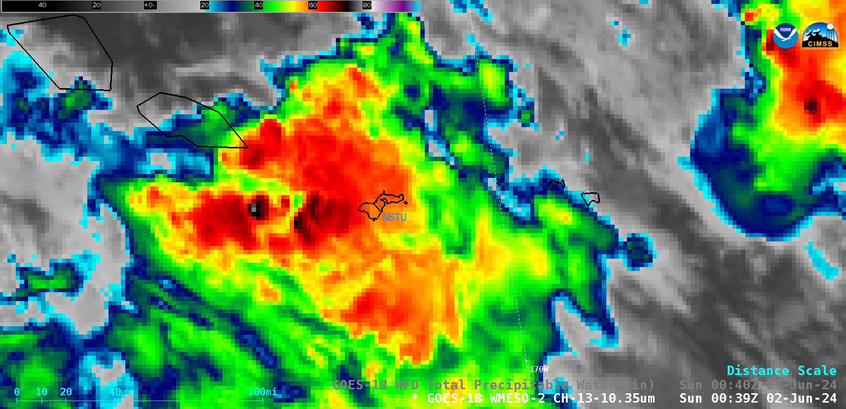
1-minute Mesoscale Domain Sector GOES-18 (GOES-West) “Clean” Infrared Window (10.3 µm) images (above) displayed areas of convection that moved across American Samoa on 01 June 2024 (1-minute imagery was requested by NWS Pago Pago to monitor the approach of thunderstorms, since they had issued a Flood Watch for the islands — and they lack radar coverage). Although there was a... Read More

Wildfire in British Columbia produces 2 pyrocumulonimbus clouds

10-minute Full Disk sector GOES-18 (GOES-West) Day Land Cloud Fire RGB, Shortwave Infrared (3.9 µm), “Clean” Infrared Window (10.3 µm) and “Red” Visible (0.64 µm) images with an overlay of the Fire Mask derived product (a component of the GOES Fire Detection and Characterization Algorithm FDCA) (above) displayed signatures of a wildfire in far northeastern British Columbia, which produced... Read More

Flooding Rains on Oahu

A 16-hour animation using 5-minute GOES-18 PACUS imagery, above (saved from the Geosphere site) shows persistent convection along the east coast of Oahu on 13 May. MIMIC estimates of Total Precipitable Water on 13 May, below, show the state of Hawai’i surounded by abundant moisture, although the richest moisture within the... Read More

Wildfires in British Columbia produce pyrocumulonimbus clouds

10-minute Full Disk sector GOES-18 (GOES-West) Day Land Cloud Fire RGB, Shortwave Infrared (3.9 µm), “Clean” Infrared Window (10.3 µm) and “Red” Visible (0.64 µm) + Fire Power derived product (a component of the GOES Fire Detection and Characterization Algorithm FDCA) images (above) showed signatures of multiple wildfires across northeastern British Columbia, two of which produced  pyrocumulonimbus (pyroCb) clouds — having cloud-top... Read More