Episode 19 of the latest Kilauea eruption on the Big Island of Hawai’i
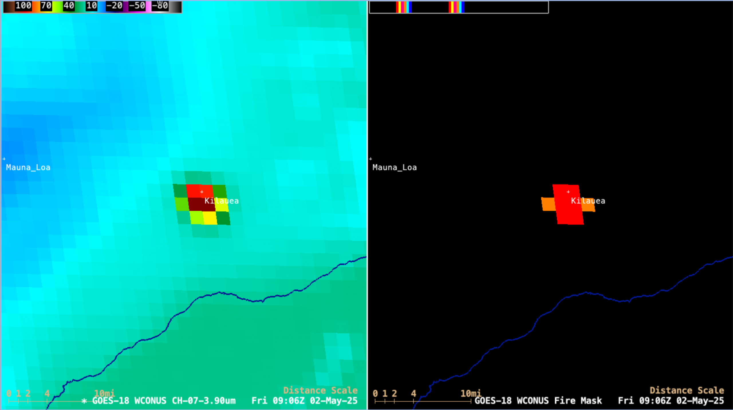
5-minute CONUS Sector GOES-18 (GOES-West) Shortwave Infrared (3.9 µm) and Fire Mask derived product images (above) displayed a pronounced thermal signature associated with Episode 19 of the ongoing eruption in the Halema’uma’u crater (located within the Kilauea summit caldera) on the Big Island of Hawai’i, which began around 0728 UTC... Read More