This website works best with a newer web browser such as Chrome, Firefox, Safari or Microsoft Edge. Internet Explorer is not supported by this website.

Category: GOES-17

Using 1-minute GOES-17 imagery to monitor tropical convection near American Samoa

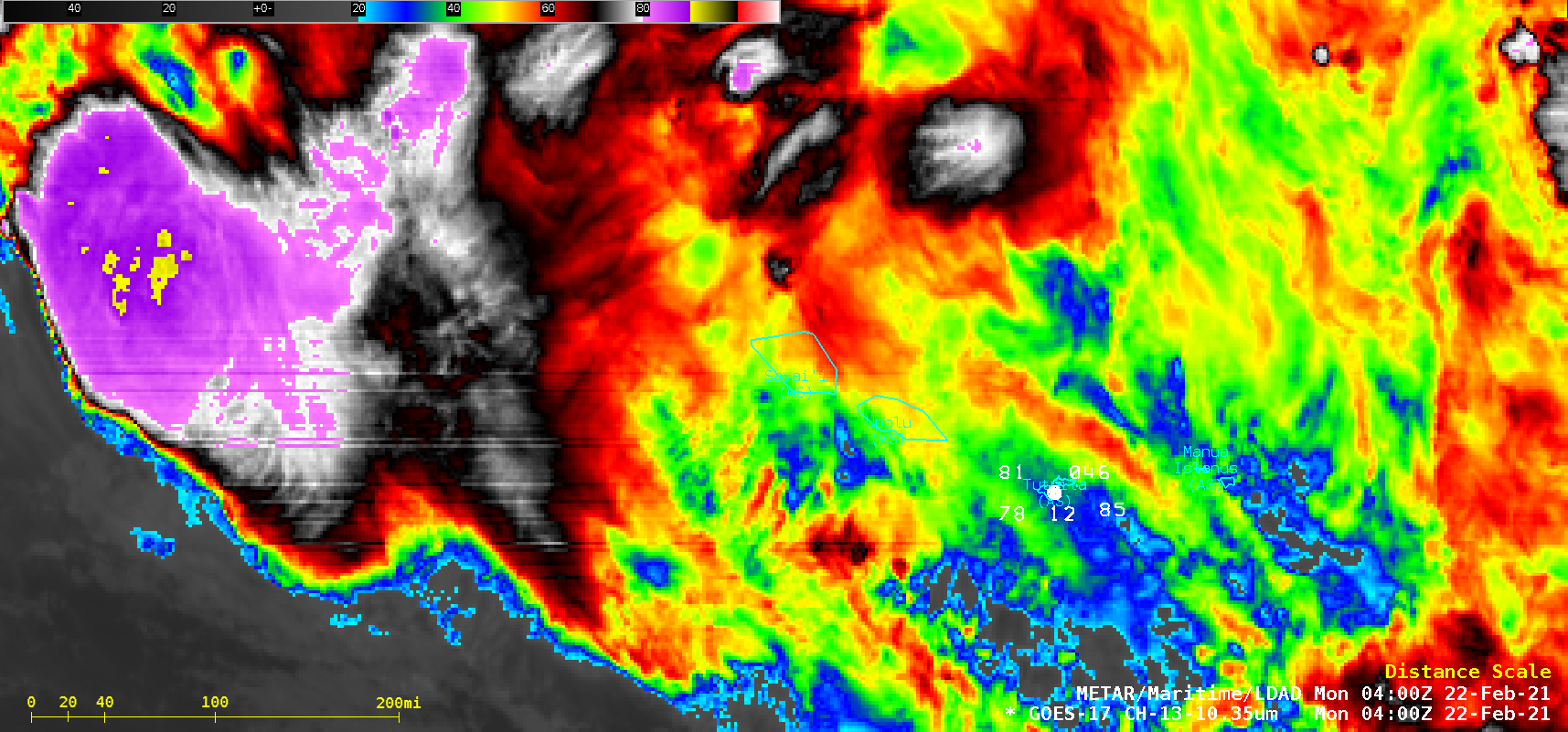
1-minute Mesoscale Domain Sector GOES-17 (GOES-West) “Clean” Infrared Window (10.35 µm) images (above) showed thunderstorms associated with the South Pacific Convergence Zone (SPCZ) on 21 February 2021. The 3 METAR stations plotted on the imagery are, from left to right, Hihifo Airport, Wallis and Fotuna (NLWW), Apia, Samoa (NSFA) and Pago Pago, American Samoa (NSTU).In spite... Read More

GOES-15 temporarily brought out of storage

Beginning on 06 February 2021, the GOES-15 satellite was brought out of storage for a 14-day period of imaging (as part of its annual checkout activities). On 10 February, a comparison of Water Vapor images from GOES-17 (6.9 µm) and GOES-15 (6.5 µm) showed mountain waves over southeastern Wyoming and... Read More