This website works best with a newer web browser such as Chrome, Firefox, Safari or Microsoft Edge. Internet Explorer is not supported by this website.

Category: GOES-16

Wind feature off the mouth of the Rio Grande

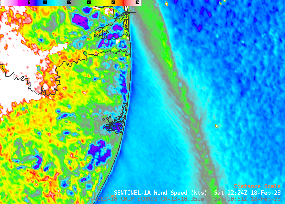
Sentinel-1A SAR data just before sunrise captured a very narrow region of enhanced winds just south of the Rio Grande delta on 18 February 2023, as shown above in a toggle with the 1226 UTC GOES-16 Band 13 Clean Window infrared (10.3 µm) imagery. There appears to be no obvious... Read More

Mesoscale convective bands enhancing snowfall rates across the Upper Midwest

GOES-16 (GOES-East) “Red” Visible (0.64 µm) and Day Cloud Phase Distinction RGB images (above) showed widespread elevated convective banding that was helping to enhance snowfall rates — with some locations reporting 1.5 to 2.0 inches per hour — across parts of Minnesota, Wisconsin, Lower Michigan, Iowa and Illinois on 16 February 2023. There was no GLM indication... Read More