Satellite signatures of the NASA/SpaceX Crew-6 launch
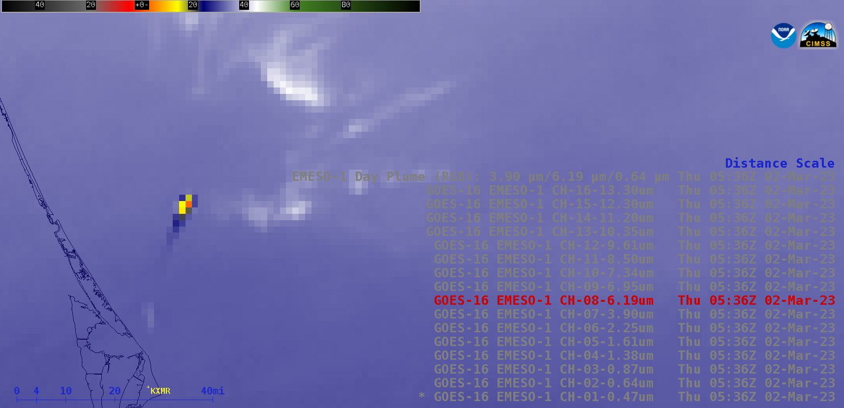
Overlapping 1-minute Mesoscale Domain Sectors provided GOES-16 (GOES-East) images at 30-second intervals from all 16 of the ABI spectral bands (above), which displayed the northeast-moving warm thermal signature of a SpaceX Falcon 9 rocket booster as the Crew-6 Mission was launched from Cape Canaveral Space Force Station in Florida at 0534 UTC (12:34... Read More