Blowing dust in New Mexico, Texas and Oklahoma

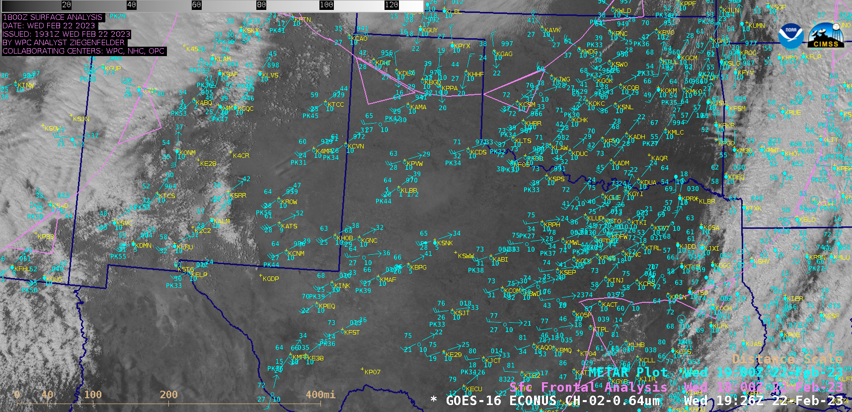
GOES-16 “Red” Visible (0.64 µm) images, with plots of surface observations and fronts [click to play animated GIF | MP4]
GOES-16 (GOES-East) “Red” Visible (0.64 µm) images (above) showed strong southwesterly winds ahead of an approaching cold front, causing areas of blowing dust across parts of New Mexico, Texas and Oklahoma on 22 February 2023. Strongest wind gusts were in the 60-70 mph range, and blowing dust was reducing the surface visibility to 1.5 miles or less at some locations.
A better signature of the blowing dust was seen in True Color RGB images — produced using Geo2Grid — from GOES-18 (GOES-West), GOES-17 and GOES-16 (below). GOES-17 (formerly GOES-West) was temporarily operating from its pre-storage checkout position over the Equator at 104.7 W longitude. Along the western edge of the widespread blowing dust, note the presence of a relatively narrow and brighter white plume (whose source region was White Sands National Park in New Mexico).

True Color RGB mages from GOES-18 (left), GOES-17 (center) and GOES-16 (right) [click to play animated GIF | MP4]
===== 23 February Update =====
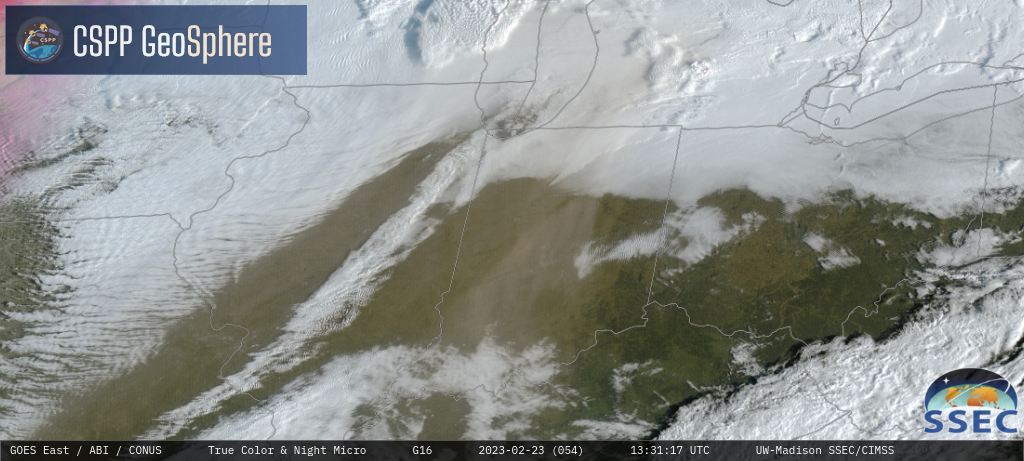
On the following morning, the hazy signature of airborne dust was evident in GOES-16 True Color RGB images (from the GeoSphere site) over cloud-free areas of Illinois, Indiana, Ohio and Kentucky — and to a lesser extent, above the clouds in southern Lower Michigan (above).
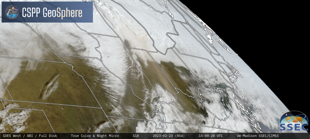
Due to the more favorable forward scattering geometry associated with GOES-18 (below), the hazy blowing dust signature was apparent for a longer period of time — and farther to the east (eventually moving over West Virginia) — compared to what was seen in GOES-16 imagery.
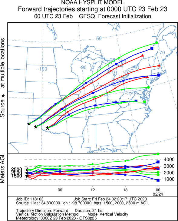
HYSPLIT model forward trajectories — initialized at 3 points where the blowing dust appeared to be particularly dense at 0000 UTC on 23 February (below) — supported this pathway of long-range dust transport from New Mexico / Texas / Oklahoma to the lower Great Lakes and Ohio Valley 12-18 hours later.


