Severe thunderstorms across the Southern Plains

GOES-16 “Red” Visible (0.64 µm) images, with time-matched SPC Storm Reports plotted in red [click to play animated GIF | MP4]
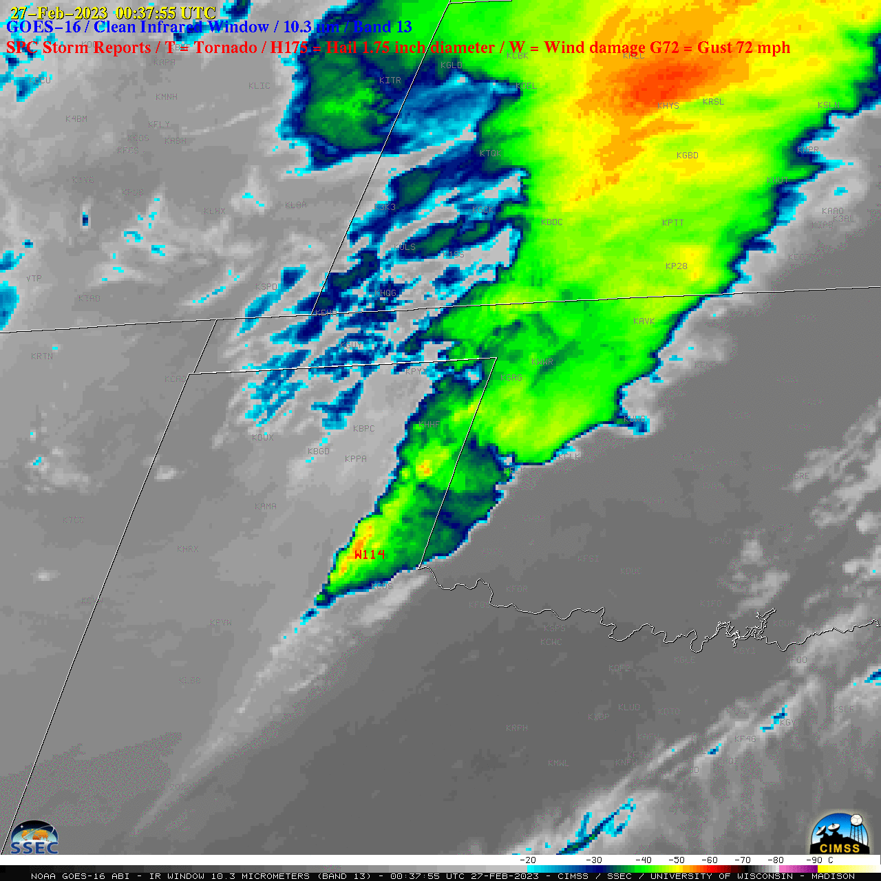
1-minute GOES-16 “Clean” Infrared Window (10.3 µm) images with plots of time-matched SPC Storm Reports (below) indicated that the coldest cloud tops associated with many of the storms exhibited infrared brightness temperatures around -60ºC range (darker red enhancement). These thunderstorms produced numerous tornadoes (the 12 in Oklahoma was a record for the month of February), hail up to 1.75 inches in diameter in Texas and Oklahoma, and damaging wind gusts as strong as 114 mph in Texas.

GOES-16 “Clean” Infrared Window (10.3 µm) images, with time-matched SPC Storm Reports plotted in red [click to play animated GIF | MP4]

GOES-16 Lifted Index derived product, with surface fronts plotted in cyan [click to play animated GIF | MP4]