Blowing dust from the Copper River Valley in Alaska
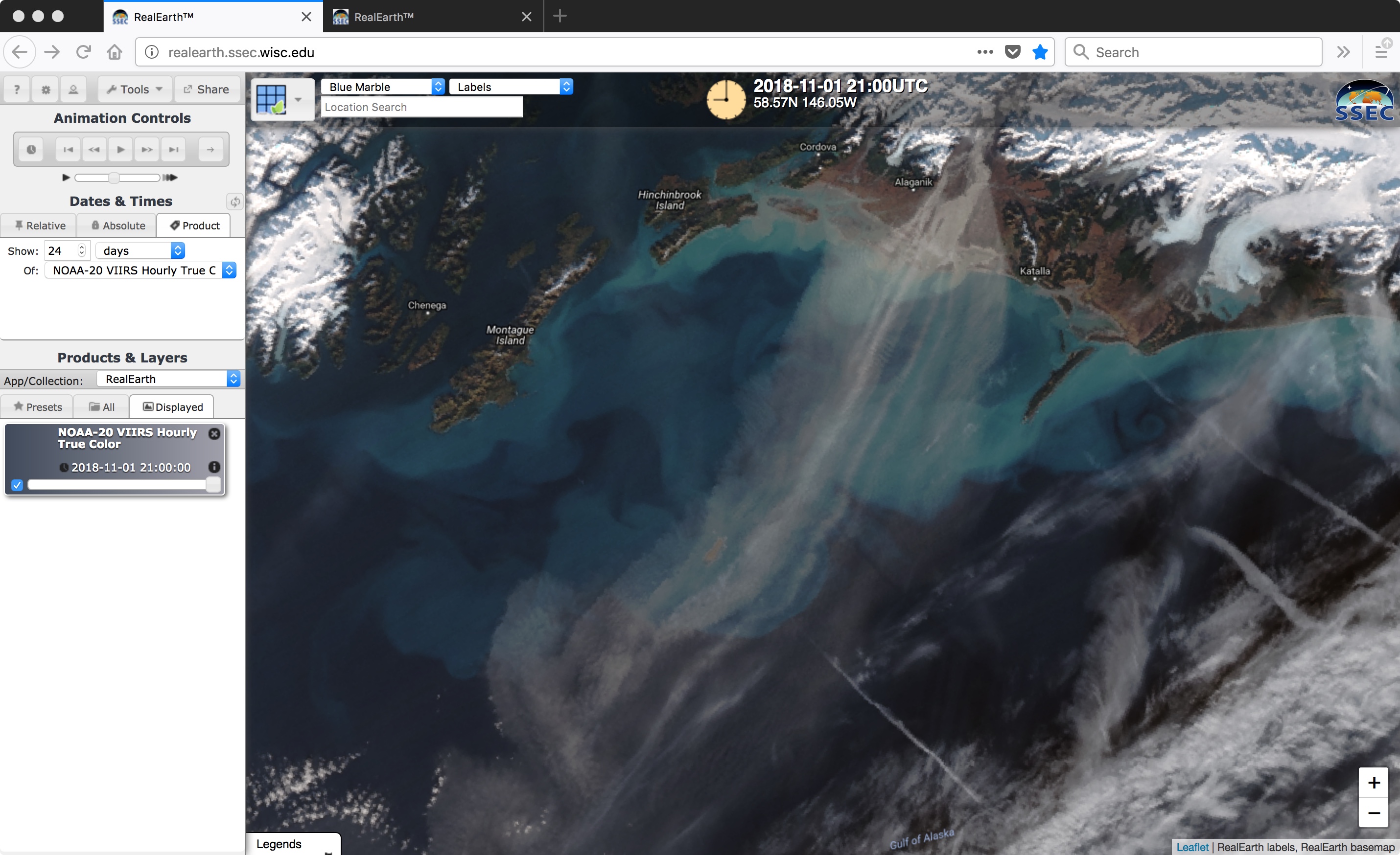
Strong gap winds accelerating out of the Copper River Valley along the southern coast of Alaska were lofting fine particles of glacial silt/sand and transporting those aerosols southwestward across the Gulf of Alaska on 31 October and 01 November 2018. A sequence of NOAA-20 VIIRS True Color Red-Green-Blue (RGB) images viewed... Read More
