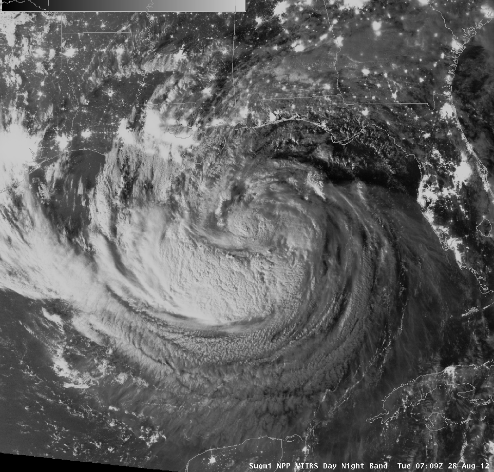
This website works best with a newer web browser such as Chrome, Firefox, Safari or Microsoft Edge. Internet Explorer is not supported by this website.

Category: GOES-14

Hurricane Isaac

Isaac reached Category 1 hurricane intensity mid-day on 28 August 2012. AWIPS images of 1-km resolution visible and IR data from the VIIRS, AVHRR, and MODIS instruments (below) showed curved banding features and convective bursts with overshooting... Read More

Day-Night Band Imagery of Isaac

The Day-Night Band on VIIRS, flying on the Suomi/NPP satellite gave an excellent view of Isaac at strong tropical storm strength in the northern Gulf of Mexico shortly after midnight on August 28 2012. VIIRS is providing something unique to forecasters: Visible imagery at night that allows easy identification of overshooting... Read More

GOES-14 SRSOR: Tropical Storm Isaac

McIDAS images of GOES-14 1-minute interval Super Rapid Scan Operations for GOES-R (SRSOR) 1-km resolution 0.63 µm visible channel images (above; click image to play animation) showed overshooting tops and cloud-top gravity waves associated with a large convective burst located just to the southwest of the center of Read More