This website works best with a newer web browser such as Chrome, Firefox, Safari or Microsoft Edge. Internet Explorer is not supported by this website.

Category: GOES-13

Hurricane Matthew: heavy rainfall and flooding across the Southeast and Mid-Atlantic US

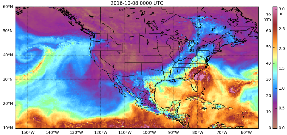
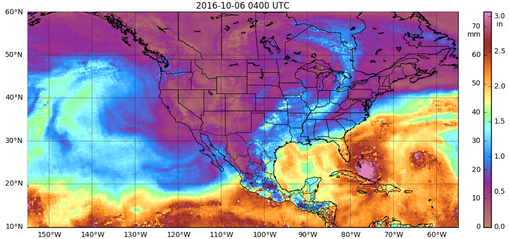
Copious amounts of moisture associated with Hurricane Matthew resulted in heavy rainfall (map | text list) and widespread flooding across the Southeast and Mid-Atlantic US during the 07 October to 09 October 2016 period. Hourly images of the MIMIC Total Precipitable Water (TPW) product (above; also available as a 22 Mbyte animated GIF) showed the high TPW values that... Read More

Matthew along the east coast of Florida

Hurricane Matthew is on a path that parallels the coast of Florida, with the center remaining just offshore. GOES-13 Visible imagery from a 1-hour time period this morning, above, shows the continued development of convection around the eyewall and the motion of convective bands inland. GOES-13 Visible images with hourly... Read More

Hurricane Matthew moves into the Bahamas

The animation of Matthew, above, from morphed microwave imagery (from this site), shows the toll that interaction with the high terrain of Hispaniola and eastern Cuba has had on the storm (causing it to be downgraded from Category 4 to Category 3 intensity). The formerly distinct eye had eroded, although eye re-formation... Read More