Migrating drift ice
As a follow-up to the previous blog post, cold air and lake-effect snow continued across the Great Lakes region on 05 February 2007. GOES-12 visible imagery (above; Java animation) revealed a narrow filament of Read More
As a follow-up to the previous blog post, cold air and lake-effect snow continued across the Great Lakes region on 05 February 2007. GOES-12 visible imagery (above; Java animation) revealed a narrow filament of Read More
GOES-12 10.7µm InfraRed (IR) imagery (above; Java animation) shows the development of multiple lines of convection that produced numerous reports of damaging winds and tornadoes across northern and central Florida during the pre-dawn hours on Read More
AWIPS images of radar reflectivity and GOES-12 visible and InfraRed (IR) imagery (above) showed a well-defined mesoscale convective eddy that was moving southward across Lake Michigan during the day on 30 January 2007. For a few hours, the core of this mesoscale... Read More
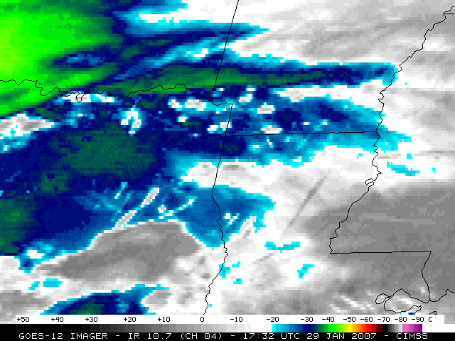
GOES-12 visible channel images (above) revealed numerous aircraft dissipation trails — otherwise known as “distrails” or “hole punch clouds” — during the day over eastern Texas, northern Louisiana, southern Arkansas, and Mississippi on 29 January 2007. Corresponding GOES-12 10.7... Read More
