Mesoscale Convective Eddy Over Lake Michigan
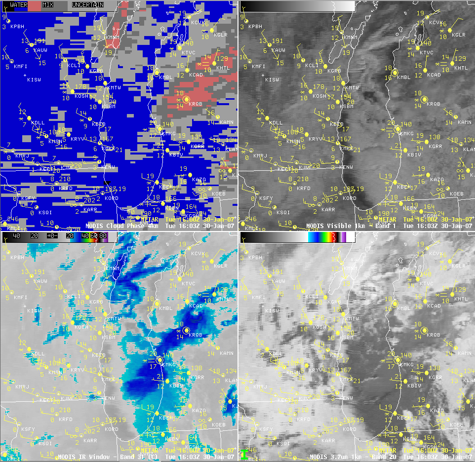
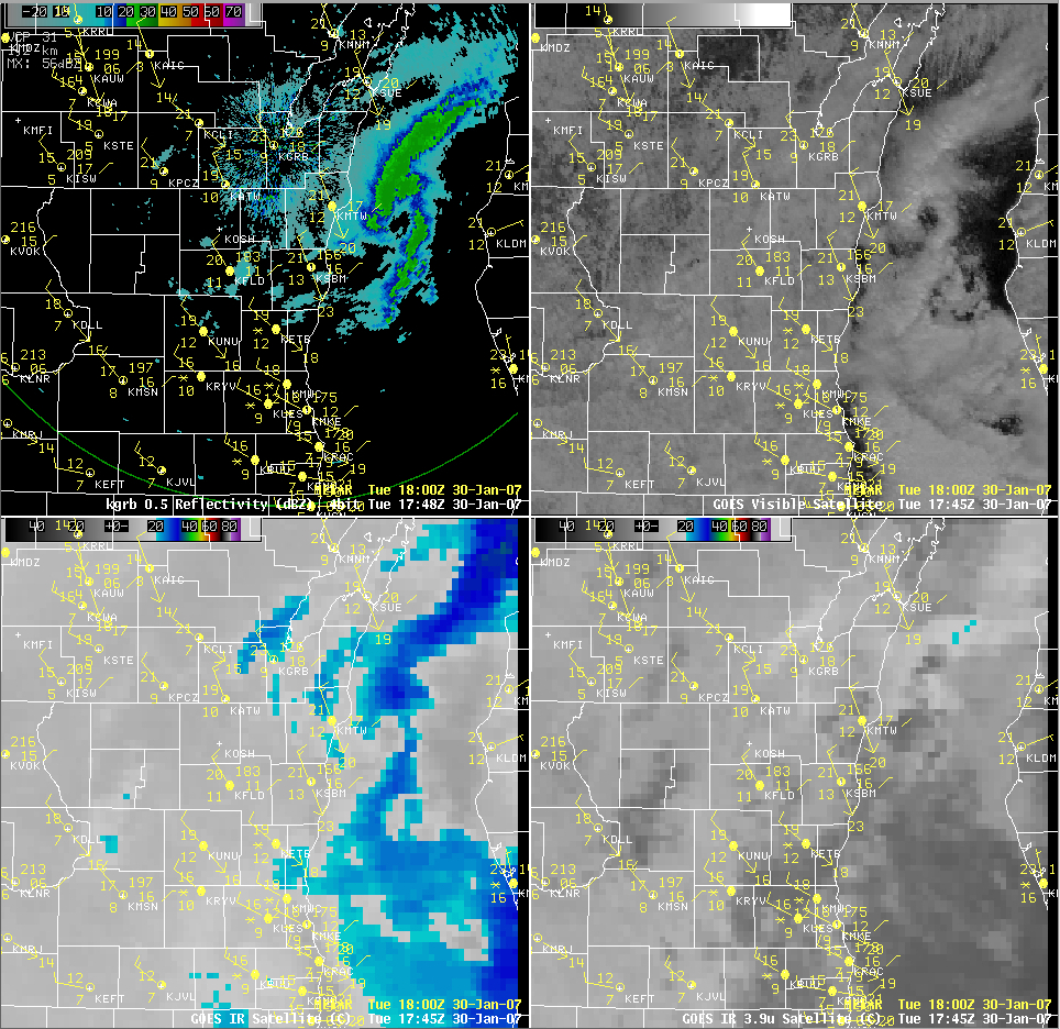
AWIPS images of radar reflectivity and GOES-12 visible and InfraRed (IR) imagery (above) showed a well-defined mesoscale convective eddy that was moving southward across Lake Michigan during the day on 30 January 2007. For a few hours, the core of this mesoscale vortex even exhibited an eye-like structure on the radar (Java animation) and visible channel satellite imagery (Java animation). To the south of this lake vortex, the clouds covering the southern half of Lake Michigan exhibited fairly cold brightness temperatures (-20º to -30º C, cyan to blue enhancement) on the 10.7µm IR imagery (Java animation), yet at the same time appeared significantly warmer (+10º to +20º C, darker gray enhancement) on the 3.9µm IR channel imagery (Java animation). This suggests that much of the cloud cover over southern Lake Michigan was composed of supercooled water droplets, rather than ice crystals (water droplets are efficient reflectors of solar radiation, making water-based clouds appear “warmer” than ice-based clouds on the shortwave IR imagery, due to that channel’s sensitivity to solar reflectance). The MODIS Cloud Phase product (below, upper left panel) supported this idea, indicating predominantly “water phase” cloud (blue enhancement) across much of the southern half of Lake Mighigan. It is interesting to note that the precipitation type at Muskegon, Michigan (station identifier KMKG) fluctuated between “snow” and “snow with freezing fog” as the clouds over southern Lake Mighigan were moving inland (there was some hint of “Mixed” or “Uncertain” cloud phase features moving over that station, which could have seeded the supercooled cloud deck below with enough ice to produce mostly snow at times) — however, the changing precipitation types could be due more to inherent ASOS uncertainties. As this lake eddy moved inland across southwestern lower Michigan later in the day, up to 15 inches of snow was reported at Allegan.

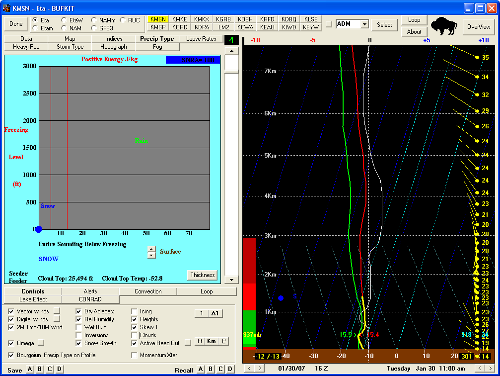
On a side note, during the morning hours over Madison, Wisconsin (station identifier KMSN) it appeared to be snowing very lightly, even though the skies overhead were practically cloud-free — actually, there were ice crystals growing within the boundary layer, rather than snowflakes falling from a cloud. The BUFKIT model sounding analysis (below) indicated a fairly moist “snow growth region” (yellow line) within the lowest 1.5 km of the atmosphere, along with some negative omega in that layer indicating upward vertical motions.


