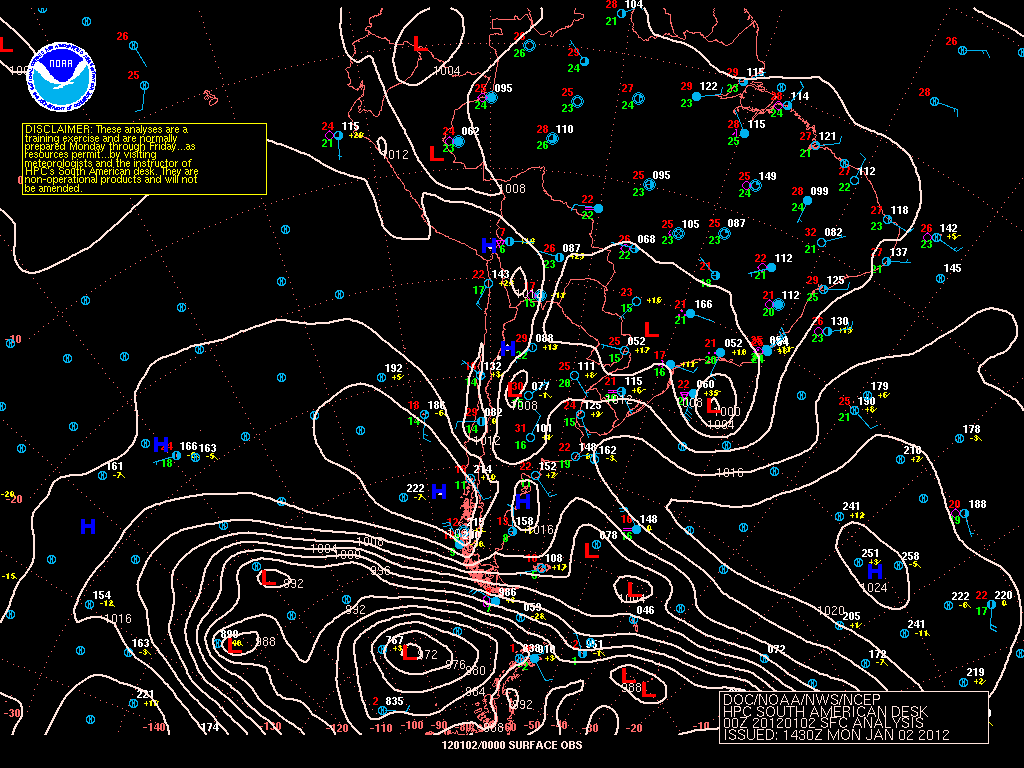
This website works best with a newer web browser such as Chrome, Firefox, Safari or Microsoft Edge. Internet Explorer is not supported by this website.

Category: GOES-12

Hurricane Adrian in the East Pacific

 Hurricane Adrian developed into a Category 3 hurricane early in the day on 09 June 2011. McIDAS images of GOES-12 0.63 µm visible channel data (above) initially showed a well-defined eye before it began to get partially obscured by the high clouds of a central dense overcast (CDO).DMSP SSMIS 85... Read More

Puyehue-Cordón Caulle volcanic eruption in Chile

An explosive eruption of the Puyehue-Cordón Caulle volcano in Chile occurred on 04 June 2011. GOES-12 0.65 µm visible channel images (above) showed a darker gray ash cloud punching above the meteorological cloud deck around 18:15 UTC, with the ash cloud quickly spreading southeastward and moving over Bariloche, Argentina (station... Read More

Subtropical Storm “Ariani” off the coast of Brazil

   Subtropical Storm “Ariani” developed off the southeast coast of Brazil on 15 March 2011. GOES-12 0.65 µm visible channel images (above; click image to play animation) displayed a number of overshooting tops within the large cloud shield of the disturbance. Some hints of a cyclonic (clockwise in the Southern Hemisphere)... Read More