Hurricane Adrian in the East Pacific
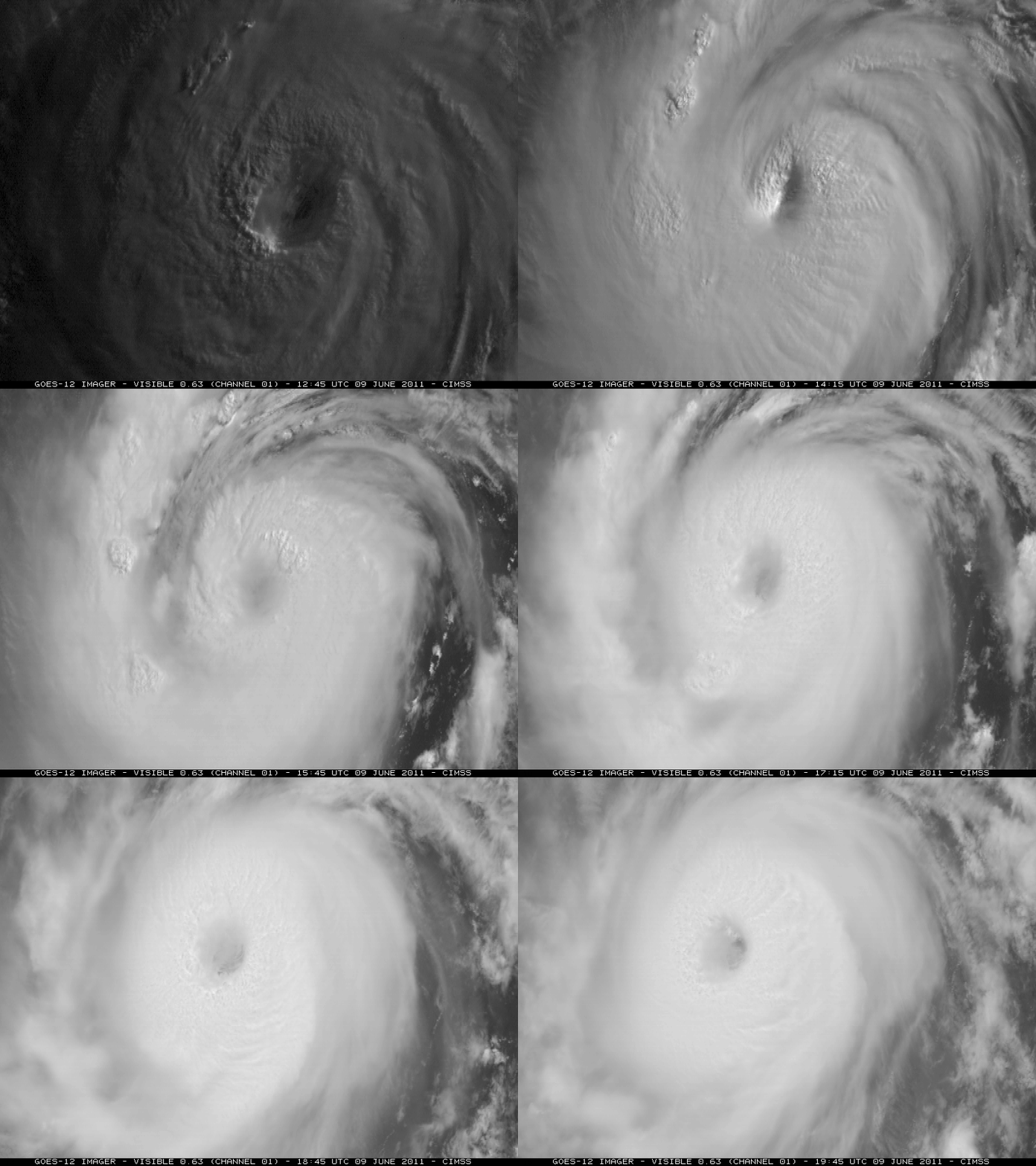
Hurricane Adrian developed into a Category 3 hurricane early in the day on 09 June 2011. McIDAS images of GOES-12 0.63 µm visible channel data (above) initially showed a well-defined eye before it began to get partially obscured by the high clouds of a central dense overcast (CDO).
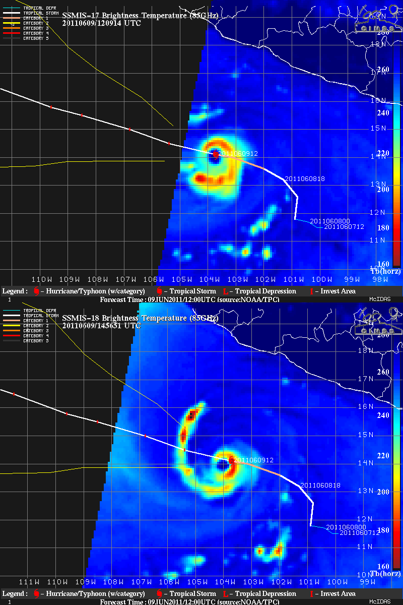
DMSP SSMIS 85 GHz microwave images from the CIMSS Tropical Cyclones site (below) revealed a distinct eye at 12:09 UTC and 14:56 UTC.
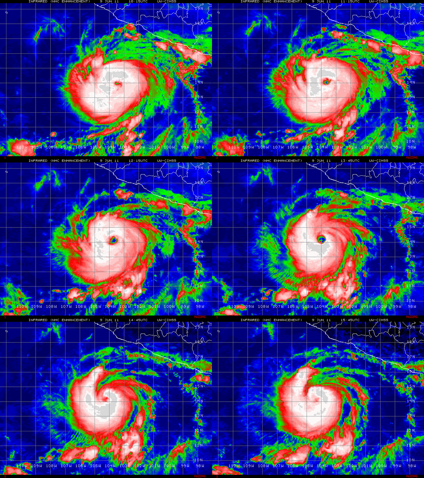
GOES 10.7 µm IR images (below) also briefly showed a well-defined eye early in the day, which later filled in a bit beneath the CDO as a curved band of cold high clouds began to wrap around the eastern and northern quadrants of the hurricane.
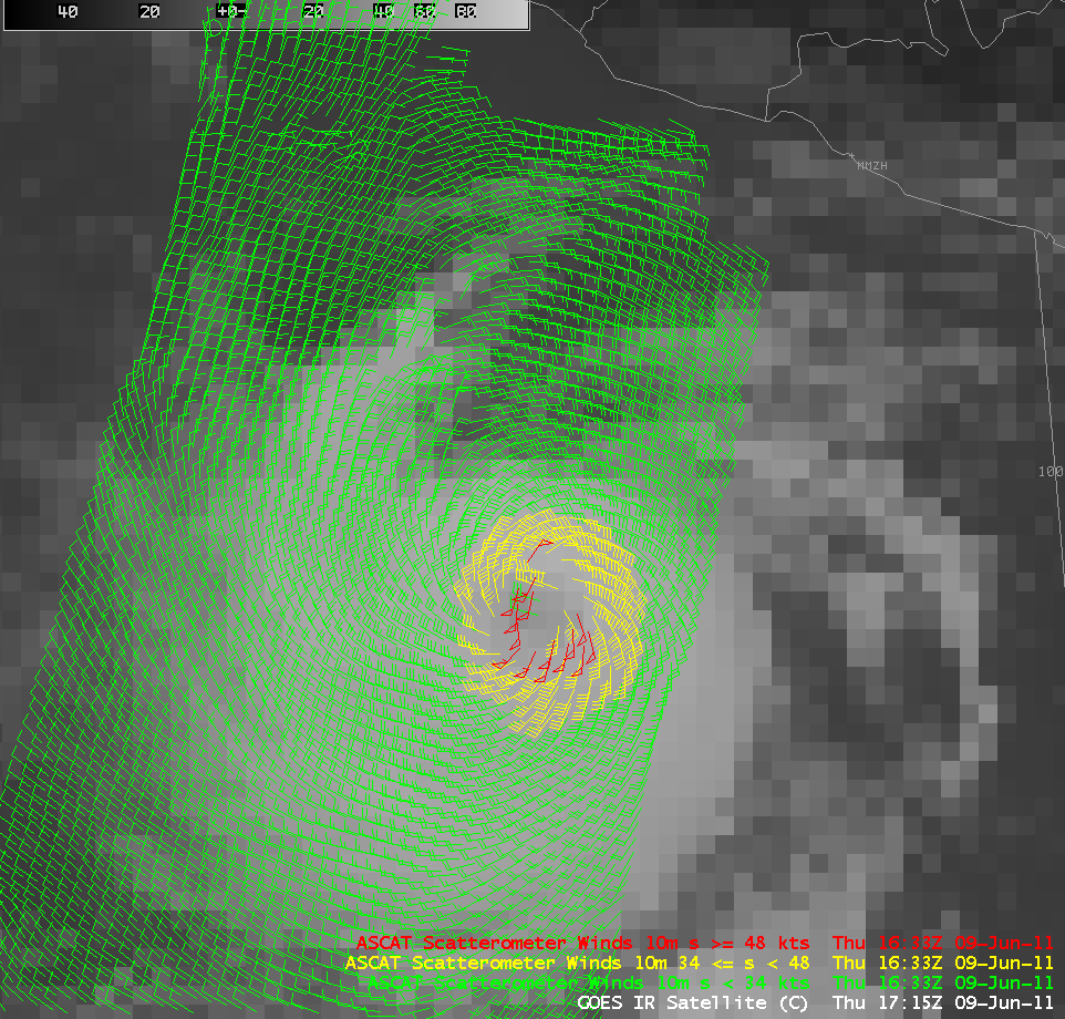
The circulation of Hurricane Adrian could be clearly seen on an AWIPS image of ASCAT scatterometer winds overlaid on a GOES IR image (below).
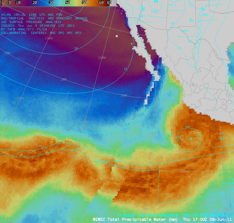
AWIPS images of the MIMIC Total Precipitable Water (TPW) product (below) showed that Adrian was tapping moisture from the Inter-Tropical Convergence Zone (ITCZ) / “Monsoon Trough”, which was located at approximately 10º North latitude over the eastern Pacific Ocean.
===== 10 June Update =====
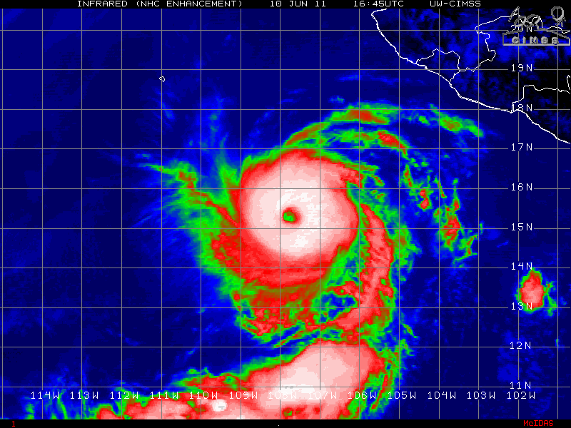
Hurricane Adrian intensified to a Category 4 storm on 10 June 2011. 4-km resolution GOES 10.7 µm IR channel images (below; click image to play animation) continued to show a well-defined eye structure.
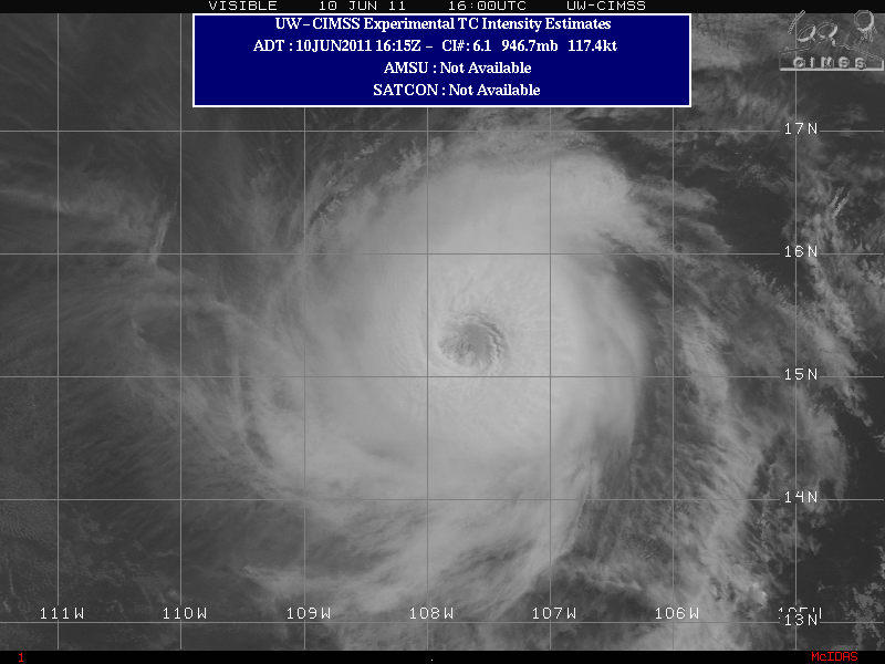
A closer view of the eye could be seen using 1-km resolution GOES visible channel images (below; click image to play animation).
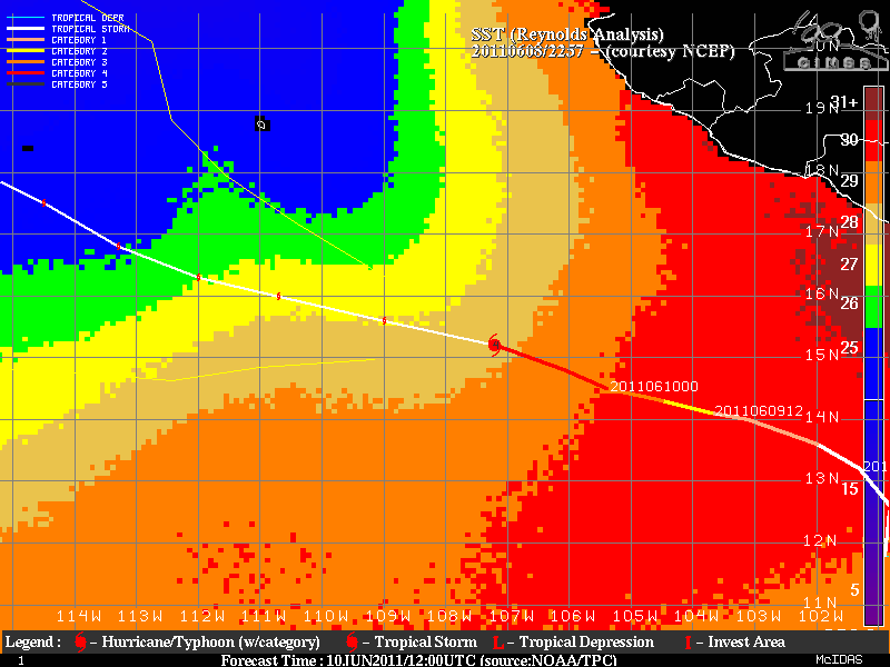
The intensity of Hurricane Adrian was expected to decrease as the storm began to move over colder waters, as seen on an image of the Sea Surface Temperature (SST) analysis (below).


